Trail Walking Lagarde-Marc-la-Tour - Lagarde Saint Paul - Photo
© OpenStreetMap contributors
Length
Length
18.5 km
Max alt
Max alt
550 m
Uphill gradient
Uphill gradient
518 m
Km-Effort
Km-Effort  
25 km
Min alt
Min alt
306 m
Downhill gradient
Downhill gradient
475 m
Boucle
Boucle
No
Creation date :
2020-12-12 11:03:18.69
Updated on :
2020-12-12 12:08:53.552

(0 Reviews)

Walking
Walking
27m
Difficulty : Very easy

Scan this QR Code to open this trail in the SityTrail application

FREE GPS app for hiking

Logo SityTrail SityTrail

IGN / Geographical institutes

Download SityTrail from the App Store Download SityTrail from Google Play

Logo SityTrail SityTrail World

The world is yours!

Download SityTrail from the App Store Download SityTrail from Google Play Download SityTrail on Huawei AppGallery

About

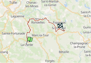
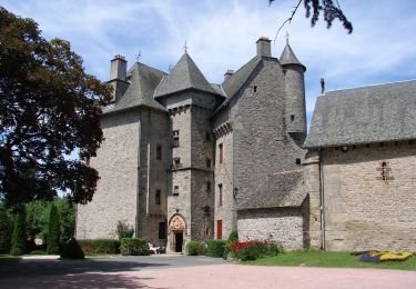
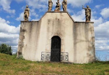
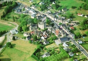
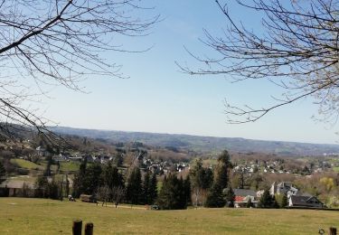
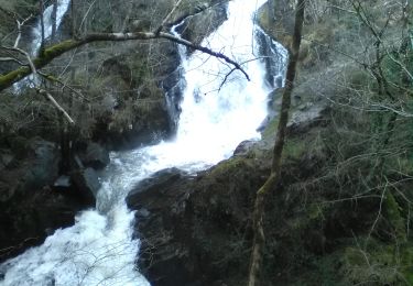
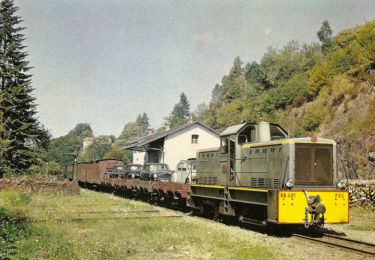
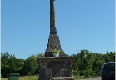
Trail Walking of 18.5 km to be discovered at New Aquitaine, Corrèze, Lagarde-Marc-la-Tour. This trail is proposed by Melanie19.

Elevation profile

Positioning

Country:
France
Region :
New Aquitaine
Department/Province :
Corrèze
Municipality :
Lagarde-Marc-la-Tour
Location:
Unknown
Start:(UTM)
406326 ; 5004327 (31T) N.

Trails nearby

Trail Walking Sainte-Fortunade - Les Puys de Sainte Fortunade - Sainte Fortunade - Pays de Tulle - Photo
Walking
tracegps

Walking

Difficult
(1)
Sainte-Fortunade, New Aquitaine, Corrèze, France
19.2 km | 26 km-effort
6h 0min
Yes
Trail Walking Forgès - Fred forges  - Photo
Walking
arnoultjf

Walking

Difficult
Forgès, New Aquitaine, Corrèze, France
10.7 km | 15.8 km-effort
3h 36min
Yes
Trail Walking Sainte-Fortunade - Les Puys de Sainte Fortunade - version courte - Sainte Fortunade  - Photo
Walking
tracegps

Walking

Medium
Sainte-Fortunade, New Aquitaine, Corrèze, France
10.4 km | 14 km-effort
2h 30min
Yes
Trail Walking Sainte-Fortunade - Fred ste fortunade  - Photo
Walking
arnoultjf

Walking

Very easy
Sainte-Fortunade, New Aquitaine, Corrèze, France
8.2 km | 11.4 km-effort
2h 46min
Yes
Trail On foot Forgès - La cascade de Murel - Photo
On foot
chanac les mines

On foot

Difficult
Forgès, New Aquitaine, Corrèze, France
9.8 km | 13.4 km-effort
3h 0min
Yes
Trail Walking Pandrignes - Circuit de la Gane - Pandrignes - Pays de Tulle - Photo
Walking
tracegps

Walking

Medium
(1)
Pandrignes, New Aquitaine, Corrèze, France
6.4 km | 9.3 km-effort
1h 30min
Yes
Trail Mountain bike Lagarde-Marc-la-Tour - Circuit des ruisseaux et de la châtaigneraie - Lagarde Enval - Pays de Tulle - Photo
Mountain bike
tracegps

Mountain bike

Medium
Lagarde-Marc-la-Tour, New Aquitaine, Corrèze, France
17.2 km | 22 km-effort
1h 30min
Yes
Trail Walking Lagarde-Marc-la-Tour - Circuit des ruisseaux et de la châtaigneraie - Lagarde Enval - Pays de Tulle - Photo
Walking
tracegps

Walking

Difficult
Lagarde-Marc-la-Tour, New Aquitaine, Corrèze, France
17.2 km | 22 km-effort
4h 30min
Yes
Trail Quad Pandrignes - pandrigne2024 samedi - Photo
Quad
lemortier19150

Quad

Very easy
Pandrignes, New Aquitaine, Corrèze, France
33 km | 47 km-effort
2h 27min
Yes


Close
My subscriptions