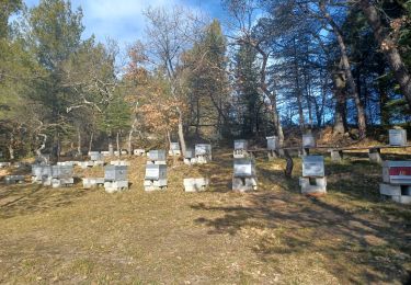
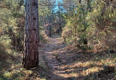
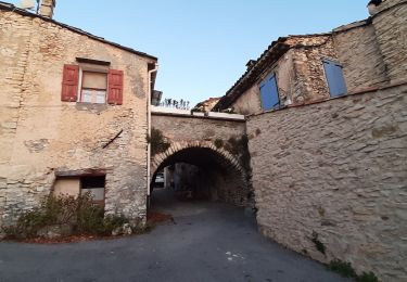
Trail Walking Mallefougasse-Augès - CHATEAU NEUF VAL SAINT DONNAT . Chapelle ST Magdeleine , bory de Baribarin , body d Emilie , jas de Mathieu , body de Mathieu  , bergerie de Combe Belle , bory vieille , body haute , body basse , o n d - Photo

CHATEAU NEUF VAL SAINT DONNAT . Chapelle ST Magdeleine , bory de Baribarin , body d Emilie , jas de Mathieu , body de Mathieu , bergerie de Combe Belle , bory vieille , body haute , body basse , o n d

© OpenStreetMap contributors
Length
Length
14.9 km
Max alt
Max alt
1188 m
Uphill gradient
Uphill gradient
586 m
Km-Effort
Km-Effort  
23 km
Min alt
Min alt
651 m
Downhill gradient
Downhill gradient
582 m
Boucle
Boucle
Yes
Creation date :
2020-11-30 08:41:35.152
Updated on :
2020-11-30 16:40:46.219

(0 Reviews)

Walking
Walking
4h28
Difficulty : Difficult

Scan this QR Code to open this trail in the SityTrail application

FREE GPS app for hiking

Logo SityTrail SityTrail

IGN / Geographical institutes

Download SityTrail from the App Store Download SityTrail from Google Play

Logo SityTrail SityTrail World

The world is yours!

Download SityTrail from the App Store Download SityTrail from Google Play Download SityTrail on Huawei AppGallery

About

Trail Walking of 14.9 km to be discovered at Provence-Alpes-Côte d'Azur, Alpes-de-Haute-Provence, Mallefougasse-Augès. This trail is proposed by RobinMicheline.
Elevation profile

Photos

22 photos in total. Please click on a photo to see them all in the gallery.

Positioning

Country:
France
Region :
Provence-Alpes-Côte d'Azur
Department/Province :
Alpes-de-Haute-Provence
Municipality :
Mallefougasse-Augès
Location:
Mallefougasse
Start:(UTM)
734340 ; 4884914 (31T) N.

Trails nearby

Trail Walking Châteauneuf-Val-Saint-Donat - Bergeries en pierres sèches - Châteauneuf Val Saint Donat - Photo
Walking
tracegps

Walking

Medium
(2)
Châteauneuf-Val-Saint-Donat, Provence-Alpes-Côte d'Azur, Alpes-de-Haute-Provence, France
7.6 km | 11.2 km-effort
2h 19min
Yes
Trail Running Peyruis - trail 29 07 2013 - Photo
Running
zapi

Running

Medium
(1)
Peyruis, Provence-Alpes-Côte d'Azur, Alpes-de-Haute-Provence, France
13.5 km | 20 km-effort
1h 27min
Yes
Trail Mountain bike Montfort - Montfort/Puimichel par les collines  - Photo
Mountain bike
Montfort

Mountain bike

Medium
Montfort, Provence-Alpes-Côte d'Azur, Alpes-de-Haute-Provence, France
42 km | 53 km-effort
2h 49min
Yes
Trail Walking Aubignosc - jas du Mathieu - Photo
Walking
saintclair04

Walking

Medium
(1)
Aubignosc, Provence-Alpes-Côte d'Azur, Alpes-de-Haute-Provence, France
6 km | 9.9 km-effort
2h 14min
Yes
Trail Walking Montfort - 2023-11-07 Tour de la Louviere et Chapelle Saint Donat - Photo
Walking
GUIDE
Kargil

Walking

Medium
Montfort, Provence-Alpes-Côte d'Azur, Alpes-de-Haute-Provence, France
12.9 km | 16.7 km-effort
3h 47min
Yes
Trail Walking Aubignosc - aubignosc. Le canyon de mourieu  , partie haute  - Photo
Walking
Roger

Walking

Medium
Aubignosc, Provence-Alpes-Côte d'Azur, Alpes-de-Haute-Provence, France
4.9 km | 6.7 km-effort
2h 20min
Yes
Trail Walking Châteauneuf-Val-Saint-Donat - château neuf val St donat. Le pas de richaud - Photo
Walking
Roger

Walking

Difficult
Châteauneuf-Val-Saint-Donat, Provence-Alpes-Côte d'Azur, Alpes-de-Haute-Provence, France
12.2 km | 22 km-effort
4h 54min
Yes
Trail Walking Châteauneuf-Val-Saint-Donat - château neuf, val St donat - Photo
Walking
Roger

Walking

Medium
Châteauneuf-Val-Saint-Donat, Provence-Alpes-Côte d'Azur, Alpes-de-Haute-Provence, France
6.8 km | 10 km-effort
2h 40min
Yes
Trail Walking Mallefougasse-Augès - col Bas depuis mallefougasse - Photo
Walking
Roger

Walking

Medium
Mallefougasse-Augès, Provence-Alpes-Côte d'Azur, Alpes-de-Haute-Provence, France
9.2 km | 12.4 km-effort
3h 1min
Yes


Close
My subscriptions