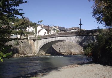
9.8 km | 13.6 km-effort
Périmetre 20 km
mitch1952
User
Length
128 km
Max alt
572 m
Uphill gradient
3699 m
Km-Effort
177 km
Min alt
113 m
Downhill gradient
3700 m
Boucle
Yes
Creation date :
2020-11-26 12:32:34.658
Updated on :
2022-06-07 12:53:56.497
40h16
Difficulty : Very difficult
FREE GPS app for hiking
About
Trail Walking of 128 km to be discovered at New Aquitaine, Pyrénées-Atlantiques, Montaut. This trail is proposed by mitch1952.
Positioning
Country:
France
Region :
New Aquitaine
Department/Province :
Pyrénées-Atlantiques
Municipality :
Montaut
Location:
Unknown
Start:(Dec)
Start:(UTM)
727775 ; 4779251 (30T) N.
Comments
Trails nearby
SAINT PE DE BIGORRE Le grand tour de saint pe "3875741" G4
On foot
Easy
Saint-Pé-de-Bigorre,
Occitania,
Hautespyrenees,
France
3h 5min
Yes
Le Plateau du Mousqué
On foot
Easy
Saint-Pé-de-Bigorre,
Occitania,
Hautespyrenees,
France
5.1 km | 7.8 km-effort
1h 45min
Yes
Lengous et Montagnou
On foot
Easy
Saint-Pé-de-Bigorre,
Occitania,
Hautespyrenees,
France
5.3 km | 7.4 km-effort
1h 40min
Yes
Les Coteaux de Saint-Pé
On foot
Easy
Saint-Pé-de-Bigorre,
Occitania,
Hautespyrenees,
France
9.2 km | 12.2 km-effort
2h 46min
Yes
SAINT PE de BIGORRE et ses côteaux G4 faite avec LPC "2661266"
Walking
Medium
Saint-Pé-de-Bigorre,
Occitania,
Hautespyrenees,
France
9 km | 12.5 km-effort
2h 40min
Yes
2023 10 10 CHEMIN du PIÉMONT PYRÉNÉEN - 18ème étape : Lestelle-Bétharram - As...
Walking
Medium
Lestelle-Bétharram,
New Aquitaine,
Pyrénées-Atlantiques,
France
28 km | 36 km-effort
6h 9min
No
ASSON Igon Touyas de Capsus "3648175"
Walking
Difficult
Asson,
New Aquitaine,
Pyrénées-Atlantiques,
France
12 km | 15.1 km-effort
3h 25min
Yes
Le sentier du Bénac
On foot
Easy
Saint-Pé-de-Bigorre,
Occitania,
Hautespyrenees,
France
8.1 km | 14.3 km-effort
3h 14min
Yes
LESTELLE BETHARRAM entre amis "2611998"
Walking
Very easy
Lestelle-Bétharram,
New Aquitaine,
Pyrénées-Atlantiques,
France
9.5 km | 12.5 km-effort
2h 29min
Yes