Trail Walking Olne - 20201125 - OLNE 7.2 Km - Photo

20201125 - OLNE 7.2 Km

 pierreh01
pierreh01

User GUIDE

© OpenStreetMap contributors
Length
Length
7.2 km
Max alt
Max alt
254 m
Uphill gradient
Uphill gradient
186 m
Km-Effort
Km-Effort  
9.6 km
Min alt
Min alt
126 m
Downhill gradient
Downhill gradient
186 m
Boucle
Boucle
Yes
Creation date :
2020-11-25 13:13:36.0
Updated on :
2020-11-25 16:18:28.946

(1 Reviews)

Walking
Walking
1h45
Difficulty : Difficult

Scan this QR Code to open this trail in the SityTrail application

FREE GPS app for hiking

Logo SityTrail SityTrail

IGN / Geographical institutes

Download SityTrail from the App Store Download SityTrail from Google Play

Logo SityTrail SityTrail World

The world is yours!

Download SityTrail from the App Store Download SityTrail from Google Play Download SityTrail on Huawei AppGallery

About

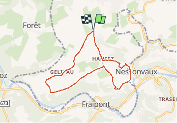
Trail Walking of 7.2 km to be discovered at Wallonia, Liège, Olne. This trail is proposed by pierreh01.

Description

Jolie balade au départ de la Croix Renard à OLNE, sans suivre de balisage avec alternance de route peu fréquentée et sentiers forestiers et traversée de prairie.
Première moitié sans difficulté, en descente vers Nessouvaux.
Remontée plus difficile, à effectuer à son rythme en sous-bois et prairie un peu à la recherche du sentier débutant par un escalier jointif d'une propriété.
Agréable avec de très beaux points de vue.

Elevation profile

Photos

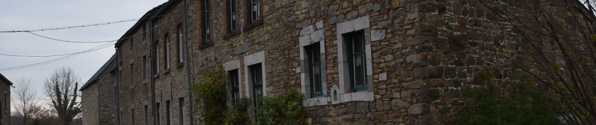
35 photos in total. Please click on a photo to see them all in the gallery.

Positioning

Country:
Belgium
Region :
Wallonia
Department/Province :
Liège
Municipality :
Olne
Location:
Olne
Start:(UTM)
692689 ; 5606974 (31U) N.

Comments

Please log in to post a review or rate the element


vraiment très déçu par cette promenade 80% de tarmac ... de la boue à volonté et traversée d'un champ privé entièrement clôturé. pour le côté sous bois... passez votre chemin 😅


Trails nearby

Trail Walking Pepinster - RB-Lg-23_Soiron_via-racc-2 - Photo
Walking
PRO

Walking

(8)
Pepinster, Wallonia, Liège, Belgium
13.4 km | 17.5 km-effort
3h 58min
Yes
Trail Walking Pepinster - RB-Lg-23_Soiron - Photo
Walking
PRO

Walking

(5)
Pepinster, Wallonia, Liège, Belgium
21 km | 26 km-effort
5h 55min
Yes
Trail Walking Trooz - RB-Lg-03 - Entre Vesdre et Hoëgne - Photo
Walking
PRO

Walking

Medium
(12)
Trooz, Wallonia, Liège, Belgium
22 km | 29 km-effort
6h 9min
Yes
Trail Walking Sprimont - Banneux - Rouge Thier - Adzeux - Photo
Walking
GUIDE
mumu.larandonneuse

Walking

Easy
(3)
Sprimont, Wallonia, Liège, Belgium
9.1 km | 11.3 km-effort
2h 34min
Yes
Trail Walking Pepinster - 2022-05-13_11h44m22_Cirkwi-Soiron_6___Tribomont,_Wegnez - Photo
Walking
GUIDE
mumu.larandonneuse

Walking

Easy
(1)
Pepinster, Wallonia, Liège, Belgium
9.5 km | 12.5 km-effort
2h 50min
Yes
Trail Walking Olne - 20220307 - Saint-Hadelin 8.8 Km - Photo
Walking
GUIDE
pierreh01

Walking

Medium
(1)
Olne, Wallonia, Liège, Belgium
8.4 km | 10.9 km-effort
2h 24min
Yes
Trail Walking Trooz - 2022-02-03_17h57m35_BaladedeFraipont - Photo
Walking
GUIDE
mumu.larandonneuse

Walking

Medium
(1)
Trooz, Wallonia, Liège, Belgium
12.3 km | 17.3 km-effort
3h 55min
Yes
Trail Walking Trooz - 2021-05-16_08h02m48_1403 - Photo
Walking
GUIDE
mumu.larandonneuse

Walking

Difficult
(1)
Trooz, Wallonia, Liège, Belgium
10.1 km | 14.6 km-effort
3h 19min
Yes
Trail Walking Olne - 2021-03-10_16h10m11_1409 - Photo
Walking
GUIDE
mumu.larandonneuse

Walking

Medium
(3)
Olne, Wallonia, Liège, Belgium
11.7 km | 16.1 km-effort
3h 39min
Yes


Close
My subscriptions