![](/images/other/stat-length.png)
![Trail Walking Diepenbeek - Diepenbeek - Photo](https://media.geolcdn.com/t/1900/400/3d529861-d153-4f9d-8730-81a882934229.jpg&format=pjpeg&maxdim=2)
Diepenbeek
mumu.larandonneuse
User GUIDE
![Length](/images/other/stat-length.png)
Length
13.2 km
![Max alt](https://static1.geolcdn.com/siteimages/upload/files/1508320355ic_sort_altitude_max_24dp.png)
Max alt
43 m
![Uphill gradient](https://static1.geolcdn.com/siteimages/upload/files/1508320355ic_sort_den_pos_24dp.png)
Uphill gradient
82 m
![Km-Effort](/images/other/stat-length.png)
Km-Effort
14.3 km
![Min alt](https://static1.geolcdn.com/siteimages/upload/files/1508320355ic_sort_altitude_min_24dp.png)
Min alt
30 m
![Downhill gradient](https://static1.geolcdn.com/siteimages/upload/files/1508320355ic_sort_den_neg_24dp.png)
Downhill gradient
81 m
![Boucle](https://static1.geolcdn.com/siteimages/upload/files/16400158638029165_repeat_loop_refresh_sync_direction_icon.png)
Boucle
Yes
Creation date :
2020-10-25 08:43:24.831
Updated on :
2020-10-25 13:24:39.552
![Walking](https://static1.geolcdn.com/sitytour/trail-icons/101.png)
2h44
Difficulty : Very easy
![Scan this QR Code to open this trail in the SityTrail application](https://capi.geolives.com/qq0zvz2zws4bq2lad0pu/sitytour/trails/2587361/qr.png?size=200)
FREE GPS app for hiking
About
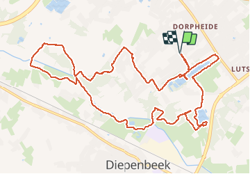
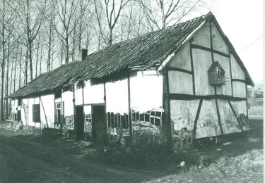
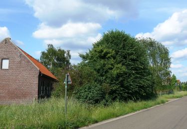
Trail Walking of 13.2 km to be discovered at Flanders, Limburg, Diepenbeek. This trail is proposed by mumu.larandonneuse.
Description
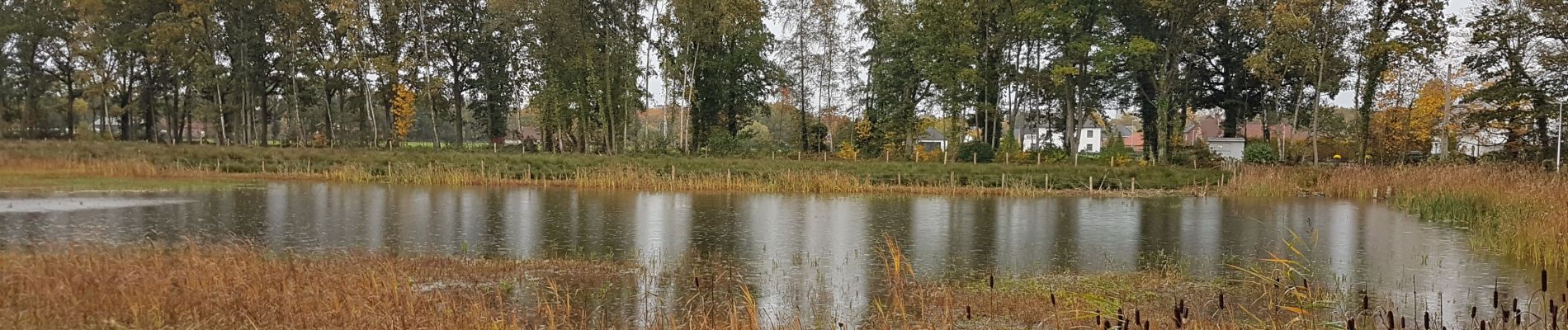
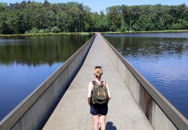
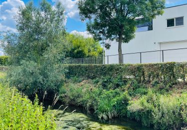
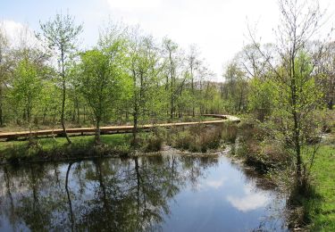
Beau parcours facile passant par plusieurs étangs dont le Pomperikvijver et 3 ruisseaux (le Stiekemerbeek, le Coetsbeek et le Demer).
📌Gasthof Lederhose, Heidstraat 55 ➡️
possibilité de parking Heidestraat (rue en cul-de-sac)
⚠️ 3 petits A/R à ne pas faire (erreurs de ma part)
Positioning
Country:
Belgium
Region :
Flanders
Department/Province :
Limburg
Municipality :
Diepenbeek
Location:
Diepenbeek
Start:(Dec)
Start:(UTM)
670817 ; 5644321 (31U) N.
Comments
Trails nearby
![Trail Walking Hasselt - Domaine Kiewit &](https://media.geolcdn.com/t/375/260/24e338e2-ab75-48fb-ae32-0abbc38a1902.jpg&format=jpg&maxdim=2)
![Walking Walking](https://static1.geolcdn.com/sitytour/trail-icons/101.png)
Domaine Kiewit & " Fietsen door het water"
Walking
Easy
Hasselt,
Flanders,
Limburg,
Belgium
![](/images/other/stat-length.png)
10.9 km | 12.1 km-effort
2h 33min
![](https://static1.geolcdn.com/siteimages/upload/files/16400158638029165_repeat_loop_refresh_sync_direction_icon.png)
Yes
![Trail Walking Genk - Promenade vers la piste dans l'eau, dans le magnifique domaine de Bokrijk - Photo](https://media.geolcdn.com/t/375/260/45cc0ed2-db94-4d5d-a7c6-1096a930a2ab.jpg&format=jpg&maxdim=2)
![Walking Walking](https://static1.geolcdn.com/sitytour/trail-icons/101.png)
Promenade vers la piste dans l'eau, dans le magnifique domaine de Bokrijk
Walking
Easy
(3)
Genk,
Flanders,
Limburg,
Belgium
![](/images/other/stat-length.png)
4.1 km | 4.6 km-effort
1h 2min
![](https://static1.geolcdn.com/siteimages/upload/files/16400158638029165_repeat_loop_refresh_sync_direction_icon.png)
Yes
![Trail Walking Diepenbeek - La vallée du Démer - La réserve naturelle Dorpsbemden à Diepenbeek - Photo](https://media.geolcdn.com/t/375/260/831c90b3-6b69-4442-bd2d-357552ece2e5.jpeg&format=jpg&maxdim=2)
![Walking Walking](https://static1.geolcdn.com/sitytour/trail-icons/101.png)
La vallée du Démer - La réserve naturelle Dorpsbemden à Diepenbeek
Walking
Easy
Diepenbeek,
Flanders,
Limburg,
Belgium
![](/images/other/stat-length.png)
3.1 km | 3.3 km-effort
45min
![](https://static1.geolcdn.com/siteimages/upload/files/16400158638029165_repeat_loop_refresh_sync_direction_icon.png)
Yes
![Trail Walking Diepenbeek - La vallée du Démer - Le ruisseau Dauten et les Dautewijers à Diepenbeek - Photo](https://media.geolcdn.com/t/375/260/ff431e14-a2e4-4401-9193-e96799f79a9a.jpeg&format=jpg&maxdim=2)
![Walking Walking](https://static1.geolcdn.com/sitytour/trail-icons/101.png)
La vallée du Démer - Le ruisseau Dauten et les Dautewijers à Diepenbeek
Walking
Easy
Diepenbeek,
Flanders,
Limburg,
Belgium
![](/images/other/stat-length.png)
5.4 km | 5.8 km-effort
1h 19min
![](https://static1.geolcdn.com/siteimages/upload/files/16400158638029165_repeat_loop_refresh_sync_direction_icon.png)
Yes
![Trail On foot Diepenbeek - Lange afstandstocht - Photo](https://media.geolcdn.com/t/375/260/c0f28296-bcff-4fe2-9db4-902c2464ce24.jpeg&format=jpg&maxdim=2)
![On foot On foot](https://static1.geolcdn.com/sitytour/trail-icons/100.png)
Lange afstandstocht
On foot
Easy
Diepenbeek,
Flanders,
Limburg,
Belgium
![](/images/other/stat-length.png)
16.5 km | 17.8 km-effort
4h 2min
![](https://static1.geolcdn.com/siteimages/upload/files/16400158638029165_repeat_loop_refresh_sync_direction_icon.png)
Yes
![Trail On foot Genk - De Maten oranje - Photo](https://media.geolcdn.com/t/375/260/5daa36df-5a45-46f0-9e87-234b3c303469.jpeg&format=jpg&maxdim=2)
![On foot On foot](https://static1.geolcdn.com/sitytour/trail-icons/100.png)
![Trail On foot Genk - Bokrijk Gele zeshoek (voor rolstoel/buggy) - Photo](https://media.geolcdn.com/t/375/260/abfb207d-dc7b-4a70-b673-1e7d6075a286.jpeg&format=jpg&maxdim=2)
![On foot On foot](https://static1.geolcdn.com/sitytour/trail-icons/100.png)
Bokrijk Gele zeshoek (voor rolstoel/buggy)
On foot
Easy
Genk,
Flanders,
Limburg,
Belgium
![](/images/other/stat-length.png)
4.1 km | 4.7 km-effort
1h 3min
![](https://static1.geolcdn.com/siteimages/upload/files/16400158638029165_repeat_loop_refresh_sync_direction_icon.png)
Yes
![Trail On foot Hasselt - Kiewit Wildernis route - Photo](https://media.geolcdn.com/t/375/260/3dbc744d-9453-4105-ac17-d803e722e0e9.jpeg&format=jpg&maxdim=2)
![On foot On foot](https://static1.geolcdn.com/sitytour/trail-icons/100.png)
Kiewit Wildernis route
On foot
Easy
Hasselt,
Flanders,
Limburg,
Belgium
![](/images/other/stat-length.png)
3.3 km | 3.7 km-effort
49min
![](https://static1.geolcdn.com/siteimages/upload/files/16400158638029165_repeat_loop_refresh_sync_direction_icon.png)
Yes
![Trail On foot Hasselt - Kiewit Wijer route - Photo](https://media.geolcdn.com/t/375/260/3dbc744d-9453-4105-ac17-d803e722e0e9.jpeg&format=jpg&maxdim=2)
![On foot On foot](https://static1.geolcdn.com/sitytour/trail-icons/100.png)
Kiewit Wijer route
On foot
Easy
Hasselt,
Flanders,
Limburg,
Belgium
![](/images/other/stat-length.png)
4.1 km | 4.6 km-effort
1h 3min
![](https://static1.geolcdn.com/siteimages/upload/files/16400158638029165_repeat_loop_refresh_sync_direction_icon.png)
Yes