Trail Walking Saint-Pierre-des-Tripiers - Boucle Cassagnes - Gorges Jonte - Photo

Boucle Cassagnes - Gorges Jonte

 prous31
prous31

User

© OpenStreetMap contributors
Length
Length
8.2 km
Max alt
Max alt
883 m
Uphill gradient
Uphill gradient
414 m
Km-Effort
Km-Effort  
13.7 km
Min alt
Min alt
641 m
Downhill gradient
Downhill gradient
414 m
Boucle
Boucle
Yes
Creation date :
2020-10-19 07:45:59.853
Updated on :
2020-10-20 16:43:03.658

(1 Reviews)

Walking
Walking
2h57
Difficulty : Easy

Scan this QR Code to open this trail in the SityTrail application

FREE GPS app for hiking

Logo SityTrail SityTrail

IGN / Geographical institutes

Download SityTrail from the App Store Download SityTrail from Google Play

Logo SityTrail SityTrail World

The world is yours!

Download SityTrail from the App Store Download SityTrail from Google Play Download SityTrail on Huawei AppGallery

About

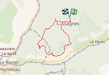
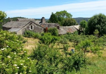
Trail Walking of 8.2 km to be discovered at Occitania, Lozère, Saint-Pierre-des-Tripiers. This trail is proposed by prous31.

Description

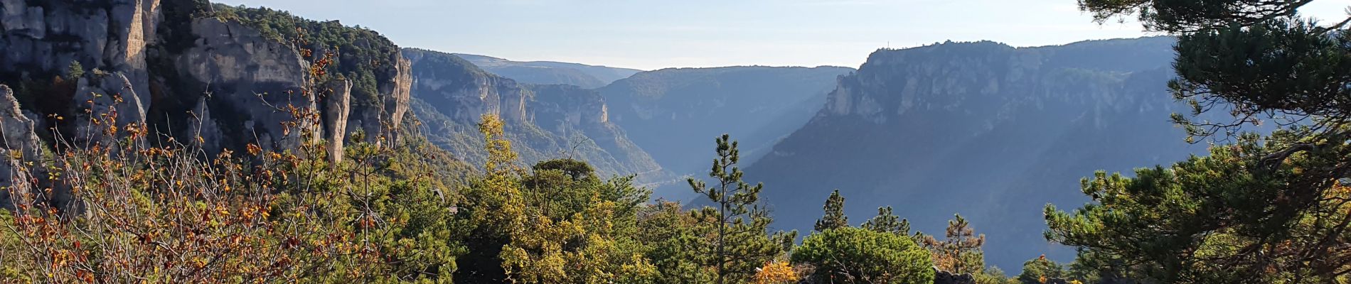
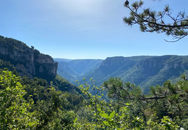
Super balade facile, sans dénivelé important, sur un trés beau chemin, structures géologiques surprenantes et vue magnifique sur les gorges. Nombreux vautours visibles.

Elevation profile

Photos

Positioning

Country:
France
Region :
Occitania
Department/Province :
Lozère
Municipality :
Saint-Pierre-des-Tripiers
Location:
Unknown
Start:(UTM)
519366 ; 4895125 (31T) N.

Comments

Please log in to post a review or rate the element


Trails nearby

Trail Walking Le Rozier - 12 vase de Sèvres Chine ch. brunet - Photo
Walking
GUIDE
randodyssée

Walking

Medium
(1)
Le Rozier, Occitania, Lozère, France
10.1 km | 18.8 km-effort
5h 40min
Yes
Trail Walking Mostuéjouls - Cirque de Saint Marcellin - Mostuéjouls - Liaucous - Photo
Walking
tracegps

Walking

Medium
(1)
Mostuéjouls, Occitania, Aveyron, France
15.4 km | 24 km-effort
5h 0min
Yes
Trail Walking Le Rozier - Causse et gorges au pays des vautours  - Photo
Walking
GUIDE
nadinebondoux

Walking

Difficult
Le Rozier, Occitania, Lozère, France
27 km | 40 km-effort
7h 48min
No
Trail Walking Saint-Pierre-des-Tripiers - Cassagnes crête vallée Jonte et Tarn 12,2 km - Photo
Walking
GUIDE
rvapeldo

Walking

Medium
Saint-Pierre-des-Tripiers, Occitania, Lozère, France
12.6 km | 20 km-effort
5h 38min
No
Trail Walking Saint-Pierre-des-Tripiers - Grands Causses - Cassagnes - Corniches du Causse Méjean - 2016 09 08 - Photo
Walking
GUIDE
Orcal37

Walking

Medium
Saint-Pierre-des-Tripiers, Occitania, Lozère, France
8.4 km | 14.2 km-effort
3h 10min
Yes
Trail Walking Peyreleau - Grands Causses - Peyreleau - Corniches du Causse Noir- 2016 09 06 - Photo
Walking
GUIDE
Orcal37

Walking

Difficult
Peyreleau, Occitania, Aveyron, France
12.5 km | 21 km-effort
6h 40min
Yes
Trail Walking Saint-Pierre-des-Tripiers - Grands Causses - La Viale - Corniches de la Jonte et du Tarn - 2016 07 03 - 880m 20,7km - Photo
Walking
GUIDE
Orcal37

Walking

Medium
Saint-Pierre-des-Tripiers, Occitania, Lozère, France
21 km | 30 km-effort
6h 40min
Yes
Trail Walking Mostuéjouls - Grands Causses - Liaucous - St-Marcellin - 2016 07 04 - 680m 14,3km - Photo
Walking
GUIDE
Orcal37

Walking

Medium
Mostuéjouls, Occitania, Aveyron, France
14.3 km | 21 km-effort
4h 50min
Yes
Trail Walking Veyreau - J3 St Jean des Balmes Ermitage St Michel - Photo
Walking
ARPF

Walking

Easy
(2)
Veyreau, Occitania, Aveyron, France
9.6 km | 13.9 km-effort
3h 18min
Yes


Close
My subscriptions