![](/images/other/stat-length.png)
![Trail Walking Lavau-sur-Loire - Syl LAVAU SUR LOIRE - Photo](https://media.geolcdn.com/t/1900/400/ext.pjpeg?maxdim=2&url=https%3A%2F%2Fstatic1.geolcdn.com%2Fsiteimages%2Fupload%2Ffiles%2F1553511878bg_sport_marche.png)
Syl LAVAU SUR LOIRE
PhilippeLegault
User
![Length](/images/other/stat-length.png)
Length
14.4 km
![Max alt](https://static1.geolcdn.com/siteimages/upload/files/1508320355ic_sort_altitude_max_24dp.png)
Max alt
17 m
![Uphill gradient](https://static1.geolcdn.com/siteimages/upload/files/1508320355ic_sort_den_pos_24dp.png)
Uphill gradient
59 m
![Km-Effort](/images/other/stat-length.png)
Km-Effort
15.2 km
![Min alt](https://static1.geolcdn.com/siteimages/upload/files/1508320355ic_sort_altitude_min_24dp.png)
Min alt
-1 m
![Downhill gradient](https://static1.geolcdn.com/siteimages/upload/files/1508320355ic_sort_den_neg_24dp.png)
Downhill gradient
54 m
![Boucle](https://static1.geolcdn.com/siteimages/upload/files/16400158638029165_repeat_loop_refresh_sync_direction_icon.png)
Boucle
No
Creation date :
2020-10-18 10:22:56.0
Updated on :
2020-10-18 14:24:34.254
![Walking](https://static1.geolcdn.com/sitytour/trail-icons/101.png)
3h31
Difficulty : Easy
![Scan this QR Code to open this trail in the SityTrail application](https://capi.geolives.com/qq0zvz2zws4bq2lad0pu/sitytour/trails/2580963/qr.png?size=200)
FREE GPS app for hiking
About
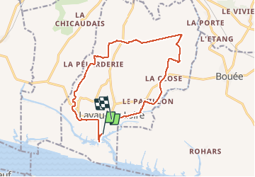
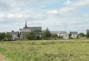
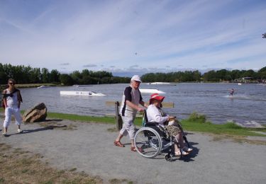
Trail Walking of 14.4 km to be discovered at Pays de la Loire, Loire-Atlantique, Lavau-sur-Loire. This trail is proposed by PhilippeLegault.
Description
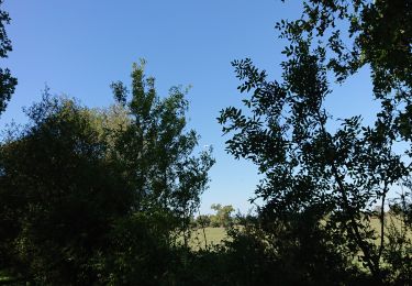
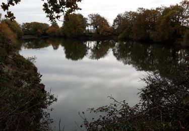
très belle randonnée, début dans le marais (attention si grande marée) puis sur des chemins. Très peu de routes.
A faire de préférence par beau temps frais.
Assez long, 16 km avec l’observatoire.
Positioning
Country:
France
Region :
Pays de la Loire
Department/Province :
Loire-Atlantique
Municipality :
Lavau-sur-Loire
Location:
Unknown
Start:(Dec)
Start:(UTM)
577801 ; 5239083 (30T) N.
Comments
Trails nearby
![Trail Walking Bouée - Sentier des Belles Demeures et le port de Rohars - Photo](https://media.geolcdn.com/t/375/260/ext.jpg?maxdim=2&url=https%3A%2F%2Fservices.sitytrail.com%2FGeolivesWS%2FDownloadMedia.ashx%3FTrailID%3D129885%26Media%3D13455_6.jpg)
![Walking Walking](https://static1.geolcdn.com/sitytour/trail-icons/101.png)
Sentier des Belles Demeures et le port de Rohars
Walking
Difficult
(2)
Bouée,
Pays de la Loire,
Loire-Atlantique,
France
![](/images/other/stat-length.png)
13.1 km | 14.1 km-effort
3h 15min
![](https://static1.geolcdn.com/siteimages/upload/files/16400158638029165_repeat_loop_refresh_sync_direction_icon.png)
Yes
![Trail On foot Lavau-sur-Loire - Sentier du Syl au Trou Bleu - Photo](https://media.geolcdn.com/t/375/260/8a542279-8894-4d3d-bde9-533686434cb3.jpeg&format=jpg&maxdim=2)
![On foot On foot](https://static1.geolcdn.com/sitytour/trail-icons/100.png)
Sentier du Syl au Trou Bleu
On foot
Easy
Lavau-sur-Loire,
Pays de la Loire,
Loire-Atlantique,
France
![](/images/other/stat-length.png)
13.9 km | 14.6 km-effort
3h 19min
![](https://static1.geolcdn.com/siteimages/upload/files/16400158638029165_repeat_loop_refresh_sync_direction_icon.png)
Yes
![Trail Walking Bouée - Sentier des Belles Demeures par le sentier de Couebas - Bouée - Photo](https://media.geolcdn.com/t/375/260/ext.jpg?maxdim=2&url=https%3A%2F%2Fservices.sitytrail.com%2FGeolivesWS%2FDownloadMedia.ashx%3FTrailID%3D129884%26Media%3D13454_4.jpg)
![Walking Walking](https://static1.geolcdn.com/sitytour/trail-icons/101.png)
Sentier des Belles Demeures par le sentier de Couebas - Bouée
Walking
Easy
Bouée,
Pays de la Loire,
Loire-Atlantique,
France
![](/images/other/stat-length.png)
4.6 km | 5 km-effort
1h 10min
![](https://static1.geolcdn.com/siteimages/upload/files/16400158638029165_repeat_loop_refresh_sync_direction_icon.png)
Yes
![Trail Walking Bouée - Sentier des Belles Demeures - Bouée - Photo](https://media.geolcdn.com/t/375/260/ext.jpg?maxdim=2&url=https%3A%2F%2Fservices.sitytrail.com%2FGeolivesWS%2FDownloadMedia.ashx%3FTrailID%3D129883%26Media%3D13453_4.jpg)
![Walking Walking](https://static1.geolcdn.com/sitytour/trail-icons/101.png)
Sentier des Belles Demeures - Bouée
Walking
Medium
Bouée,
Pays de la Loire,
Loire-Atlantique,
France
![](/images/other/stat-length.png)
10.1 km | 10.9 km-effort
2h 30min
![](https://static1.geolcdn.com/siteimages/upload/files/16400158638029165_repeat_loop_refresh_sync_direction_icon.png)
Yes
![Trail Walking Lavau-sur-Loire - lavau sur loire - Photo](https://media.geolcdn.com/t/375/260/b2786be4-4713-45c5-b880-1e8e7a08b2b7.jpg&format=jpg&maxdim=2)
![Walking Walking](https://static1.geolcdn.com/sitytour/trail-icons/101.png)
lavau sur loire
Walking
Very easy
Lavau-sur-Loire,
Pays de la Loire,
Loire-Atlantique,
France
![](/images/other/stat-length.png)
11.4 km | 12 km-effort
3h 15min
![](https://static1.geolcdn.com/siteimages/upload/files/16400158638029165_repeat_loop_refresh_sync_direction_icon.png)
Yes
![Trail Walking Lavau-sur-Loire - Lavau: Observatoire, trou bleu et Syl - Photo](https://media.geolcdn.com/t/375/260/ext.jpg?maxdim=2&url=https%3A%2F%2Fservices.sitytrail.com%2FGeolivesWS%2FDownloadMedia.ashx%3FTrailID%3D862603%26Media%3De48a4394-f15a-4790-a3a4-9ac3ebc0bc3c.jpg)
![Walking Walking](https://static1.geolcdn.com/sitytour/trail-icons/101.png)
Lavau: Observatoire, trou bleu et Syl
Walking
Medium
(1)
Lavau-sur-Loire,
Pays de la Loire,
Loire-Atlantique,
France
![](/images/other/stat-length.png)
14.9 km | 15.7 km-effort
3h 29min
![](https://static1.geolcdn.com/siteimages/upload/files/16400158638029165_repeat_loop_refresh_sync_direction_icon.png)
Yes
![Trail Walking Saint-Viaud - Carnet_St-Viaud - Photo](https://media.geolcdn.com/t/375/260/ext.jpg?maxdim=2&url=https%3A%2F%2Fservices.sitytrail.com%2FGeolivesWS%2FDownloadMedia.ashx%3FTrailID%3D491499%26Media%3D849ff152-581b-46c2-8ad8-9730e625a905.JPG)
![Walking Walking](https://static1.geolcdn.com/sitytour/trail-icons/101.png)
Carnet_St-Viaud
Walking
Easy
Saint-Viaud,
Pays de la Loire,
Loire-Atlantique,
France
![](/images/other/stat-length.png)
14 km | 15.2 km-effort
3h 23min
![](https://static1.geolcdn.com/siteimages/upload/files/16400158638029165_repeat_loop_refresh_sync_direction_icon.png)
Yes
![Trail Mountain bike Lavau-sur-Loire - Lavau sur Loire 2023 - Photo](https://media.geolcdn.com/t/375/260/ext.jpg?maxdim=2&url=https%3A%2F%2Fstatic1.geolcdn.com%2Fsiteimages%2Fupload%2Ffiles%2F1524743154velo.jpg)
![Mountain bike Mountain bike](https://static1.geolcdn.com/sitytour/trail-icons/202.png)
Lavau sur Loire 2023
Mountain bike
Difficult
Lavau-sur-Loire,
Pays de la Loire,
Loire-Atlantique,
France
![](/images/other/stat-length.png)
33 km | 37 km-effort
2h 14min
![](https://static1.geolcdn.com/siteimages/upload/files/16400158638029165_repeat_loop_refresh_sync_direction_icon.png)
Yes
![Trail Mountain bike Paimbœuf - Paimboeuf juin 23 - Photo](https://media.geolcdn.com/t/375/260/ext.jpg?maxdim=2&url=https%3A%2F%2Fstatic1.geolcdn.com%2Fsiteimages%2Fupload%2Ffiles%2F1524743154velo.jpg)
![Mountain bike Mountain bike](https://static1.geolcdn.com/sitytour/trail-icons/202.png)
Paimboeuf juin 23
Mountain bike
Medium
Paimbœuf,
Pays de la Loire,
Loire-Atlantique,
France
![](/images/other/stat-length.png)
26 km | 29 km-effort
2h 0min
![](https://static1.geolcdn.com/siteimages/upload/files/16400158638029165_repeat_loop_refresh_sync_direction_icon.png)
Yes