![](/images/other/stat-length.png)
![Trail Walking Zoutleeuw - Zoutleeuw 16 km - Photo](https://media.geolcdn.com/t/1900/400/b3a37ac3-8fca-4eba-bd9d-831054990cdb.jpg&format=pjpeg&maxdim=2)
Zoutleeuw 16 km
rvapeldo
User GUIDE
![Length](/images/other/stat-length.png)
![Max alt](https://static1.geolcdn.com/siteimages/upload/files/1508320355ic_sort_altitude_max_24dp.png)
![Uphill gradient](https://static1.geolcdn.com/siteimages/upload/files/1508320355ic_sort_den_pos_24dp.png)
![Km-Effort](/images/other/stat-length.png)
![Min alt](https://static1.geolcdn.com/siteimages/upload/files/1508320355ic_sort_altitude_min_24dp.png)
![Downhill gradient](https://static1.geolcdn.com/siteimages/upload/files/1508320355ic_sort_den_neg_24dp.png)
![Boucle](https://static1.geolcdn.com/siteimages/upload/files/16400158638029165_repeat_loop_refresh_sync_direction_icon.png)
![Walking](https://static1.geolcdn.com/sitytour/trail-icons/101.png)
3h59
Difficulty : Very easy
![Scan this QR Code to open this trail in the SityTrail application](https://capi.geolives.com/qq0zvz2zws4bq2lad0pu/sitytour/trails/2579768/qr.png?size=200)
FREE GPS app for hiking
About
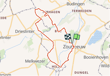
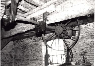
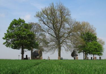
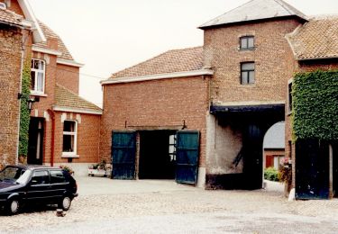
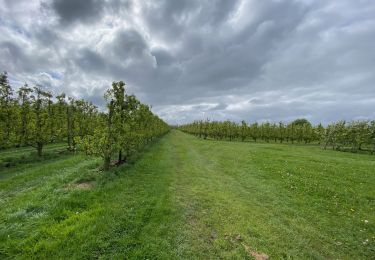
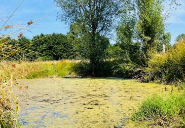
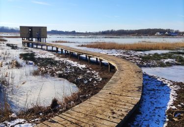
Trail Walking of 15.6 km to be discovered at Flanders, Flemish Brabant, Zoutleeuw. This trail is proposed by rvapeldo.
Description
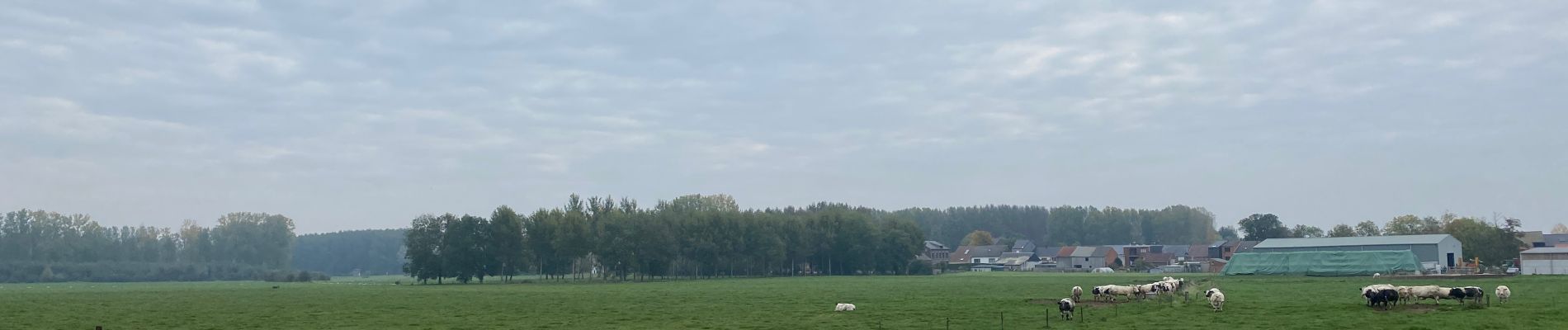
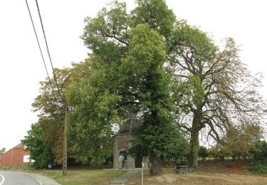
Une belle surprise que la campagne environnant la charmante ville de Zoutleeuw (église et hotel de ville remarquables), sillonnée par de nombreux cours d’eau et canaux (Leigracht, Kleine Gete, Grote Gete,...), où sont cultivés poiriers et pommiers. Le parcours peut aisément être allongé.
Een leuke verrassing dat het platteland rondom het charmante stadje Zoutleeuw (opmerkelijke kerk en stadhuis), doorkruist door talloze rivieren en kanalen (Leigracht, Kleine Gete, Grote Gete, ...), waar perenbomen worden gekweekt en appelbomen. De route kan eenvoudig worden verlengd.
Positioning
Comments
Trails nearby
![Trail On foot Kortenaken - A Speculowandelpad - Photo](https://media.geolcdn.com/t/375/260/e8a891a7-8e5d-4d65-ada1-9dd128a1791b.jpeg&format=jpg&maxdim=2)
![On foot On foot](https://static1.geolcdn.com/sitytour/trail-icons/100.png)
On foot
![](/images/other/stat-length.png)
![](https://static1.geolcdn.com/siteimages/upload/files/16400158638029165_repeat_loop_refresh_sync_direction_icon.png)
![Trail On foot Sint-Truiden - Staaien rode driehoek - Photo](https://media.geolcdn.com/t/375/260/cd3d1f60-3cd2-4539-a2b4-06ec7df817c9.jpeg&format=jpg&maxdim=2)
![On foot On foot](https://static1.geolcdn.com/sitytour/trail-icons/100.png)
On foot
![](/images/other/stat-length.png)
![](https://static1.geolcdn.com/siteimages/upload/files/16400158638029165_repeat_loop_refresh_sync_direction_icon.png)
![Trail On foot Sint-Truiden - Staaien oranje bol - Photo](https://media.geolcdn.com/t/375/260/7b137b54-411c-4e68-8c6c-aeb3fad0dd86.jpeg&format=jpg&maxdim=2)
![On foot On foot](https://static1.geolcdn.com/sitytour/trail-icons/100.png)
On foot
![](/images/other/stat-length.png)
![](https://static1.geolcdn.com/siteimages/upload/files/16400158638029165_repeat_loop_refresh_sync_direction_icon.png)
![Trail On foot Zoutleeuw - Kempinnewandeling - Photo](https://media.geolcdn.com/t/375/260/fc67a971-5072-4fc1-b052-2b5bd59bf268.jpeg&format=jpg&maxdim=2)
![On foot On foot](https://static1.geolcdn.com/sitytour/trail-icons/100.png)
On foot
![](/images/other/stat-length.png)
![](https://static1.geolcdn.com/siteimages/upload/files/16400158638029165_repeat_loop_refresh_sync_direction_icon.png)
![Trail On foot Zoutleeuw - Panbruggewandeling - Photo](https://media.geolcdn.com/t/375/260/96714c06-dac1-4b7c-b690-c79a4c973766.jpeg&format=jpg&maxdim=2)
![On foot On foot](https://static1.geolcdn.com/sitytour/trail-icons/100.png)
On foot
![](/images/other/stat-length.png)
![](https://static1.geolcdn.com/siteimages/upload/files/16400158638029165_repeat_loop_refresh_sync_direction_icon.png)
![Trail Walking Linter - Melkwezer Haspengouw GroteGetewandeling - 11 km RT - Photo](https://media.geolcdn.com/t/375/260/ext.jpg?maxdim=2&url=https%3A%2F%2Fstatic1.geolcdn.com%2Fsiteimages%2Fupload%2Ffiles%2F1553511878bg_sport_marche.png)
![Walking Walking](https://static1.geolcdn.com/sitytour/trail-icons/101.png)
Walking
![](/images/other/stat-length.png)
![](https://static1.geolcdn.com/siteimages/upload/files/16400158638029165_repeat_loop_refresh_sync_direction_icon.png)
![Trail Walking Zoutleeuw - S-GR Hageland : Terhagen - Diest - Photo](https://media.geolcdn.com/t/375/260/0bcaa454-b723-4dae-8870-b6599e62c5b1.jpeg&format=jpg&maxdim=2)
![Walking Walking](https://static1.geolcdn.com/sitytour/trail-icons/101.png)
Walking
![](/images/other/stat-length.png)
![](https://static1.geolcdn.com/siteimages/upload/files/16400158638029165_repeat_loop_refresh_sync_direction_icon.png)
![Trail Walking Sint-Truiden - La reserve naturelle Op d’Hei à Runkelen - Photo](https://media.geolcdn.com/t/375/260/66426e65-b121-47ad-be3c-c041b27709ce.jpeg&format=jpg&maxdim=2)
![Walking Walking](https://static1.geolcdn.com/sitytour/trail-icons/101.png)
Walking
![](/images/other/stat-length.png)
![](https://static1.geolcdn.com/siteimages/upload/files/16400158638029165_repeat_loop_refresh_sync_direction_icon.png)
![Trail Walking Zoutleeuw - Promenade romantique dans la Vallée de la Gette - Photo](https://media.geolcdn.com/t/375/260/057fed0c-a346-40f4-a8e3-ef5b6be90d5d.jpg&format=jpg&maxdim=2)
![Walking Walking](https://static1.geolcdn.com/sitytour/trail-icons/101.png)
Walking
![](/images/other/stat-length.png)
![](https://static1.geolcdn.com/siteimages/upload/files/16400158638029165_repeat_loop_refresh_sync_direction_icon.png)