Trail On foot Saint-Paul-sur-Ubaye - Alpes jour 13: Lieu de Bivouac à Larche - Photo
© OpenStreetMap contributors
Length
Length
19.7 km
Max alt
Max alt
2559 m
Uphill gradient
Uphill gradient
1229 m
Km-Effort
Km-Effort  
36 km
Min alt
Min alt
1590 m
Downhill gradient
Downhill gradient
1309 m
Boucle
Boucle
No
Creation date :
2020-10-16 12:26:05.535
Updated on :
2020-10-16 12:40:04.987

(0 Reviews)

On foot
On foot
--
Difficulty : Difficult

Scan this QR Code to open this trail in the SityTrail application

FREE GPS app for hiking

Logo SityTrail SityTrail

IGN / Geographical institutes

Download SityTrail from the App Store Download SityTrail from Google Play

Logo SityTrail SityTrail World

The world is yours!

Download SityTrail from the App Store Download SityTrail from Google Play Download SityTrail on Huawei AppGallery

About

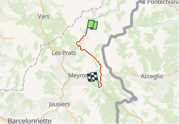
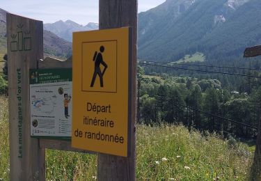
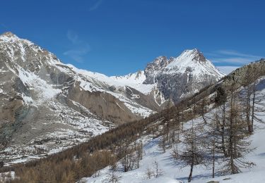
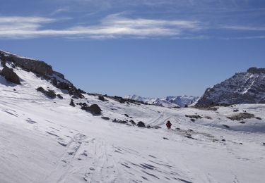
Trail On foot of 19.7 km to be discovered at Provence-Alpes-Côte d'Azur, Alpes-de-Haute-Provence, Saint-Paul-sur-Ubaye. This trail is proposed by MathieuBourgois.

Description

Fouilleuse 6.4km 400D   bar et resto
Fort de Plate Lombarde 9km et 710D
Col de Valonnet 12km et 1000D
Col de Mallemort 15km et 1200D
Larche 20km et 1200D

Elevation profile

Positioning

Country:
France
Region :
Provence-Alpes-Côte d'Azur
Department/Province :
Alpes-de-Haute-Provence
Municipality :
Saint-Paul-sur-Ubaye
Location:
Unknown
Start:(UTM)
325863 ; 4935701 (32T) N.

Trails nearby

Trail Walking Saint-Paul-sur-Ubaye - 05 Tour Font Sancte - étape 3 - Photo
Walking
Maryma

Walking

Very difficult
(1)
Saint-Paul-sur-Ubaye, Provence-Alpes-Côte d'Azur, Alpes-de-Haute-Provence, France
16.7 km | 31 km-effort
7h 8min
No
Trail Walking Saint-Paul-sur-Ubaye - Pic Panestrel - Photo
Walking
GAPIAN43

Walking

Difficult
(1)
Saint-Paul-sur-Ubaye, Provence-Alpes-Côte d'Azur, Alpes-de-Haute-Provence, France
13 km | 32 km-effort
6h 16min
Yes
Trail Other activity Saint-Paul-sur-Ubaye - massour  - Photo
Other activity
Sandrine1

Other activity

Medium
(1)
Saint-Paul-sur-Ubaye, Provence-Alpes-Côte d'Azur, Alpes-de-Haute-Provence, France
6.1 km | 19.3 km-effort
3h 19min
No
Trail Walking Saint-Paul-sur-Ubaye - Lac des 9 couleurs - Photo
Walking
andre06130

Walking

Medium
(1)
Saint-Paul-sur-Ubaye, Provence-Alpes-Côte d'Azur, Alpes-de-Haute-Provence, France
17.4 km | 31 km-effort
6h 15min
Yes
Trail Walking Saint-Paul-sur-Ubaye - PLAN DE PAROUART DEPUIS MALJASSET - Photo
Walking
walrou63

Walking

Difficult
Saint-Paul-sur-Ubaye, Provence-Alpes-Côte d'Azur, Alpes-de-Haute-Provence, France
12.1 km | 15.6 km-effort
3h 20min
Yes
Trail Touring skiing Saint-Paul-sur-Ubaye - les portes de chillol  - Photo
Touring skiing
tchoua

Touring skiing

Medium
Saint-Paul-sur-Ubaye, Provence-Alpes-Côte d'Azur, Alpes-de-Haute-Provence, France
16.9 km | 31 km-effort
3h 45min
Yes
Trail Walking Saint-Paul-sur-Ubaye - Col Mary et col marie Marinet - Photo
Walking
janussity

Walking

Very difficult
Saint-Paul-sur-Ubaye, Provence-Alpes-Côte d'Azur, Alpes-de-Haute-Provence, France
18.3 km | 31 km-effort
5h 37min
No
Trail Walking Acceglio - tour  du chambeyron 2e jour - Photo
Walking
tchoua

Walking

Very difficult
Acceglio, Piemont, Cuneo, Italy
17.4 km | 29 km-effort
4h 46min
No
Trail Walking Saint-Paul-sur-Ubaye - SAINT PAUL  . Fouillouse o - Photo
Walking
RobinMicheline

Walking

Easy
Saint-Paul-sur-Ubaye, Provence-Alpes-Côte d'Azur, Alpes-de-Haute-Provence, France
12.6 km | 21 km-effort
3h 52min
Yes


Close
My subscriptions