![](/images/other/stat-length.png)
![Trail On foot Arvieux - Alpes jour 7: Brunissart à lieu de bivouac - Photo](https://media.geolcdn.com/t/1900/400/ext.pjpeg?maxdim=2&url=https%3A%2F%2Fstatic1.geolcdn.com%2Fsiteimages%2Fupload%2Ffiles%2F1545311037marcheuse_200dpi.jpg)
Alpes jour 7: Brunissart à lieu de bivouac
MathieuBourgois
User
![Length](/images/other/stat-length.png)
Length
18.4 km
![Max alt](https://static1.geolcdn.com/siteimages/upload/files/1508320355ic_sort_altitude_max_24dp.png)
Max alt
2497 m
![Uphill gradient](https://static1.geolcdn.com/siteimages/upload/files/1508320355ic_sort_den_pos_24dp.png)
Uphill gradient
1120 m
![Km-Effort](/images/other/stat-length.png)
Km-Effort
35 km
![Min alt](https://static1.geolcdn.com/siteimages/upload/files/1508320355ic_sort_altitude_min_24dp.png)
Min alt
1188 m
![Downhill gradient](https://static1.geolcdn.com/siteimages/upload/files/1508320355ic_sort_den_neg_24dp.png)
Downhill gradient
1525 m
![Boucle](https://static1.geolcdn.com/siteimages/upload/files/16400158638029165_repeat_loop_refresh_sync_direction_icon.png)
Boucle
No
Creation date :
2020-10-16 10:32:49.619
Updated on :
2021-06-07 12:47:44.429
![On foot](https://static1.geolcdn.com/sitytour/trail-icons/100.png)
--
Difficulty : Medium
![Scan this QR Code to open this trail in the SityTrail application](https://capi.geolives.com/qq0zvz2zws4bq2lad0pu/sitytour/trails/2578703/qr.png?size=200)
FREE GPS app for hiking
About
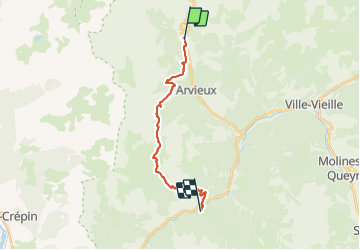
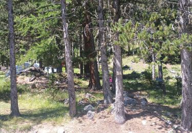
Trail On foot of 18.4 km to be discovered at Provence-Alpes-Côte d'Azur, Hautes-Alpes, Arvieux. This trail is proposed by MathieuBourgois.
Description
Torrent de Combe 3.2km et 100D
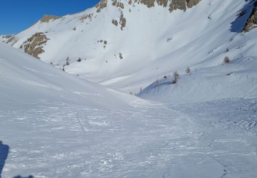
Col de Furfande 10km et 930D
Refuge de Furfande 11km et 930D , bar et resto
Escoyères 16km et 930D
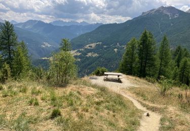
Lieu de bivouac 18km et 1100D
Positioning
Country:
France
Region :
Provence-Alpes-Côte d'Azur
Department/Province :
Hautes-Alpes
Municipality :
Arvieux
Location:
Unknown
Start:(Dec)
Start:(UTM)
320520 ; 4962472 (32T) N.
Comments
Trails nearby
![Trail Walking Arvieux - col de Néal par les chalets de Clapeyto - Photo](https://media.geolcdn.com/t/375/260/ext.jpg?maxdim=2&url=https%3A%2F%2Fservices.sitytrail.com%2FGeolivesWS%2FDownloadMedia.ashx%3FTrailID%3D599138%26Media%3Dfix__20160716134849.jpg)
![Walking Walking](https://static1.geolcdn.com/sitytour/trail-icons/101.png)
col de Néal par les chalets de Clapeyto
Walking
Easy
(2)
Arvieux,
Provence-Alpes-Côte d'Azur,
Hautes-Alpes,
France
![](/images/other/stat-length.png)
11.7 km | 19.7 km-effort
5h 34min
![](https://static1.geolcdn.com/siteimages/upload/files/16400158638029165_repeat_loop_refresh_sync_direction_icon.png)
Yes
![Trail Via ferrata Arvieux - via Ferrara combe la roche et pratique premier - Photo](https://media.geolcdn.com/t/375/260/7011aa1b-85bc-49b9-bfdc-a0fac06944f3.jpg&format=jpg&maxdim=2)
![Via ferrata Via ferrata](https://static1.geolcdn.com/sitytour/trail-icons/902.png)
via Ferrara combe la roche et pratique premier
Via ferrata
Easy
(1)
Arvieux,
Provence-Alpes-Côte d'Azur,
Hautes-Alpes,
France
![](/images/other/stat-length.png)
1.6 km | 7.7 km-effort
2h 16min
![](https://static1.geolcdn.com/siteimages/upload/files/16400158638029165_repeat_loop_refresh_sync_direction_icon.png)
No
![Trail Mountain bike Château-Ville-Vieille - Tour du Queyras - Photo](https://media.geolcdn.com/t/375/260/ext.jpg?maxdim=2&url=https%3A%2F%2Fservices.sitytrail.com%2FGeolivesWS%2FDownloadMedia.ashx%3FTrailID%3D101000%26Media%3D499_1.jpg)
![Mountain bike Mountain bike](https://static1.geolcdn.com/sitytour/trail-icons/202.png)
Tour du Queyras
Mountain bike
Very difficult
(1)
Château-Ville-Vieille,
Provence-Alpes-Côte d'Azur,
Hautes-Alpes,
France
![](/images/other/stat-length.png)
32 km | 50 km-effort
3h 0min
![](https://static1.geolcdn.com/siteimages/upload/files/16400158638029165_repeat_loop_refresh_sync_direction_icon.png)
Yes
![Trail Walking Cervières - pic de Rochebrune - Photo](https://media.geolcdn.com/t/375/260/ea442997-86d7-4881-85ee-42a65728ee43.jpg&format=jpg&maxdim=2)
![Walking Walking](https://static1.geolcdn.com/sitytour/trail-icons/101.png)
pic de Rochebrune
Walking
Very difficult
Cervières,
Provence-Alpes-Côte d'Azur,
Hautes-Alpes,
France
![](/images/other/stat-length.png)
10.8 km | 26 km-effort
8h 10min
![](https://static1.geolcdn.com/siteimages/upload/files/16400158638029165_repeat_loop_refresh_sync_direction_icon.png)
Yes
![Trail Other activity Cervières - crête de Bugnet. crête des Granges. Col des Peygus - Photo](https://media.geolcdn.com/t/375/260/ext.jpg?maxdim=2&url=https%3A%2F%2Fservices.sitytrail.com%2FGeolivesWS%2FDownloadMedia.ashx%3FTrailID%3D580887%26Media%3Dfix__20160520081820.jpg)
![Other activity Other activity](https://static1.geolcdn.com/sitytour/trail-icons/900.png)
crête de Bugnet. crête des Granges. Col des Peygus
Other activity
Medium
Cervières,
Provence-Alpes-Côte d'Azur,
Hautes-Alpes,
France
![](/images/other/stat-length.png)
14.3 km | 30 km-effort
8h 17min
![](https://static1.geolcdn.com/siteimages/upload/files/16400158638029165_repeat_loop_refresh_sync_direction_icon.png)
Yes
![Trail Other activity Arvieux - les chalet de clapeto - Photo](https://media.geolcdn.com/t/375/260/ext.jpg?maxdim=2&url=https%3A%2F%2Fstatic1.geolcdn.com%2Fsiteimages%2Fupload%2Ffiles%2F1545311037marcheuse_200dpi.jpg)
![Other activity Other activity](https://static1.geolcdn.com/sitytour/trail-icons/900.png)
les chalet de clapeto
Other activity
Medium
(2)
Arvieux,
Provence-Alpes-Côte d'Azur,
Hautes-Alpes,
France
![](/images/other/stat-length.png)
10.2 km | 18.3 km-effort
4h 18min
![](https://static1.geolcdn.com/siteimages/upload/files/16400158638029165_repeat_loop_refresh_sync_direction_icon.png)
Yes
![Trail Walking Arvieux - tour de la crête de combe la roche par Clapeyto - Photo](https://media.geolcdn.com/t/375/260/ada26b5c-248b-4898-ad11-59540c05ffed.jpg&format=jpg&maxdim=2)
![Walking Walking](https://static1.geolcdn.com/sitytour/trail-icons/101.png)
tour de la crête de combe la roche par Clapeyto
Walking
Very easy
Arvieux,
Provence-Alpes-Côte d'Azur,
Hautes-Alpes,
France
![](/images/other/stat-length.png)
7.7 km | 14.8 km-effort
1h 40min
![](https://static1.geolcdn.com/siteimages/upload/files/16400158638029165_repeat_loop_refresh_sync_direction_icon.png)
Yes
![Trail Snowshoes Arvieux - Arvieux- Col de Furfande - Photo](https://media.geolcdn.com/t/375/260/9dfc15e0-52ef-46ec-b577-723d411025c1.jpg&format=jpg&maxdim=2)
![Snowshoes Snowshoes](https://static1.geolcdn.com/sitytour/trail-icons/504.png)
Arvieux- Col de Furfande
Snowshoes
Easy
Arvieux,
Provence-Alpes-Côte d'Azur,
Hautes-Alpes,
France
![](/images/other/stat-length.png)
12.9 km | 26 km-effort
4h 6min
![](https://static1.geolcdn.com/siteimages/upload/files/16400158638029165_repeat_loop_refresh_sync_direction_icon.png)
Yes
![Trail Walking Arvieux - Lac de Roue variante - Photo](https://media.geolcdn.com/t/375/260/47a1f693-cfe5-4d23-9d8f-93854336be7c.jpg&format=jpg&maxdim=2)
![Walking Walking](https://static1.geolcdn.com/sitytour/trail-icons/101.png)
Lac de Roue variante
Walking
Difficult
Arvieux,
Provence-Alpes-Côte d'Azur,
Hautes-Alpes,
France
![](/images/other/stat-length.png)
9.5 km | 14.6 km-effort
3h 34min
![](https://static1.geolcdn.com/siteimages/upload/files/16400158638029165_repeat_loop_refresh_sync_direction_icon.png)
Yes