


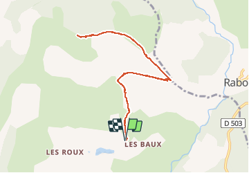

11.5 km | 21 km-effort

User


FREE GPS app for hiking
 SityTrail
IGN / Geographical institutes
SityTrail World
The world is yours!
Trail Walking of 9.8 km to be discovered at Provence-Alpes-Côte d'Azur, Hautes-Alpes, La Roche-des-Arnauds. This trail is proposed by Dervalmarc.
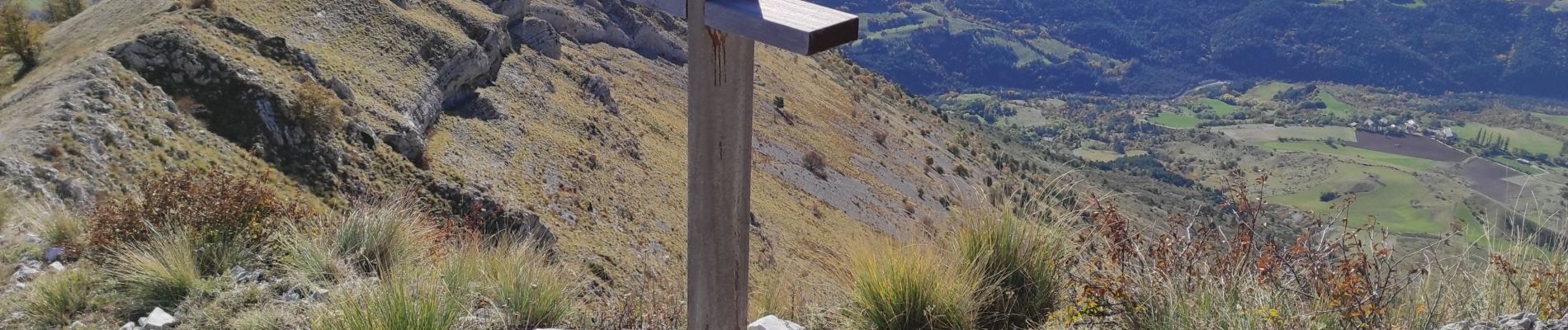
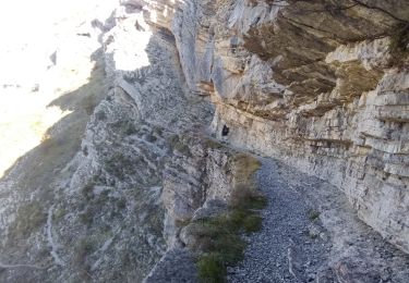
Attention les deux tiers de la randonnée se déroule sur une ligne de crête qui domine de nombreux à pics.
Randonnée à caractère très alpin.


Walking

Walking

Walking

Mountain bike

On foot
Walking

Running

Mountain bike

Mountain bike