


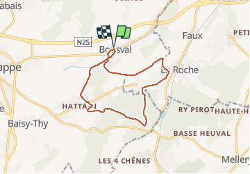

13.3 km | 16.4 km-effort


User GUIDE


FREE GPS app for hiking
 SityTrail
IGN / Geographical institutes
SityTrail World
The world is yours!
Trail On foot of 12.3 km to be discovered at Wallonia, Walloon Brabant, Genappe. This trail is proposed by Desrumaux.
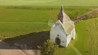
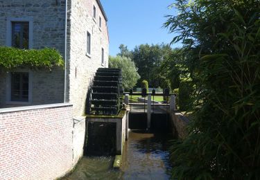
Très agréable balade au départ de Bousval vers le village de Tangissart en passant par la chapelle du try-au-Chêne, le bois de Hez et le Ry de Falise.


Walking

Walking

Walking

Walking

Walking

Walking

Walking

Walking
Walking