![](/images/other/stat-length.png)
![Trail Walking Diepenbeek - Diepenbeek - Photo](https://media.geolcdn.com/t/1900/400/01eb599c-386f-4b0d-b162-ae9d112c9ebf.jpg&format=pjpeg&maxdim=2)
Diepenbeek
mumu.larandonneuse
User GUIDE
![Length](/images/other/stat-length.png)
Length
18.9 km
![Max alt](https://static1.geolcdn.com/siteimages/upload/files/1508320355ic_sort_altitude_max_24dp.png)
Max alt
47 m
![Uphill gradient](https://static1.geolcdn.com/siteimages/upload/files/1508320355ic_sort_den_pos_24dp.png)
Uphill gradient
114 m
![Km-Effort](/images/other/stat-length.png)
Km-Effort
20 km
![Min alt](https://static1.geolcdn.com/siteimages/upload/files/1508320355ic_sort_altitude_min_24dp.png)
Min alt
30 m
![Downhill gradient](https://static1.geolcdn.com/siteimages/upload/files/1508320355ic_sort_den_neg_24dp.png)
Downhill gradient
114 m
![Boucle](https://static1.geolcdn.com/siteimages/upload/files/16400158638029165_repeat_loop_refresh_sync_direction_icon.png)
Boucle
Yes
Creation date :
2020-10-07 08:19:50.295
Updated on :
2020-10-16 15:04:54.115
![Walking](https://static1.geolcdn.com/sitytour/trail-icons/101.png)
3h49
Difficulty : Very easy
![Scan this QR Code to open this trail in the SityTrail application](https://capi.geolives.com/qq0zvz2zws4bq2lad0pu/sitytour/trails/2570727/qr.png?size=200)
FREE GPS app for hiking
About
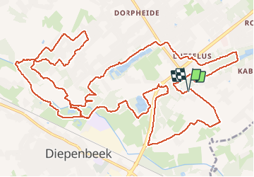
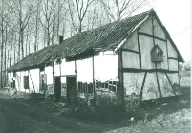
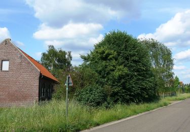
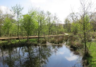
Trail Walking of 18.9 km to be discovered at Flanders, Limburg, Diepenbeek. This trail is proposed by mumu.larandonneuse.
Description
Belle randonnée sans difficulté et chemins diversifiés.
D/A : Parking Onze Lieve Vrouwstraat 22 à Diepenbeek.
Parcours de 12 km possible sans faire la boucle après le complexe sportif. Après le petit pont, tourner directement à droite le long de l'eau.
Positioning
Country:
Belgium
Region :
Flanders
Department/Province :
Limburg
Municipality :
Diepenbeek
Location:
Diepenbeek
Start:(Dec)
Start:(UTM)
671992 ; 5643488 (31U) N.
Comments
Trails nearby
![Trail Walking Genk - Promenade vers la piste dans l'eau, dans le magnifique domaine de Bokrijk - Photo](https://media.geolcdn.com/t/375/260/45cc0ed2-db94-4d5d-a7c6-1096a930a2ab.jpg&format=jpg&maxdim=2)
![Walking Walking](https://static1.geolcdn.com/sitytour/trail-icons/101.png)
Promenade vers la piste dans l'eau, dans le magnifique domaine de Bokrijk
Walking
Easy
(3)
Genk,
Flanders,
Limburg,
Belgium
![](/images/other/stat-length.png)
4.1 km | 4.6 km-effort
1h 2min
![](https://static1.geolcdn.com/siteimages/upload/files/16400158638029165_repeat_loop_refresh_sync_direction_icon.png)
Yes
![Trail Walking Diepenbeek - La vallée du Démer - La réserve naturelle Dorpsbemden à Diepenbeek - Photo](https://media.geolcdn.com/t/375/260/831c90b3-6b69-4442-bd2d-357552ece2e5.jpeg&format=jpg&maxdim=2)
![Walking Walking](https://static1.geolcdn.com/sitytour/trail-icons/101.png)
La vallée du Démer - La réserve naturelle Dorpsbemden à Diepenbeek
Walking
Easy
Diepenbeek,
Flanders,
Limburg,
Belgium
![](/images/other/stat-length.png)
3.1 km | 3.3 km-effort
45min
![](https://static1.geolcdn.com/siteimages/upload/files/16400158638029165_repeat_loop_refresh_sync_direction_icon.png)
Yes
![Trail Walking Diepenbeek - La vallée du Démer - Le ruisseau Dauten et les Dautewijers à Diepenbeek - Photo](https://media.geolcdn.com/t/375/260/ff431e14-a2e4-4401-9193-e96799f79a9a.jpeg&format=jpg&maxdim=2)
![Walking Walking](https://static1.geolcdn.com/sitytour/trail-icons/101.png)
La vallée du Démer - Le ruisseau Dauten et les Dautewijers à Diepenbeek
Walking
Easy
Diepenbeek,
Flanders,
Limburg,
Belgium
![](/images/other/stat-length.png)
5.4 km | 5.8 km-effort
1h 19min
![](https://static1.geolcdn.com/siteimages/upload/files/16400158638029165_repeat_loop_refresh_sync_direction_icon.png)
Yes
![Trail On foot Diepenbeek - Lange afstandstocht - Photo](https://media.geolcdn.com/t/375/260/c0f28296-bcff-4fe2-9db4-902c2464ce24.jpeg&format=jpg&maxdim=2)
![On foot On foot](https://static1.geolcdn.com/sitytour/trail-icons/100.png)
Lange afstandstocht
On foot
Easy
Diepenbeek,
Flanders,
Limburg,
Belgium
![](/images/other/stat-length.png)
16.5 km | 17.8 km-effort
4h 2min
![](https://static1.geolcdn.com/siteimages/upload/files/16400158638029165_repeat_loop_refresh_sync_direction_icon.png)
Yes
![Trail On foot Genk - Zillebos blauwe ruit - Photo](https://media.geolcdn.com/t/375/260/6925453e-2323-4e41-8380-50ced4fee93a.jpeg&format=jpg&maxdim=2)
![On foot On foot](https://static1.geolcdn.com/sitytour/trail-icons/100.png)
Zillebos blauwe ruit
On foot
Easy
Genk,
Flanders,
Limburg,
Belgium
![](/images/other/stat-length.png)
4.2 km | 4.9 km-effort
1h 7min
![](https://static1.geolcdn.com/siteimages/upload/files/16400158638029165_repeat_loop_refresh_sync_direction_icon.png)
Yes
![Trail On foot Genk - Zillebos rode driehoek - Photo](https://media.geolcdn.com/t/375/260/6925453e-2323-4e41-8380-50ced4fee93a.jpeg&format=jpg&maxdim=2)
![On foot On foot](https://static1.geolcdn.com/sitytour/trail-icons/100.png)
Zillebos rode driehoek
On foot
Easy
Genk,
Flanders,
Limburg,
Belgium
![](/images/other/stat-length.png)
5.5 km | 6.4 km-effort
1h 27min
![](https://static1.geolcdn.com/siteimages/upload/files/16400158638029165_repeat_loop_refresh_sync_direction_icon.png)
Yes
![Trail On foot Genk - De Maten oranje - Photo](https://media.geolcdn.com/t/375/260/5daa36df-5a45-46f0-9e87-234b3c303469.jpeg&format=jpg&maxdim=2)
![On foot On foot](https://static1.geolcdn.com/sitytour/trail-icons/100.png)
![Trail On foot Hasselt - Kiewit Wildernis route - Photo](https://media.geolcdn.com/t/375/260/3dbc744d-9453-4105-ac17-d803e722e0e9.jpeg&format=jpg&maxdim=2)
![On foot On foot](https://static1.geolcdn.com/sitytour/trail-icons/100.png)
Kiewit Wildernis route
On foot
Easy
Hasselt,
Flanders,
Limburg,
Belgium
![](/images/other/stat-length.png)
3.3 km | 3.7 km-effort
49min
![](https://static1.geolcdn.com/siteimages/upload/files/16400158638029165_repeat_loop_refresh_sync_direction_icon.png)
Yes
![Trail On foot Hasselt - Kiewit Wijer route - Photo](https://media.geolcdn.com/t/375/260/3dbc744d-9453-4105-ac17-d803e722e0e9.jpeg&format=jpg&maxdim=2)
![On foot On foot](https://static1.geolcdn.com/sitytour/trail-icons/100.png)
Kiewit Wijer route
On foot
Easy
Hasselt,
Flanders,
Limburg,
Belgium
![](/images/other/stat-length.png)
4.1 km | 4.6 km-effort
1h 3min
![](https://static1.geolcdn.com/siteimages/upload/files/16400158638029165_repeat_loop_refresh_sync_direction_icon.png)
Yes