Trail Walking Montperreux - Chaon Saint Point - Lac - Photo
 helmut68
helmut68

User

© OpenStreetMap contributors
Length
Length
15.1 km
Max alt
Max alt
982 m
Uphill gradient
Uphill gradient
317 m
Km-Effort
Km-Effort  
19.4 km
Min alt
Min alt
848 m
Downhill gradient
Downhill gradient
329 m
Boucle
Boucle
Yes
Creation date :
2020-10-02 12:26:08.05
Updated on :
2020-10-11 15:21:59.107

(1 Reviews)

Walking
Walking
3h05
Difficulty : Easy

Scan this QR Code to open this trail in the SityTrail application

FREE GPS app for hiking

Logo SityTrail SityTrail

IGN / Geographical institutes

Download SityTrail from the App Store Download SityTrail from Google Play

Logo SityTrail SityTrail World

The world is yours!

Download SityTrail from the App Store Download SityTrail from Google Play Download SityTrail on Huawei AppGallery

About

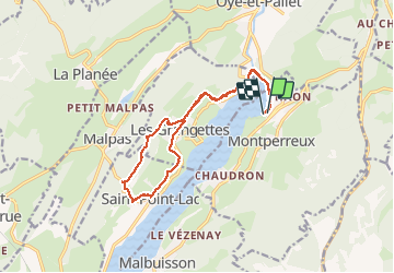
Trail Walking of 15.1 km to be discovered at Bourgogne-Franche-Comté, Doubs, Montperreux. This trail is proposed by helmut68.

Description

Départ et retour " rue du Lac " à Chaon .
Suivre le balisage " jaune bleu " tout le long du parcours.
La randonnée est une partie du " Tour du Lac de St Point " rive gauche ( Port Titi , Les Grangettes , Saint Point - Lac  mais avec la boucle Les Grangettes et Saint Point - Lac en plus) .
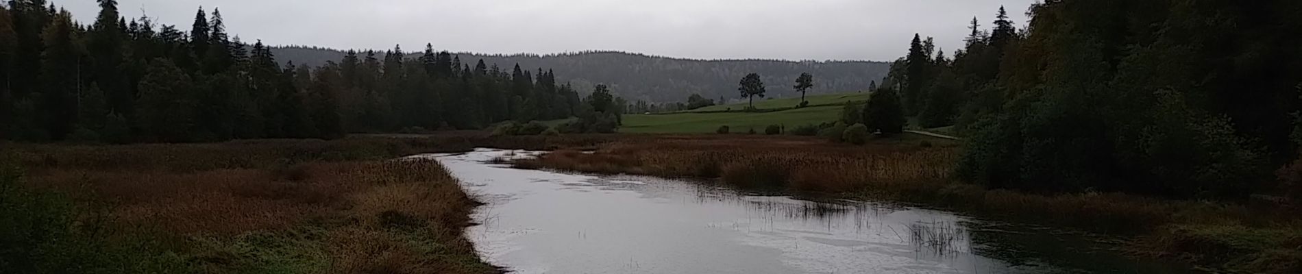
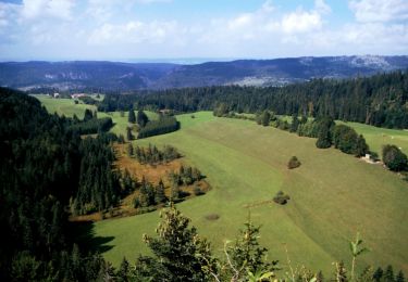
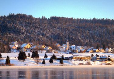
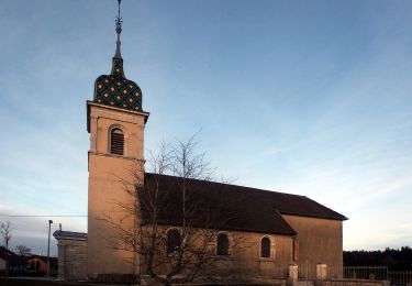
Cette balade offre un bref aperçu de la partie orientale de la Haute Vallée du Doubs. Le sentier chemine depuis la vallée aux paysages façonnés par une agriculture vouée à l'élevage , jusqu'aux versants et sommets ou la forêt (bois de Montaigu ) à conservée ses droits . A noter qu' à Saint Point -Lac l'église est classée Monument Historique. Son clocher -porche est surmonté d'un clocher coiffé d'u dôme à impériale .Ses chapelles latérales datent de 1480.
Alors à vos chaussures !

Elevation profile

Photos

23 photos in total. Please click on a photo to see them all in the gallery.

Positioning

Country:
France
Region :
Bourgogne-Franche-Comté
Department/Province :
Doubs
Municipality :
Montperreux
Location:
Unknown
Start:(UTM)
297052 ; 5189867 (32T) N.

Comments

Please log in to post a review or rate the element


Trails nearby

Trail Walking Les Fourgs - Le Stratégique - Doubs - Photo
Walking
tracegps

Walking

Medium
(1)
Les Fourgs, Bourgogne-Franche-Comté, Doubs, France
8.3 km | 10.6 km-effort
2h 45min
Yes
Trail Walking Les Fourgs - 2024-01-31_00h34m12_le-belvedere-de-la-roche-sarrasine_randonnee-2285212 - Photo
Walking
daniellebou

Walking

Difficult
(1)
Les Fourgs, Bourgogne-Franche-Comté, Doubs, France
12.4 km | 17 km-effort
3h 51min
Yes
Trail Walking Saint-Antoine - Boucle du fort St Antoine  - Photo
Walking
mallovon

Walking

Medium
Saint-Antoine, Bourgogne-Franche-Comté, Doubs, France
4.8 km | 6.2 km-effort
1h 25min
Yes
Trail On foot Saint-Point-Lac - La Ronde des Deux Villages - Photo
On foot
GUIDE+

On foot

Easy
Saint-Point-Lac, Bourgogne-Franche-Comté, Doubs, France
5.5 km | 7.3 km-effort
1h 40min
Yes
Trail On foot Les Grangettes - La Pierre qui Tourne - Photo
On foot
GUIDE+

On foot

Easy
Les Grangettes, Bourgogne-Franche-Comté, Doubs, France
8.2 km | 10.7 km-effort
2h 25min
Yes
Trail On foot Malpas - Le Tour du Lac de Malpas - Photo
On foot
GUIDE+

On foot

Easy
Malpas, Bourgogne-Franche-Comté, Doubs, France
4.9 km | 5.7 km-effort
1h 17min
Yes
Trail On foot Malbuisson - Sentier du Tour du Lac - Photo
On foot
GUIDE+

On foot

Easy
Malbuisson, Bourgogne-Franche-Comté, Doubs, France
16 km | 19.9 km-effort
4h 30min
No
Trail Nordic walking Malbuisson - Fort St Antoine  - Photo
Nordic walking
mallovon

Nordic walking

Easy
Malbuisson, Bourgogne-Franche-Comté, Doubs, France
5.8 km | 7.3 km-effort
2h 21min
Yes
Trail Cross-country skiing Les Hôpitaux-Vieux - Les Essarts - Photo
Cross-country skiing
mallovon

Cross-country skiing

Easy
Les Hôpitaux-Vieux, Bourgogne-Franche-Comté, Doubs, France
6.5 km | 8.1 km-effort
2h 3min
Yes


Close
My subscriptions