![](/images/other/stat-length.png)
![Trail On foot Plateau-des-Petites-Roches - Mont Pravouta - Photo](https://media.geolcdn.com/t/1900/400/9a1bbdcd-d8fc-4b57-9b58-cd74e88e17ff.jpg&format=pjpeg&maxdim=2)
Mont Pravouta
crocau
User
![Length](/images/other/stat-length.png)
![Max alt](https://static1.geolcdn.com/siteimages/upload/files/1508320355ic_sort_altitude_max_24dp.png)
![Uphill gradient](https://static1.geolcdn.com/siteimages/upload/files/1508320355ic_sort_den_pos_24dp.png)
![Km-Effort](/images/other/stat-length.png)
![Min alt](https://static1.geolcdn.com/siteimages/upload/files/1508320355ic_sort_altitude_min_24dp.png)
![Downhill gradient](https://static1.geolcdn.com/siteimages/upload/files/1508320355ic_sort_den_neg_24dp.png)
![Boucle](https://static1.geolcdn.com/siteimages/upload/files/16400158638029165_repeat_loop_refresh_sync_direction_icon.png)
![On foot](https://static1.geolcdn.com/sitytour/trail-icons/100.png)
1h30
Difficulty : Easy
![Scan this QR Code to open this trail in the SityTrail application](https://capi.geolives.com/qq0zvz2zws4bq2lad0pu/sitytour/trails/2547506/qr.png?size=200)
FREE GPS app for hiking
About
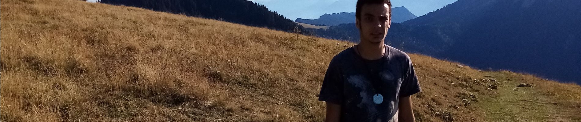
Trail On foot of 4.6 km to be discovered at Auvergne-Rhône-Alpes, Isère, Plateau-des-Petites-Roches. This trail is proposed by crocau.
Description
Une très jolie rando facile avec un petit coup de cul juste après le début. Rien de méchant. On peut y aller avec des enfants en bas âge. Tout est beau dans cette balade et surtout un point de vue très remarquable : à gauche la dent de Crolles, l'Etendard, le Pic de Bayle , Belledonne et son pic, le Taillefer, L'obiou , le Mont Aiguille et bien d'autres choses à voir !
Positioning
Comments
Trails nearby
![Trail Walking Saint-Nazaire-les-Eymes - Chateau-Nardent par le C9 - Photo](https://media.geolcdn.com/t/375/260/536a5eba-5214-4ffc-98c0-901c667d171a.jpg&format=jpg&maxdim=2)
![Walking Walking](https://static1.geolcdn.com/sitytour/trail-icons/101.png)
Walking
![](/images/other/stat-length.png)
![](https://static1.geolcdn.com/siteimages/upload/files/16400158638029165_repeat_loop_refresh_sync_direction_icon.png)
![Trail Walking Plateau-des-Petites-Roches - Dent de Crolles - Photo](https://media.geolcdn.com/t/375/260/ext.jpg?maxdim=2&url=https%3A%2F%2Fservices.sitytrail.com%2FGeolivesWS%2FDownloadMedia.ashx%3FTrailID%3D130814%26Media%3D767bc21a-4ce2-4030-b461-37133051040c.jpg)
![Walking Walking](https://static1.geolcdn.com/sitytour/trail-icons/101.png)
Walking
![](/images/other/stat-length.png)
![](https://static1.geolcdn.com/siteimages/upload/files/16400158638029165_repeat_loop_refresh_sync_direction_icon.png)
![Trail Walking Saint-Pierre-de-Chartreuse - Le Charmant Som 1867m, par les dalles - Photo](https://media.geolcdn.com/t/375/260/ext.jpg?maxdim=2&url=https%3A%2F%2Fservices.sitytrail.com%2FGeolivesWS%2FDownloadMedia.ashx%3FTrailID%3D101690%26Media%3D1926_1.jpg)
![Walking Walking](https://static1.geolcdn.com/sitytour/trail-icons/101.png)
Walking
![](/images/other/stat-length.png)
![](https://static1.geolcdn.com/siteimages/upload/files/16400158638029165_repeat_loop_refresh_sync_direction_icon.png)
![Trail Walking Plateau-des-Petites-Roches - Piton et Dôme de Bellefont - Photo](https://media.geolcdn.com/t/375/260/ext.jpg?maxdim=2&url=https%3A%2F%2Fservices.sitytrail.com%2FGeolivesWS%2FDownloadMedia.ashx%3FTrailID%3D101446%26Media%3D1519_1.jpg)
![Walking Walking](https://static1.geolcdn.com/sitytour/trail-icons/101.png)
Walking
![](/images/other/stat-length.png)
![](https://static1.geolcdn.com/siteimages/upload/files/16400158638029165_repeat_loop_refresh_sync_direction_icon.png)
![Trail Walking Saint-Pierre-de-Chartreuse - pas de rochebrune et de rocheplane - Photo](https://media.geolcdn.com/t/375/260/643b9872-5358-4c95-b9d7-43cb72f88471.jpg&format=jpg&maxdim=2)
![Walking Walking](https://static1.geolcdn.com/sitytour/trail-icons/101.png)
Walking
![](/images/other/stat-length.png)
![](https://static1.geolcdn.com/siteimages/upload/files/16400158638029165_repeat_loop_refresh_sync_direction_icon.png)
![Trail Walking Saint-Pierre-de-Chartreuse - tour de la Dent de crolles par des sangles - Photo](https://media.geolcdn.com/t/375/260/9e1abd5a-85a3-461c-ab6a-25f1470ccefa.jpg&format=jpg&maxdim=2)
![Walking Walking](https://static1.geolcdn.com/sitytour/trail-icons/101.png)
Walking
![](/images/other/stat-length.png)
![](https://static1.geolcdn.com/siteimages/upload/files/16400158638029165_repeat_loop_refresh_sync_direction_icon.png)
![Trail On foot Plateau-des-Petites-Roches - Tour de Pravouta - Photo](https://media.geolcdn.com/t/375/260/432c9697-22d9-4837-a6d3-2165ebce375b.jpeg&format=jpg&maxdim=2)
![On foot On foot](https://static1.geolcdn.com/sitytour/trail-icons/100.png)
On foot
![](/images/other/stat-length.png)
![](https://static1.geolcdn.com/siteimages/upload/files/16400158638029165_repeat_loop_refresh_sync_direction_icon.png)
![Trail Touring skiing Plateau-des-Petites-Roches - Pravouta et bec de Charvet - Photo](https://media.geolcdn.com/t/375/260/b74dc963-a672-4a8f-9168-b0500b4135b1.jpg&format=jpg&maxdim=2)
![Touring skiing Touring skiing](https://static1.geolcdn.com/sitytour/trail-icons/503.png)
Touring skiing
![](/images/other/stat-length.png)
![](https://static1.geolcdn.com/siteimages/upload/files/16400158638029165_repeat_loop_refresh_sync_direction_icon.png)
![Trail Walking Plateau-des-Petites-Roches - Dent de Crolles tour - Photo](https://media.geolcdn.com/t/375/260/ext.jpg?maxdim=2&url=https%3A%2F%2Fstatic1.geolcdn.com%2Fsiteimages%2Fupload%2Ffiles%2F1553511878bg_sport_marche.png)
![Walking Walking](https://static1.geolcdn.com/sitytour/trail-icons/101.png)
Walking
![](/images/other/stat-length.png)
![](https://static1.geolcdn.com/siteimages/upload/files/16400158638029165_repeat_loop_refresh_sync_direction_icon.png)