Trail Walking Chalais -  - Photo
 lroux
lroux

User

© OpenStreetMap contributors
Length
Length
14.1 km
Max alt
Max alt
2979 m
Uphill gradient
Uphill gradient
1742 m
Km-Effort
Km-Effort  
32 km
Min alt
Min alt
1317 m
Downhill gradient
Downhill gradient
83 m
Boucle
Boucle
No
Creation date :
2014-12-11 00:00:00.0
Updated on :
2014-12-11 00:00:00.0

(0 Reviews)

Walking
Walking
6h30
Difficulty : Unknown

Scan this QR Code to open this trail in the SityTrail application

FREE GPS app for hiking

Logo SityTrail SityTrail

IGN / Geographical institutes

Download SityTrail from the App Store Download SityTrail from Google Play

Logo SityTrail SityTrail World

The world is yours!

Download SityTrail from the App Store Download SityTrail from Google Play Download SityTrail on Huawei AppGallery

About

Trail Walking of 14.1 km to be discovered at Valais/Wallis, Sierre, Chalais. This trail is proposed by lroux.

Description

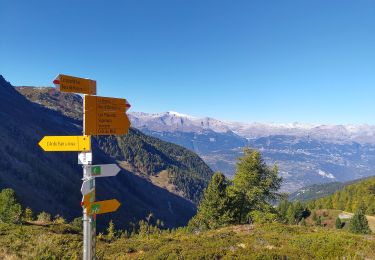
Attention à bien passer par le refuge du bisse et par le bisse de Vercorin qui amène à l''apage de La Lé. Sinon, on monte sur les piste de ski, et ça, c''est pas le pied. Au fonds du Tsartsey, là où le pont de bois traverse la Rèche, face à la cascade qui descend de l''Ar du Tsan, c''est probablement le plus beau paysage d''alpage que je connaisse. Surtout si les fleurs décorent la montée raide sur l''Ar du Tsan. La dernière montée jsuqu''au col de Tsavolire peut être couveerte d''un grand névé. Dans l''après-midi la neige ne portee plu, et il faut trouver des passages dans la caillasse. Mais courage, la cabane est juste là après le cil et le Leonberg de Chantal vous accueille en grondant gentiment (cf. commentaire de la deuxième étape.). En montant, le lac du Louché invite à la baigande et certains l''on fait.

Elevation profile

Positioning

Country:
Switzerland
Region :
Valais/Wallis
Department/Province :
Sierre
Municipality :
Chalais
Location:
Unknown
Start:(UTM)
386804 ; 5123569 (32T) N.

Trails nearby

Trail On foot Chalais - Les Planards-L'Ar du Tsan - Photo
On foot
GUIDE+

On foot

Easy
Chalais, Valais/Wallis, Sierre, Switzerland
4.8 km | 6.7 km-effort
1h 31min
No
Trail On foot Chalais - La Lé-refuge du Bisse - Photo
On foot
GUIDE+

On foot

Easy
Chalais, Valais/Wallis, Sierre, Switzerland
3.2 km | 5 km-effort
1h 7min
No
Trail Walking Crans-Montana - Chemin du Vignoble - Itinéraire dégustation - Photo
Walking
GUIDE+

Walking

Very easy
Crans-Montana, Valais/Wallis, Sierre, Switzerland
7 km | 10.2 km-effort
2h 45min
No
Trail Walking Sierre - Sierre à Chandolin - Photo
Walking
chandolin

Walking

Very easy
(1)
Sierre, Valais/Wallis, Sierre, Switzerland
11.5 km | 28 km-effort
7h 24min
No
Trail Walking Chalais - Crêt du Midi - Ar du Tsan- Bisse Vercorin - Photo
Walking
vercorin

Walking

Very easy
(1)
Chalais, Valais/Wallis, Sierre, Switzerland
11.4 km | 17 km-effort
3h 46min
No
Trail On foot Grône - Mayens de Réchy-Brie - Photo
On foot
GUIDE+

On foot

Easy
Grône, Valais/Wallis, Sierre, Switzerland
6.3 km | 11.2 km-effort
2h 32min
No
Trail Walking Sierre - Promenade de Finges - Photo
Walking
GUIDE+

Walking

Very easy
Sierre, Valais/Wallis, Sierre, Switzerland
8.4 km | 10.4 km-effort
2h 29min
No
Trail Walking Crans-Montana - Crans-Montana, Terre de foi - Photo
Walking
GUIDE+

Walking

Very easy
Crans-Montana, Valais/Wallis, Sierre, Switzerland
16.4 km | 26 km-effort
8h 0min
Yes
Trail Walking Crans-Montana - Montana-Village - Lens - Photo
Walking
GUIDE+

Walking

Very easy
Crans-Montana, Valais/Wallis, Sierre, Switzerland
4.3 km | 5.1 km-effort
1h 15min
No


Close
My subscriptions