![](/images/other/stat-length.png)
![Trail Walking Soccia - LAC DE CRENO - Photo](https://media.geolcdn.com/t/1900/400/ext.pjpeg?maxdim=2&url=https%3A%2F%2Fmedia.geolcdn.com%2Ff%2Fbaa822e7-7544-4373-a928-bf8342301d52.jpg)
LAC DE CRENO
jean-marie.parachini
User
![Length](/images/other/stat-length.png)
Length
7.4 km
![Max alt](https://static1.geolcdn.com/siteimages/upload/files/1508320355ic_sort_altitude_max_24dp.png)
Max alt
1349 m
![Uphill gradient](https://static1.geolcdn.com/siteimages/upload/files/1508320355ic_sort_den_pos_24dp.png)
Uphill gradient
367 m
![Km-Effort](/images/other/stat-length.png)
Km-Effort
12.3 km
![Min alt](https://static1.geolcdn.com/siteimages/upload/files/1508320355ic_sort_altitude_min_24dp.png)
Min alt
1008 m
![Downhill gradient](https://static1.geolcdn.com/siteimages/upload/files/1508320355ic_sort_den_neg_24dp.png)
Downhill gradient
371 m
![Boucle](https://static1.geolcdn.com/siteimages/upload/files/16400158638029165_repeat_loop_refresh_sync_direction_icon.png)
Boucle
Yes
Creation date :
2020-09-07 09:22:20.246
Updated on :
2020-09-07 19:22:39.795
![Walking](https://static1.geolcdn.com/sitytour/trail-icons/101.png)
2h53
Difficulty : Difficult
![Scan this QR Code to open this trail in the SityTrail application](https://capi.geolives.com/qq0zvz2zws4bq2lad0pu/sitytour/trails/2542512/qr.png?size=200)
FREE GPS app for hiking
About
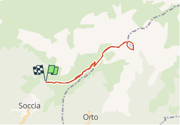
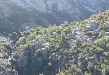
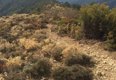
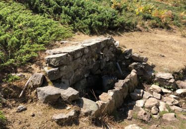
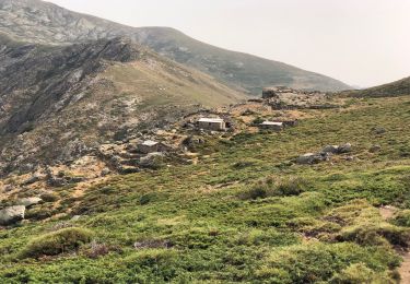
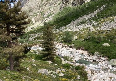
Trail Walking of 7.4 km to be discovered at Corsica, South Corsica, Soccia. This trail is proposed by jean-marie.parachini.
Description
parcours aller et retour depuis village de Soccia vers le lac de Creno.
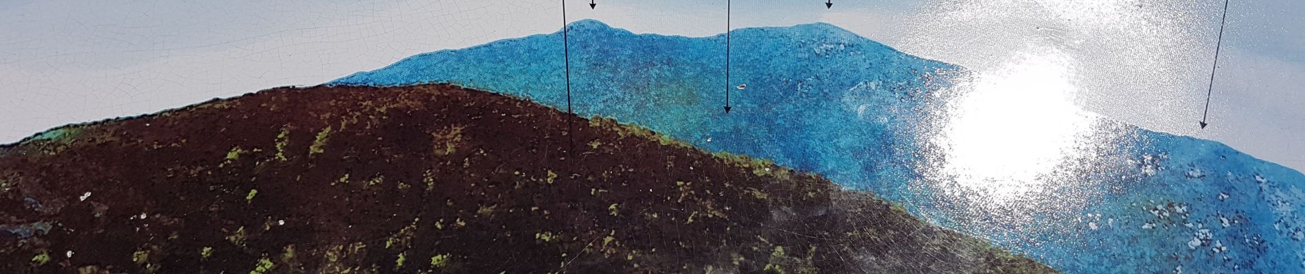
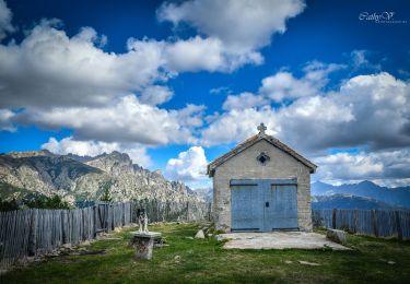
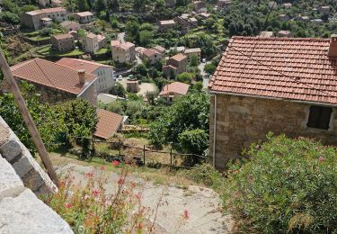
Positioning
Country:
France
Region :
Corsica
Department/Province :
South Corsica
Municipality :
Soccia
Location:
Unknown
Start:(Dec)
Start:(UTM)
493162 ; 4671526 (32T) N.
Comments
Trails nearby
![Trail On foot Soccia - Lac de CRENA et Chapelle St Eliseo - Photo](https://media.geolcdn.com/t/375/260/ext.jpg?maxdim=2&url=https%3A%2F%2Fmedia.geolcdn.com%2Ff%2Feb8f6c32-2d15-454a-82a0-f0390d86d1f8.jpg)
![On foot On foot](https://static1.geolcdn.com/sitytour/trail-icons/100.png)
Lac de CRENA et Chapelle St Eliseo
On foot
Easy
(1)
Soccia,
Corsica,
South Corsica,
France
![](/images/other/stat-length.png)
8.1 km | 15.2 km-effort
Unknown
![](https://static1.geolcdn.com/siteimages/upload/files/16400158638029165_repeat_loop_refresh_sync_direction_icon.png)
Yes
![Trail Walking Soccia - lac de creno - Photo](https://media.geolcdn.com/t/375/260/ext.jpg?maxdim=2&url=https%3A%2F%2Fstatic1.geolcdn.com%2Fsiteimages%2Fupload%2Ffiles%2F1553511878bg_sport_marche.png)
![Walking Walking](https://static1.geolcdn.com/sitytour/trail-icons/101.png)
lac de creno
Walking
Easy
(3)
Soccia,
Corsica,
South Corsica,
France
![](/images/other/stat-length.png)
8.9 km | 13.6 km-effort
2h 25min
![](https://static1.geolcdn.com/siteimages/upload/files/16400158638029165_repeat_loop_refresh_sync_direction_icon.png)
Yes
![Trail Walking Soccia - Lac de Creno - Photo](https://media.geolcdn.com/t/375/260/ext.jpg?maxdim=2&url=https%3A%2F%2Fstatic1.geolcdn.com%2Fsiteimages%2Fupload%2Ffiles%2F1553511878bg_sport_marche.png)
![Walking Walking](https://static1.geolcdn.com/sitytour/trail-icons/101.png)
Lac de Creno
Walking
Easy
(3)
Soccia,
Corsica,
South Corsica,
France
![](/images/other/stat-length.png)
7.6 km | 12.6 km-effort
3h 28min
![](https://static1.geolcdn.com/siteimages/upload/files/16400158638029165_repeat_loop_refresh_sync_direction_icon.png)
Yes
![Trail Walking Soccia - Lac de Creno depuis Soccia - Photo](https://media.geolcdn.com/t/375/260/ext.jpg?maxdim=2&url=https%3A%2F%2Fmedia.geolcdn.com%2Ff%2Fd33ee31a-2418-4668-9b10-fc06e03e2f9b.jpg)
![Walking Walking](https://static1.geolcdn.com/sitytour/trail-icons/101.png)
Lac de Creno depuis Soccia
Walking
Difficult
Soccia,
Corsica,
South Corsica,
France
![](/images/other/stat-length.png)
10.5 km | 19.1 km-effort
3h 36min
![](https://static1.geolcdn.com/siteimages/upload/files/16400158638029165_repeat_loop_refresh_sync_direction_icon.png)
Yes
![Trail Walking Soccia - Lac de Goria - Photo](https://media.geolcdn.com/t/375/260/ext.jpg?maxdim=2&url=https%3A%2F%2Fmedia.geolcdn.com%2Ff%2F6c4d20a7-4a11-40fc-ab38-4d19571b2772.jpg)
![Walking Walking](https://static1.geolcdn.com/sitytour/trail-icons/101.png)
Lac de Goria
Walking
Very difficult
Soccia,
Corsica,
South Corsica,
France
![](/images/other/stat-length.png)
22 km | 36 km-effort
7h 34min
![](https://static1.geolcdn.com/siteimages/upload/files/16400158638029165_repeat_loop_refresh_sync_direction_icon.png)
Yes
![Trail Walking Soccia - Soccia lac de creno monte santelisea - Photo](https://media.geolcdn.com/t/375/260/ext.jpg?maxdim=2&url=https%3A%2F%2Fmedia.geolcdn.com%2Ff%2Fe96f9911-d811-4b64-89ac-acc7b371493a.jpg)
![Walking Walking](https://static1.geolcdn.com/sitytour/trail-icons/101.png)
Soccia lac de creno monte santelisea
Walking
Easy
Soccia,
Corsica,
South Corsica,
France
![](/images/other/stat-length.png)
9.3 km | 16.7 km-effort
4h 16min
![](https://static1.geolcdn.com/siteimages/upload/files/16400158638029165_repeat_loop_refresh_sync_direction_icon.png)
Yes
![Trail Walking Poggiolo - Monte Ciarbellu - Photo](https://media.geolcdn.com/t/375/260/ext.jpg?maxdim=2&url=https%3A%2F%2Fmedia.geolcdn.com%2Ff%2Fc06ffb1c-0d80-4711-8d2f-967568f3cb90.jpg)
![Walking Walking](https://static1.geolcdn.com/sitytour/trail-icons/101.png)
Monte Ciarbellu
Walking
Very difficult
Poggiolo,
Corsica,
South Corsica,
France
![](/images/other/stat-length.png)
17.5 km | 34 km-effort
8h 32min
![](https://static1.geolcdn.com/siteimages/upload/files/16400158638029165_repeat_loop_refresh_sync_direction_icon.png)
Yes
![Trail Walking Soccia - À Cimatella - Photo](https://media.geolcdn.com/t/375/260/ext.jpg?maxdim=2&url=https%3A%2F%2Fmedia.geolcdn.com%2Ff%2F9ed08440-b00c-4ec3-af46-a86f83e8c4f3.jpg)
![Walking Walking](https://static1.geolcdn.com/sitytour/trail-icons/101.png)
À Cimatella
Walking
Very difficult
Soccia,
Corsica,
South Corsica,
France
![](/images/other/stat-length.png)
17 km | 32 km-effort
8h 24min
![](https://static1.geolcdn.com/siteimages/upload/files/16400158638029165_repeat_loop_refresh_sync_direction_icon.png)
Yes
![Trail Walking Corte - GR20 bergerie de Vaccaghja - Grotelles - Photo](https://media.geolcdn.com/t/375/260/ext.jpg?maxdim=2&url=https%3A%2F%2Fmedia.geolcdn.com%2Ff%2Fe38dc38f-04d2-41e4-9b96-5e2a48d123af.jpg)
![Walking Walking](https://static1.geolcdn.com/sitytour/trail-icons/101.png)
GR20 bergerie de Vaccaghja - Grotelles
Walking
Difficult
Corte,
Corsica,
Haute-Corse,
France
![](/images/other/stat-length.png)
11.5 km | 21 km-effort
6h 32min
![](https://static1.geolcdn.com/siteimages/upload/files/16400158638029165_repeat_loop_refresh_sync_direction_icon.png)
No