![](/images/other/stat-length.png)
![Trail Walking Souppes-sur-Loing - De Souppes-sur-Loing à Chablis - Photo](https://media.geolcdn.com/t/1900/400/ext.pjpeg?maxdim=2&url=https%3A%2F%2Fstatic1.geolcdn.com%2Fsiteimages%2Fupload%2Ffiles%2F1553511878bg_sport_marche.png)
De Souppes-sur-Loing à Chablis
guillaume.bodin
User
![Length](/images/other/stat-length.png)
Length
152 km
![Max alt](https://static1.geolcdn.com/siteimages/upload/files/1508320355ic_sort_altitude_max_24dp.png)
Max alt
286 m
![Uphill gradient](https://static1.geolcdn.com/siteimages/upload/files/1508320355ic_sort_den_pos_24dp.png)
Uphill gradient
1862 m
![Km-Effort](/images/other/stat-length.png)
Km-Effort
177 km
![Min alt](https://static1.geolcdn.com/siteimages/upload/files/1508320355ic_sort_altitude_min_24dp.png)
Min alt
62 m
![Downhill gradient](https://static1.geolcdn.com/siteimages/upload/files/1508320355ic_sort_den_neg_24dp.png)
Downhill gradient
1787 m
![Boucle](https://static1.geolcdn.com/siteimages/upload/files/16400158638029165_repeat_loop_refresh_sync_direction_icon.png)
Boucle
No
Creation date :
2014-12-10 00:00:00.0
Updated on :
2014-12-10 00:00:00.0
![Walking](https://static1.geolcdn.com/sitytour/trail-icons/101.png)
60h00
Difficulty : Difficult
![Scan this QR Code to open this trail in the SityTrail application](https://capi.geolives.com/qq0zvz2zws4bq2lad0pu/sitytour/trails/254033/qr.png?size=200)
FREE GPS app for hiking
About
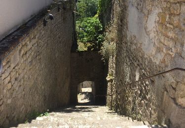
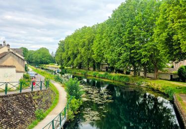
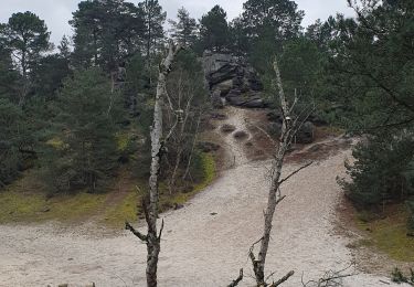
Trail Walking of 152 km to be discovered at Ile-de-France, Seine-et-Marne, Souppes-sur-Loing. This trail is proposed by guillaume.bodin.
Description
Parcours faisant parti de notre voyage Step by Step: http://curiozworld.fr/projets/de-paris-jusquen-inde-step-by-step/step-by-step
Positioning
Country:
France
Region :
Ile-de-France
Department/Province :
Seine-et-Marne
Municipality :
Souppes-sur-Loing
Location:
Unknown
Start:(Dec)
Start:(UTM)
479875 ; 5336988 (31U) N.
Comments
Trails nearby
![Trail Walking Souppes-sur-Loing - Soupe sur Loing Chateau Landon en 8 - Photo](https://media.geolcdn.com/t/375/260/ext.jpg?maxdim=2&url=https%3A%2F%2Fservices.sitytrail.com%2FGeolivesWS%2FDownloadMedia.ashx%3FTrailID%3D790644%26Media%3D20170716134421.jpg)
![Walking Walking](https://static1.geolcdn.com/sitytour/trail-icons/101.png)
Soupe sur Loing Chateau Landon en 8
Walking
Easy
(1)
Souppes-sur-Loing,
Ile-de-France,
Seine-et-Marne,
France
![](/images/other/stat-length.png)
21 km | 24 km-effort
4h 55min
![](https://static1.geolcdn.com/siteimages/upload/files/16400158638029165_repeat_loop_refresh_sync_direction_icon.png)
Yes
![Trail Walking Château-Landon - Linéaire de Chateau Landon à Nemours - Photo](https://media.geolcdn.com/t/375/260/8753eae8-2f26-4943-87f7-54ddecdce294.jpg&format=jpg&maxdim=2)
![Walking Walking](https://static1.geolcdn.com/sitytour/trail-icons/101.png)
Linéaire de Chateau Landon à Nemours
Walking
Difficult
Château-Landon,
Ile-de-France,
Seine-et-Marne,
France
![](/images/other/stat-length.png)
32 km | 37 km-effort
6h 49min
![](https://static1.geolcdn.com/siteimages/upload/files/16400158638029165_repeat_loop_refresh_sync_direction_icon.png)
No
![Trail Walking Château-Landon - De Château Landon à Nemours - Photo](https://media.geolcdn.com/t/375/260/7994ec5b-0bd1-4371-b464-9311cc61e5ca.jpg&format=jpg&maxdim=2)
![Walking Walking](https://static1.geolcdn.com/sitytour/trail-icons/101.png)
De Château Landon à Nemours
Walking
Medium
Château-Landon,
Ile-de-France,
Seine-et-Marne,
France
![](/images/other/stat-length.png)
32 km | 37 km-effort
6h 59min
![](https://static1.geolcdn.com/siteimages/upload/files/16400158638029165_repeat_loop_refresh_sync_direction_icon.png)
No
![Trail Walking Château-Landon - Promenade à Château Landon et ses alentours - Photo](https://media.geolcdn.com/t/375/260/244bb424-b741-4ba6-890d-87f3dc9ec396.jpg&format=jpg&maxdim=2)
![Walking Walking](https://static1.geolcdn.com/sitytour/trail-icons/101.png)
Promenade à Château Landon et ses alentours
Walking
Very easy
Château-Landon,
Ile-de-France,
Seine-et-Marne,
France
![](/images/other/stat-length.png)
12.7 km | 15.1 km-effort
2h 50min
![](https://static1.geolcdn.com/siteimages/upload/files/16400158638029165_repeat_loop_refresh_sync_direction_icon.png)
Yes
![Trail Walking Poligny - polynoise 2017 - Photo](https://media.geolcdn.com/t/375/260/ext.jpg?maxdim=2&url=https%3A%2F%2Fstatic1.geolcdn.com%2Fsiteimages%2Fupload%2Ffiles%2F1553511878bg_sport_marche.png)
![Walking Walking](https://static1.geolcdn.com/sitytour/trail-icons/101.png)
polynoise 2017
Walking
Medium
(2)
Poligny,
Ile-de-France,
Seine-et-Marne,
France
![](/images/other/stat-length.png)
19.3 km | 23 km-effort
3h 44min
![](https://static1.geolcdn.com/siteimages/upload/files/16400158638029165_repeat_loop_refresh_sync_direction_icon.png)
Yes
![Trail Mountain bike Poligny - Poligny 55km - Photo](https://media.geolcdn.com/t/375/260/ext.jpg?maxdim=2&url=https%3A%2F%2Fstatic1.geolcdn.com%2Fsiteimages%2Fupload%2Ffiles%2F1524743154velo.jpg)
![Mountain bike Mountain bike](https://static1.geolcdn.com/sitytour/trail-icons/202.png)
Poligny 55km
Mountain bike
Difficult
(1)
Poligny,
Ile-de-France,
Seine-et-Marne,
France
![](/images/other/stat-length.png)
55 km | 64 km-effort
4h 9min
![](https://static1.geolcdn.com/siteimages/upload/files/16400158638029165_repeat_loop_refresh_sync_direction_icon.png)
No
![Trail Walking Souppes-sur-Loing - Autour de Château Landon - Photo](https://media.geolcdn.com/t/375/260/ext.jpg?maxdim=2&url=https%3A%2F%2Fstatic1.geolcdn.com%2Fsiteimages%2Fupload%2Ffiles%2F1553511878bg_sport_marche.png)
![Walking Walking](https://static1.geolcdn.com/sitytour/trail-icons/101.png)
Autour de Château Landon
Walking
Very difficult
(1)
Souppes-sur-Loing,
Ile-de-France,
Seine-et-Marne,
France
![](/images/other/stat-length.png)
17.1 km | 20 km-effort
4h 33min
![](https://static1.geolcdn.com/siteimages/upload/files/16400158638029165_repeat_loop_refresh_sync_direction_icon.png)
Yes
![Trail Walking Poligny - poligny rpn 2024 - Photo](https://media.geolcdn.com/t/375/260/2270a50c-cfdd-41d3-91ea-987964c69bf7.jpg&format=jpg&maxdim=2)
![Walking Walking](https://static1.geolcdn.com/sitytour/trail-icons/101.png)
poligny rpn 2024
Walking
Medium
(1)
Poligny,
Ile-de-France,
Seine-et-Marne,
France
![](/images/other/stat-length.png)
23 km | 27 km-effort
5h 8min
![](https://static1.geolcdn.com/siteimages/upload/files/16400158638029165_repeat_loop_refresh_sync_direction_icon.png)
Yes
![Trail sport Souppes-sur-Loing - Château Landon es et ff - Photo](https://media.geolcdn.com/t/375/260/af2ba421-5186-4be2-b439-a1eb87adf51e.jpg&format=jpg&maxdim=2)
Château Landon es et ff
sport
Very easy
Souppes-sur-Loing,
Ile-de-France,
Seine-et-Marne,
France
![](/images/other/stat-length.png)
20 km | 23 km-effort
Unknown
![](https://static1.geolcdn.com/siteimages/upload/files/16400158638029165_repeat_loop_refresh_sync_direction_icon.png)
No