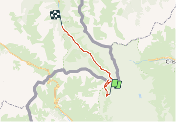
![](/images/other/stat-length.png)
![Trail Walking Pontechianale - Tour du Viso J5 - Rif. Vallanta - La Roche écroulée - Photo](https://media.geolcdn.com/t/1900/400/9b7e0cea-2f5b-448b-9f59-d37a014ca017.jpg&format=pjpeg&maxdim=2)
Tour du Viso J5 - Rif. Vallanta - La Roche écroulée
patjobou
User
![Length](/images/other/stat-length.png)
![Max alt](https://static1.geolcdn.com/siteimages/upload/files/1508320355ic_sort_altitude_max_24dp.png)
![Uphill gradient](https://static1.geolcdn.com/siteimages/upload/files/1508320355ic_sort_den_pos_24dp.png)
![Km-Effort](/images/other/stat-length.png)
![Min alt](https://static1.geolcdn.com/siteimages/upload/files/1508320355ic_sort_altitude_min_24dp.png)
![Downhill gradient](https://static1.geolcdn.com/siteimages/upload/files/1508320355ic_sort_den_neg_24dp.png)
![Boucle](https://static1.geolcdn.com/siteimages/upload/files/16400158638029165_repeat_loop_refresh_sync_direction_icon.png)
![Walking](https://static1.geolcdn.com/sitytour/trail-icons/101.png)
7h42
Difficulty : Difficult
![Scan this QR Code to open this trail in the SityTrail application](https://capi.geolives.com/qq0zvz2zws4bq2lad0pu/sitytour/trails/2537069/qr.png?size=200)
FREE GPS app for hiking
About
Trail Walking of 16.9 km to be discovered at Piemont, Cuneo, Pontechianale. This trail is proposed by patjobou.
Description
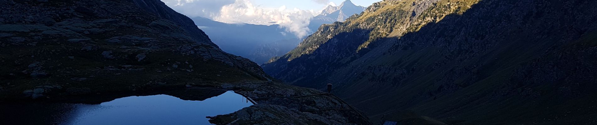
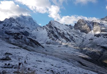
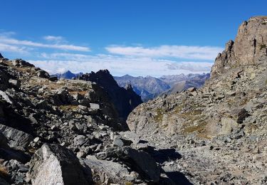
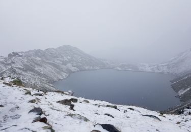
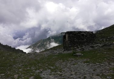
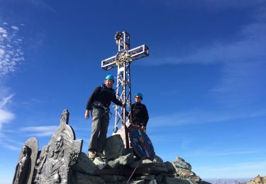
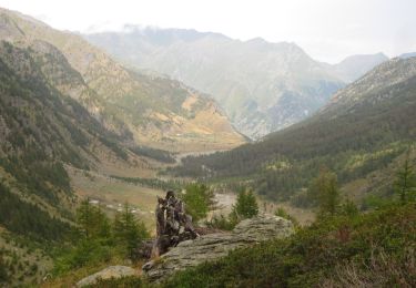
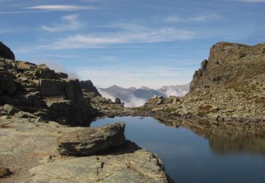
Itinéraire passant par le col et le mont Losetta (Pointe Joanne en France 3054m). Beau temps. Du col de Losetta, on peut admirer le vallon de Soustra, le Visolotto, le Monviso, et le Viso di Vallanta. On accède sans problème au Monte Losetta: belle vue à 360°. Retour par le col Losetta, pour rejoindre en traversée le Col de Vallanta, où on peut observer une colonie de Bouquetins. Du col, descente au lac Lestio, par un mauvais itinéraire, préférer l'itinéraire balisé. On poursuit dans ce beau vallon pour rejoindre La Gardiole et le belvédère du Viso, puis La Roche Ecroulée.
Note: Du sommet du Monte Losetta, on peut apparemment descendre directement sous le Lac Lestio, par un sentier bien tracé, au moins au départ,dans le vallon NO.
Positioning
Comments
Trails nearby
![Trail On foot Crissolo - (SI E22) Rifugio Quintino Sella - Rifugio Barbara Lowrie (Grange del Pis) - Photo](https://media.geolcdn.com/t/375/260/4eb9b25a-b061-458c-929f-b70437b5fe4d.jpeg&format=jpg&maxdim=2)
![On foot On foot](https://static1.geolcdn.com/sitytour/trail-icons/100.png)
On foot
![](/images/other/stat-length.png)
![](https://static1.geolcdn.com/siteimages/upload/files/16400158638029165_repeat_loop_refresh_sync_direction_icon.png)
![Trail Walking Abriès-Ristolas - Tour du Viso J2 - Ref. du Viso - Rif. Giacoletti - Photo](https://media.geolcdn.com/t/375/260/414d4897-6b3a-4bfe-8834-3163f7594f82.jpg&format=jpg&maxdim=2)
![Walking Walking](https://static1.geolcdn.com/sitytour/trail-icons/101.png)
Walking
![](/images/other/stat-length.png)
![](https://static1.geolcdn.com/siteimages/upload/files/16400158638029165_repeat_loop_refresh_sync_direction_icon.png)
![Trail Walking Crissolo - Tour du Viso J4 - Rif. Sella - Rif Vallenta - Photo](https://media.geolcdn.com/t/375/260/99953a71-274a-4817-9d46-8fbbd2eb4dd6.jpg&format=jpg&maxdim=2)
![Walking Walking](https://static1.geolcdn.com/sitytour/trail-icons/101.png)
Walking
![](/images/other/stat-length.png)
![](https://static1.geolcdn.com/siteimages/upload/files/16400158638029165_repeat_loop_refresh_sync_direction_icon.png)
![Trail Walking Crissolo - Tour du Viso J3 - Rif. Giacoletti - Rif. Q. Sella - Photo](https://media.geolcdn.com/t/375/260/7f471012-3ab5-4251-8e80-059690b0eca3.jpg&format=jpg&maxdim=2)
![Walking Walking](https://static1.geolcdn.com/sitytour/trail-icons/101.png)
Walking
![](/images/other/stat-length.png)
![](https://static1.geolcdn.com/siteimages/upload/files/16400158638029165_repeat_loop_refresh_sync_direction_icon.png)
![Trail Walking Abriès-Ristolas - Queyras jour 14 - Photo](https://media.geolcdn.com/t/375/260/0afd94ea-e505-496e-831e-706be29f4182.jpg&format=jpg&maxdim=2)
![Walking Walking](https://static1.geolcdn.com/sitytour/trail-icons/101.png)
Walking
![](/images/other/stat-length.png)
![](https://static1.geolcdn.com/siteimages/upload/files/16400158638029165_repeat_loop_refresh_sync_direction_icon.png)
![Trail Walking Pontechianale - Viso2 - Photo](https://media.geolcdn.com/t/375/260/df568391-5276-4e7a-baa8-7b2c94bc5c47.jpeg&format=jpg&maxdim=2)
![Walking Walking](https://static1.geolcdn.com/sitytour/trail-icons/101.png)
Walking
![](/images/other/stat-length.png)
![](https://static1.geolcdn.com/siteimages/upload/files/16400158638029165_repeat_loop_refresh_sync_direction_icon.png)
![Walking Walking](https://static1.geolcdn.com/sitytour/trail-icons/101.png)
Walking
![](/images/other/stat-length.png)
![](https://static1.geolcdn.com/siteimages/upload/files/16400158638029165_repeat_loop_refresh_sync_direction_icon.png)
![Walking Walking](https://static1.geolcdn.com/sitytour/trail-icons/101.png)
Walking
![](/images/other/stat-length.png)
![](https://static1.geolcdn.com/siteimages/upload/files/16400158638029165_repeat_loop_refresh_sync_direction_icon.png)
![Trail Walking Crissolo - Tour du Viso J3 (Op2) - Photo](https://media.geolcdn.com/t/375/260/ext.jpg?maxdim=2&url=https%3A%2F%2Fstatic1.geolcdn.com%2Fsiteimages%2Fupload%2Ffiles%2F1553511878bg_sport_marche.png)
![Walking Walking](https://static1.geolcdn.com/sitytour/trail-icons/101.png)
Walking
![](/images/other/stat-length.png)
![](https://static1.geolcdn.com/siteimages/upload/files/16400158638029165_repeat_loop_refresh_sync_direction_icon.png)