Trail Walking Ax-les-Thermes - AX ORGEIX MERENS - 05 - chemin des Bons-Hommes GR107 - Photo

AX ORGEIX MERENS - 05 - chemin des Bons-Hommes GR107

 jopost
jopost

User

© OpenStreetMap contributors
Length
Length
22 km
Max alt
Max alt
1787 m
Uphill gradient
Uphill gradient
1156 m
Km-Effort
Km-Effort  
37 km
Min alt
Min alt
700 m
Downhill gradient
Downhill gradient
802 m
Boucle
Boucle
No
Creation date :
2020-08-27 04:19:19.407
Updated on :
2020-10-20 18:49:44.907

(0 Reviews)

Walking
Walking
7h28
Difficulty : Difficult

Scan this QR Code to open this trail in the SityTrail application

FREE GPS app for hiking

Logo SityTrail SityTrail

IGN / Geographical institutes

Download SityTrail from the App Store Download SityTrail from Google Play

Logo SityTrail SityTrail World

The world is yours!

Download SityTrail from the App Store Download SityTrail from Google Play Download SityTrail on Huawei AppGallery

About

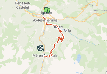
Trail Walking of 22 km to be discovered at Occitania, Ariège, Ax-les-Thermes. This trail is proposed by jopost.

Description

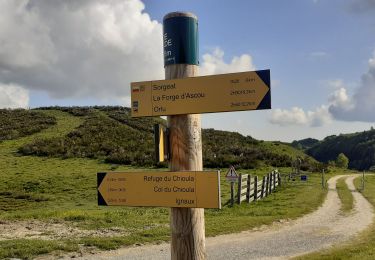
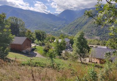
Variante depuis la gare d'Ax les Thermes pour rejoindre Orgeix.
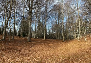
Depuis la gare d'Ax les Thermes où j'ai garé mon VW, me voici parti de bonne heure (6h20) direction Orgeix pour continuer le chemin des Bons-Hommes jusqu'à Mérens.
Au bout d'1h arrivé à Orgeix où nous retrouvons le chemin des Bons-Hommes puis on continue la piste forestière, après 2h de montée arrêt de 10 mn puis on repart vers le col de Joux (route forestière normalement interdite car débardage de bois).
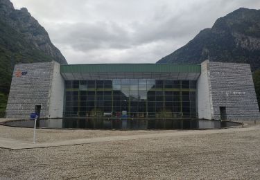
Arrivée col de Joux après 5h depuis Ax donc 3h50 depuis Orgeix, arrêt 40 mn. belle vue sur la massif de Tabe, la carrière de Talc de Luzenac et le plateau de Beille.
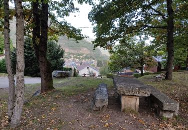
Encore 2h de marche et 4km (descente difficile due à mes pieds) et nous voici à Mérens le Haut et son église romane, encore 30 mn et arrivé à la gare de Mérens, après 22,5km et 8h20 dont 1h de pauses. Retour par train ou bus SNCF vers la gare d'Ax.

Elevation profile

Photos

Positioning

Country:
France
Region :
Occitania
Department/Province :
Ariège
Municipality :
Ax-les-Thermes
Location:
Unknown
Start:(UTM)
404438 ; 4730914 (31T) N.

Trails nearby

Trail Walking Perles-et-Castelet - cabane de Bistort Teoula et Mouscadou - Photo
Walking
chrisgps

Walking

Medium
(1)
Perles-et-Castelet, Occitania, Ariège, France
12.3 km | 26 km-effort
6h 15min
No
Trail Walking Sorgeat - Chemin des Bonhommes - Sorgeat Merens - Photo
Walking
tracegps

Walking

Very difficult
(1)
Sorgeat, Occitania, Ariège, France
21 km | 36 km-effort
8h 0min
No
Trail Mountain bike Orlu - Orlu  Parking Aygue Longue - Photo
Mountain bike
GUIDE
harydh

Mountain bike

Medium
Orlu, Occitania, Ariège, France
16.1 km | 24 km-effort
2h 51min
Yes
Trail Walking Ax-les-Thermes - Lac de Campauleil - Orgeix - Photo
Walking
Oupia82

Walking

Very easy
(1)
Ax-les-Thermes, Occitania, Ariège, France
8.6 km | 11.2 km-effort
3h 3min
Yes
Trail Walking Ignaux - Chioula d - Photo
Walking
GUIDE
antignacs

Walking

Very easy
Ignaux, Occitania, Ariège, France
15.1 km | 21 km-effort
3h 50min
Yes
Trail Walking Orlu - Le Fanguil - Photo
Walking
c.chehere

Walking

Medium
Orlu, Occitania, Ariège, France
16.8 km | 23 km-effort
6h 59min
Yes
Trail Walking Prades - La Chioula Orlu GR107 le chemins des Bonshommes - Photo
Walking
tercla

Walking

Difficult
Prades, Occitania, Ariège, France
18.7 km | 25 km-effort
6h 17min
No
Trail Walking Ax-les-Thermes - balade bleue au dessus d'Ax - Photo
Walking
c.chehere

Walking

Easy
Ax-les-Thermes, Occitania, Ariège, France
3.8 km | 6.1 km-effort
1h 22min
Yes
Trail Walking Ax-les-Thermes - Orgeix _ Ignaux - Photo
Walking
c.chehere

Walking

Medium
Ax-les-Thermes, Occitania, Ariège, France
12.8 km | 19.1 km-effort
4h 12min
Yes


Close
My subscriptions