Trail Walking Lachau - Boucle de la Roche Milliee - Photo

Boucle de la Roche Milliee

© OpenStreetMap contributors
Length
Length
15.8 km
Max alt
Max alt
1266 m
Uphill gradient
Uphill gradient
569 m
Km-Effort
Km-Effort  
23 km
Min alt
Min alt
718 m
Downhill gradient
Downhill gradient
569 m
Boucle
Boucle
Yes
Creation date :
2020-08-26 06:09:08.546
Updated on :
2020-08-26 13:20:09.705

(0 Reviews)

Walking
Walking
5h11
Difficulty : Medium

Scan this QR Code to open this trail in the SityTrail application

FREE GPS app for hiking

Logo SityTrail SityTrail

IGN / Geographical institutes

Download SityTrail from the App Store Download SityTrail from Google Play

Logo SityTrail SityTrail World

The world is yours!

Download SityTrail from the App Store Download SityTrail from Google Play Download SityTrail on Huawei AppGallery

About

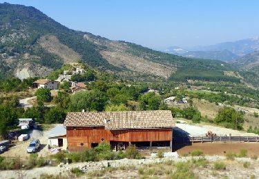
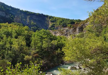
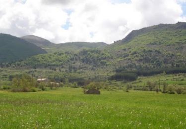
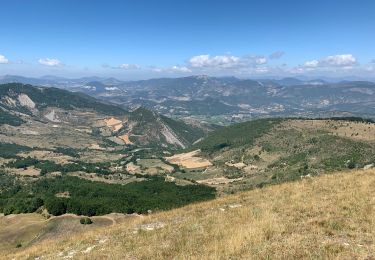
Trail Walking of 15.8 km to be discovered at Auvergne-Rhône-Alpes, Drôme, Lachau. This trail is proposed by claude nier.

Description

belle rando à l ombre...

Elevation profile

Positioning

Country:
France
Region :
Auvergne-Rhône-Alpes
Department/Province :
Drôme
Municipality :
Lachau
Location:
Unknown
Start:(UTM)
710664 ; 4900779 (31T) N.

Trails nearby

Trail Walking Éourres - mare et pied du mulet - Photo
Walking
y39c43l

Walking

Easy
(1)
Éourres, Provence-Alpes-Côte d'Azur, Hautes-Alpes, France
12.2 km | 23 km-effort
5h 47min
No
Trail Walking Éourres - La Montagne de Mare et le Pied du Mulet - Eourres - Photo
Walking
tracegps

Walking

Difficult
Éourres, Provence-Alpes-Côte d'Azur, Hautes-Alpes, France
14.8 km | 27 km-effort
6h 30min
Yes
Trail Electric bike Lachau - Les Gorges de la Méouge - Photo
Electric bike
gd284

Electric bike

Medium
Lachau, Auvergne-Rhône-Alpes, Drôme, France
43 km | 53 km-effort
Unknown
Yes
Trail Walking Lachau - Lachau - les Chanaux - Photo
Walking
tracegps

Walking

Medium
Lachau, Auvergne-Rhône-Alpes, Drôme, France
14.2 km | 21 km-effort
3h 40min
Yes
Trail Walking Éourres - Eourres/Montagne de Mare / Pied du Mulet - Photo
Walking
Mickael Barrier

Walking

Easy
Éourres, Provence-Alpes-Côte d'Azur, Hautes-Alpes, France
11.3 km | 22 km-effort
3h 40min
Yes
Trail Walking Eygalayes - Palle - Photo
Walking
GAPIAN43

Walking

Medium
Eygalayes, Auvergne-Rhône-Alpes, Drôme, France
14.8 km | 25 km-effort
5h 41min
Yes
Trail Walking Éourres - montagne de mare Eourre  - Photo
Walking
jeanjacquescavet

Walking

Medium
Éourres, Provence-Alpes-Côte d'Azur, Hautes-Alpes, France
12.9 km | 23 km-effort
4h 40min
Yes
Trail Walking Izon-la-Bruisse - chamouse - Photo
Walking
Eparot

Walking

Very easy
Izon-la-Bruisse, Auvergne-Rhône-Alpes, Drôme, France
13.1 km | 21 km-effort
5h 57min
Yes
Trail On foot Izon-la-Bruisse - Boucle de le Bruisse - Photo
On foot
claude nier

On foot

Medium
Izon-la-Bruisse, Auvergne-Rhône-Alpes, Drôme, France
11.8 km | 19 km-effort
Unknown
Yes


Close
My subscriptions