Trail On foot Saint-Pol-sur-Ternoise - Le Fossé Cagnu - Photo
 BOUMA
BOUMA

User

© OpenStreetMap contributors
Length
Length
10.7 km
Max alt
Max alt
147 m
Uphill gradient
Uphill gradient
137 m
Km-Effort
Km-Effort  
12.5 km
Min alt
Min alt
81 m
Downhill gradient
Downhill gradient
137 m
Boucle
Boucle
Yes
Creation date :
2020-08-24 17:07:32.564
Updated on :
2020-08-24 17:10:37.783

(0 Reviews)

On foot
On foot
--
Difficulty : Medium

Scan this QR Code to open this trail in the SityTrail application

FREE GPS app for hiking

Logo SityTrail SityTrail

IGN / Geographical institutes

Download SityTrail from the App Store Download SityTrail from Google Play

Logo SityTrail SityTrail World

The world is yours!

Download SityTrail from the App Store Download SityTrail from Google Play Download SityTrail on Huawei AppGallery

About

Trail On foot of 10.7 km to be discovered at Hauts-de-France, Pas-de-Calais, Saint-Pol-sur-Ternoise. This trail is proposed by BOUMA.

Elevation profile

Points of interest

Point of interest Saint-Pol-sur-Ternoise - Place Mitterrand face au centre des impôts - Photo
BOUMA
SAINT-POL-SUR-TERNOISE 
Point of interest Gauchin-Verloingt - Rue de Fruge - Photo
BOUMA
GAUCHIN-VERLOINGT 
Point of interest Gauchin-Verloingt - Chemin à gauche - Photo
BOUMA
GAUCHIN-VERLOINGT 
Point of interest Gauchin-Verloingt - Bancs publics - Photo
BOUMA
GAUCHIN-VERLOINGT 
Point of interest Troisvaux - Croisement de chemins - Photo
BOUMA
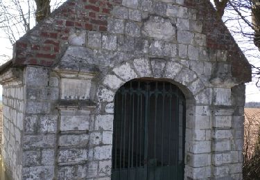
Point of interest Troisvaux - Chapelle - Photo
BOUMA
TROISVAUX 
Point of interest Troisvaux - Carrefour - Photo
BOUMA
TROISVAUX 
Point of interest Troisvaux - Troisvaux - Photo
BOUMA
TROISVAUX 
Point of interest Troisvaux - Route D941 - Photo
BOUMA
TROISVAUX 
Point of interest Saint-Pol-sur-Ternoise - Polyclinique - Photo
BOUMA
SAINT-POL-SUR-TERNOISE 
Point of interest Saint-Pol-sur-Ternoise - Restaurant La St-Poloise - Photo
BOUMA
SAINT-POL-SUR-TERNOISE 
Point of interest Saint-Pol-sur-Ternoise - Place Mitterrand face au centre des impôts - Photo
BOUMA
SAINT-POL-SUR-TERNOISE 

Positioning

Country:
France
Region :
Hauts-de-France
Department/Province :
Pas-de-Calais
Municipality :
Saint-Pol-sur-Ternoise
Location:
Unknown
Start:(UTM)
452501 ; 5581343 (31U) N.

Trails nearby

Trail Walking Troisvaux - Autour de l'abbaye de Belval - Photo
Walking
reneperrin

Walking

Easy
Troisvaux, Hauts-de-France, Pas-de-Calais, France
25 km | 30 km-effort
5h 9min
Yes
Trail Walking Troisvaux - Autour de l'abbaye de Belval - Photo
Walking
reneperrin

Walking

Easy
Troisvaux, Hauts-de-France, Pas-de-Calais, France
25 km | 30 km-effort
6h 26min
Yes
Trail Walking Saint-Pol-sur-Ternoise - Rando Gastronomique et Châteaux du Ternois - Photo
Walking

Walking

Easy
(1)
Saint-Pol-sur-Ternoise, Hauts-de-France, Pas-de-Calais, France
26 km | 30 km-effort
6h 45min
Yes
Trail Walking Troisvaux - 27/07/24 Charles à  Belval - Photo
Walking
eaea7charles

Walking

Very difficult
Troisvaux, Hauts-de-France, Pas-de-Calais, France
24 km | 28 km-effort
4h 55min
Yes
Trail Walking Herlin-le-Sec - Herlin le Sec - Photo
Walking
jpblimond

Walking

Medium
Herlin-le-Sec, Hauts-de-France, Pas-de-Calais, France
19.4 km | 22 km-effort
4h 35min
Yes
Trail On foot Troisvaux - belval NORD vers Huclier - Photo
On foot
eaea7charles

On foot

Medium
Troisvaux, Hauts-de-France, Pas-de-Calais, France
22 km | 27 km-effort
6h 1min
Yes
Trail Other activity Saint-Pol-sur-Ternoise - Nord - Pas-de-Calais - Ligne 289 - Saint-Pol-sur-Ternoise - Abbeville - Photo
Other activity
mich54

Other activity

Very easy
Saint-Pol-sur-Ternoise, Hauts-de-France, Pas-de-Calais, France
35 km | 40 km-effort
5min
No
Trail sport Troisvaux - 2024-09-03_20h12m25_stbenoit - Photo
sport
tenace

sport

Very easy
Troisvaux, Hauts-de-France, Pas-de-Calais, France
12.4 km | 14.8 km-effort
Unknown
Yes
Trail Walking Troisvaux - Belval 21.3km départ abbaye - Photo
Walking
eaea7charles

Walking

Very difficult
Troisvaux, Hauts-de-France, Pas-de-Calais, France
21 km | 25 km-effort
5h 44min
Yes


Close
My subscriptions