


Jour 7 safari sérénités

vverafon
User
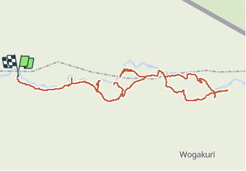

Length
81 km

Max alt
1485 m

Uphill gradient
876 m
Km-Effort
93 km

Min alt
1356 m

Downhill gradient
880 m
Boucle
No
Creation date :
2020-08-19 05:11:28.0
Updated on :
2020-08-23 16:23:14.382
7h51
Difficulty : Unknown

FREE GPS app for hiking
 SityTrail
IGN / Geographical institutes
SityTrail World
The world is yours!
About
Trail 4x4 of 81 km to be discovered at Mara. This trail is proposed by vverafon.
Positioning
Country:
Tanzania, United Republic of
Region :
Mara
Department/Province :
Serengeti
Municipality :
Machochwe
Location:
Unknown
Start:(Dec)
Start:(UTM)
693640 ; 9826436 (36M) S.
Comments
Trails nearby