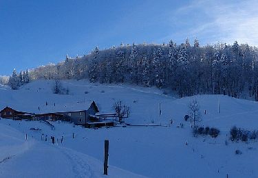
4 km | 7.6 km-effort
Wasserfallen - Reigoldswil
meury
User
Length
3.3 km
Max alt
929 m
Uphill gradient
382 m
Km-Effort
7.1 km
Min alt
547 m
Downhill gradient
4 m
Boucle
No
Creation date :
2014-12-11 00:00:00.0
Updated on :
2014-12-11 00:00:00.0
--
Difficulty : Unknown
FREE GPS app for hiking
About
Trail Other activity of 3.3 km to be discovered at Basel-Landschaft, Bezirk Waldenburg. This trail is proposed by meury.
Positioning
Country:
Switzerland
Region :
Basel-Landschaft
Department/Province :
Bezirk Waldenburg
Municipality :
Reigoldswil
Location:
Unknown
Start:(Dec)
Start:(UTM)
401631 ; 5249350 (32T) N.
Comments
Trails nearby
Gondelbahn - Wasserfallen
On foot
Easy
,
Basel-Landschaft,
Bezirk Waldenburg,
Switzerland
1h 43min
No
Wasserfallen Rochus Kapelle - Mümliswil
On foot
Easy
Mümliswil-Ramiswil,
Solothurn,
Bezirk Thal,
Switzerland
4.2 km | 5.9 km-effort
1h 20min
No
Rebenweg
On foot
Easy
Oberdorf (BL),
Basel-Landschaft,
Bezirk Waldenburg,
Switzerland
4.6 km | 7.3 km-effort
1h 40min
No
Helfenberg - Mümliswil
On foot
Easy
Langenbruck,
Basel-Landschaft,
Bezirk Waldenburg,
Switzerland
3.9 km | 5.3 km-effort
1h 11min
No
Breitenhöchi - Langenbruck
On foot
Easy
Mümliswil-Ramiswil,
Solothurn,
Bezirk Thal,
Switzerland
3.6 km | 6.1 km-effort
1h 22min
No
Bogental - Vogelberg
On foot
Easy
Lauwil,
Basel-Landschaft,
Bezirk Waldenburg,
Switzerland
3.7 km | 7.4 km-effort
1h 40min
No
Sool - Mümliswil
On foot
Easy
Mümliswil-Ramiswil,
Solothurn,
Bezirk Thal,
Switzerland
3.9 km | 5.5 km-effort
1h 15min
No
Passwang - Bogental
On foot
Easy
Lauwil,
Basel-Landschaft,
Bezirk Waldenburg,
Switzerland
3.6 km | 7.7 km-effort
1h 45min
No
ST_fede_bs10
Other activity
Very easy
Waldenburg,
Basel-Landschaft,
Bezirk Waldenburg,
Switzerland
11.4 km | 18 km-effort
3h 58min
No