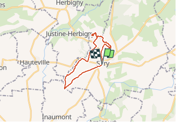
10.1 km | 12.8 km-effort
sery
gilbertwarin08
User
Length
10.5 km
Max alt
177 m
Uphill gradient
204 m
Km-Effort
13.2 km
Min alt
96 m
Downhill gradient
205 m
Boucle
Yes
Creation date :
2020-06-16 12:46:13.616
Updated on :
2020-08-18 16:18:36.698
3h22
Difficulty : Very easy
FREE GPS app for hiking
About
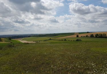
Trail Walking of 10.5 km to be discovered at Grand Est, Ardennes, Sery. This trail is proposed by gilbertwarin08.
Description
16/06/2020
Positioning
Country:
France
Region :
Grand Est
Department/Province :
Ardennes
Municipality :
Sery
Location:
Unknown
Start:(Dec)
Start:(UTM)
597382 ; 5493133 (31U) N.
Comments
Trails nearby
(16/8/2019) Herbigny - les 2 tables d'orientation
Walking
Easy
Justine-Herbigny,
Grand Est,
Ardennes,
France
17.4 km | 20 km-effort
4h 45min
Yes
Les Monts de Sery
Walking
Easy
Sery,
Grand Est,
Ardennes,
France
5.1 km | 6.8 km-effort
1h 15min
Yes
Porcien. Sery
Mountain bike
Easy
Sery,
Grand Est,
Ardennes,
France
36 km | 43 km-effort
2h 53min
Yes