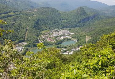
10.3 km | 16.4 km-effort
Molinge Pratz St Romain
Jackoyo
User
Length
9.2 km
Max alt
689 m
Uphill gradient
369 m
Km-Effort
14.1 km
Min alt
346 m
Downhill gradient
370 m
Boucle
Yes
Creation date :
2020-08-18 11:43:41.242
Updated on :
2020-08-18 13:55:16.848
2h11
Difficulty : Medium
FREE GPS app for hiking
About
Trail Walking of 9.2 km to be discovered at Bourgogne-Franche-Comté, Jura, Chassal-Molinges. This trail is proposed by Jackoyo .
Positioning
Country:
France
Region :
Bourgogne-Franche-Comté
Department/Province :
Jura
Municipality :
Chassal-Molinges
Location:
Chassal
Start:(Dec)
Start:(UTM)
712946 ; 5137747 (31T) N.
Comments
Trails nearby
molinges st romain
Walking
Difficult
Chassal-Molinges,
Bourgogne-Franche-Comté,
Jura,
France
3h 52min
Yes
partis de jeurre ensuite la chapelle Saint Romain et la cascade de l enragé
Walking
Medium
Jeurre,
Bourgogne-Franche-Comté,
Jura,
France
18 km | 25 km-effort
5h 9min
Yes
gorges du Lison . départ de Saint lupicin
Walking
Medium
Coteaux du Lizon,
Bourgogne-Franche-Comté,
Jura,
France
18 km | 26 km-effort
5h 55min
No
les gorges du lison
Walking
Very easy
Coteaux du Lizon,
Bourgogne-Franche-Comté,
Jura,
France
18.6 km | 26 km-effort
7h 0min
Yes
molinges-st-romain
Walking
Easy
(1)
Chassal-Molinges,
Bourgogne-Franche-Comté,
Jura,
France
9.5 km | 15.4 km-effort
3h 5min
Yes
Vers la chapelle Saint-Romain et retour par le village...
Walking
Easy
Lavans-lès-Saint-Claude,
Bourgogne-Franche-Comté,
Jura,
France
2.8 km | 4 km-effort
2h 16min
Yes
Lison Avignon Ponthoux
Walking
Difficult
Lavans-lès-Saint-Claude,
Bourgogne-Franche-Comté,
Jura,
France
17.6 km | 28 km-effort
5h 16min
Yes
Pont de Lison Ponthoux
Walking
Difficult
Saint-Claude,
Bourgogne-Franche-Comté,
Jura,
France
10 km | 16.3 km-effort
2h 49min
No
St Lupicin Les Tureys
Walking
Medium
Coteaux du Lizon,
Bourgogne-Franche-Comté,
Jura,
France
10.4 km | 15.8 km-effort
2h 32min
Yes