![](/images/other/stat-length.png)
![Trail Walking Saint-Jeures - 43200_StJeur-LeMousse_200817-pieds - Photo](https://media.geolcdn.com/t/1900/400/ext.pjpeg?maxdim=2&url=https%3A%2F%2Fstatic1.geolcdn.com%2Fsiteimages%2Fupload%2Ffiles%2F1553511878bg_sport_marche.png)
43200_StJeur-LeMousse_200817-pieds
adye
User
![Length](/images/other/stat-length.png)
Length
5.2 km
![Max alt](https://static1.geolcdn.com/siteimages/upload/files/1508320355ic_sort_altitude_max_24dp.png)
Max alt
1051 m
![Uphill gradient](https://static1.geolcdn.com/siteimages/upload/files/1508320355ic_sort_den_pos_24dp.png)
Uphill gradient
112 m
![Km-Effort](/images/other/stat-length.png)
Km-Effort
6.7 km
![Min alt](https://static1.geolcdn.com/siteimages/upload/files/1508320355ic_sort_altitude_min_24dp.png)
Min alt
955 m
![Downhill gradient](https://static1.geolcdn.com/siteimages/upload/files/1508320355ic_sort_den_neg_24dp.png)
Downhill gradient
114 m
![Boucle](https://static1.geolcdn.com/siteimages/upload/files/16400158638029165_repeat_loop_refresh_sync_direction_icon.png)
Boucle
Yes
Creation date :
2020-08-17 07:51:41.234
Updated on :
2020-08-17 19:07:48.59
![Walking](https://static1.geolcdn.com/sitytour/trail-icons/101.png)
1h15
Difficulty : Easy
![Running](https://static1.geolcdn.com/sitytour/trail-icons/103.png)
35m
Difficulty : Easy
![Scan this QR Code to open this trail in the SityTrail application](https://capi.geolives.com/qq0zvz2zws4bq2lad0pu/sitytour/trails/2518272/qr.png?size=200)
FREE GPS app for hiking
About
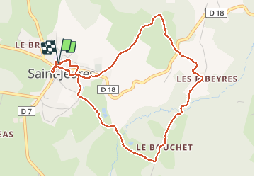
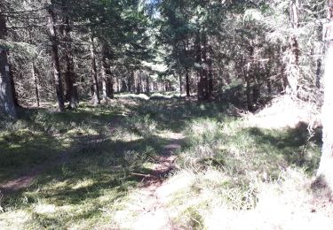
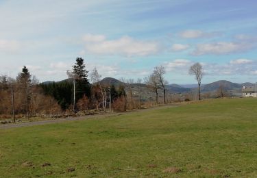
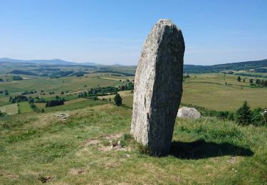
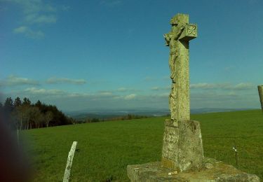
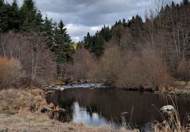
Trail Walking of 5.2 km to be discovered at Auvergne-Rhône-Alpes, Haute-Loire, Saint-Jeures. This trail is proposed by adye.
Description
Balade familiale autour de Saint Jeur et le long de son ruisseau Le Mousse. Peu de route, chemins de randonnées faciles et avec ombre.
Positioning
Country:
France
Region :
Auvergne-Rhône-Alpes
Department/Province :
Haute-Loire
Municipality :
Saint-Jeures
Location:
Unknown
Start:(Dec)
Start:(UTM)
594799 ; 4994386 (31T) N.
Comments
Trails nearby
![Trail Walking Araules - Suc de Lizieux - Photo](https://media.geolcdn.com/t/375/260/3244aa12-5792-460e-ba20-16eff7ba3ca0.jpg&format=jpg&maxdim=2)
![Walking Walking](https://static1.geolcdn.com/sitytour/trail-icons/101.png)
Suc de Lizieux
Walking
Medium
Araules,
Auvergne-Rhône-Alpes,
Haute-Loire,
France
![](/images/other/stat-length.png)
4.6 km | 6.9 km-effort
1h 38min
![](https://static1.geolcdn.com/siteimages/upload/files/16400158638029165_repeat_loop_refresh_sync_direction_icon.png)
Yes
![Trail Walking Chenereilles - Chenereilles, Lac de la Valette - Photo](https://media.geolcdn.com/t/375/260/388ebbcb-d8d6-4d0c-9d4d-f65e45105430.jpg&format=jpg&maxdim=2)
![Walking Walking](https://static1.geolcdn.com/sitytour/trail-icons/101.png)
Chenereilles, Lac de la Valette
Walking
Medium
Chenereilles,
Auvergne-Rhône-Alpes,
Haute-Loire,
France
![](/images/other/stat-length.png)
18.7 km | 24 km-effort
4h 15min
![](https://static1.geolcdn.com/siteimages/upload/files/16400158638029165_repeat_loop_refresh_sync_direction_icon.png)
Yes
![Trail Walking Chenereilles - Chenereilles, le château de Joux - Photo](https://media.geolcdn.com/t/375/260/bc72b279-cf9e-4b33-b880-67c7750c5c1c.jpg&format=jpg&maxdim=2)
![Walking Walking](https://static1.geolcdn.com/sitytour/trail-icons/101.png)
Chenereilles, le château de Joux
Walking
Medium
Chenereilles,
Auvergne-Rhône-Alpes,
Haute-Loire,
France
![](/images/other/stat-length.png)
12.3 km | 16.6 km-effort
3h 5min
![](https://static1.geolcdn.com/siteimages/upload/files/16400158638029165_repeat_loop_refresh_sync_direction_icon.png)
Yes
![Trail Walking Araules - le sentier de Bonas - Photo](https://media.geolcdn.com/t/375/260/d68ee2be-74cb-4667-89e5-08e6c8a501e3.jpg&format=jpg&maxdim=2)
![Walking Walking](https://static1.geolcdn.com/sitytour/trail-icons/101.png)
le sentier de Bonas
Walking
Easy
Araules,
Auvergne-Rhône-Alpes,
Haute-Loire,
France
![](/images/other/stat-length.png)
6.8 km | 9.5 km-effort
1h 57min
![](https://static1.geolcdn.com/siteimages/upload/files/16400158638029165_repeat_loop_refresh_sync_direction_icon.png)
Yes
![Trail Walking Yssingeaux - 43 Yssingeaux 3sucs 9km 300m - Photo](https://media.geolcdn.com/t/375/260/447ecca4-c317-418d-bcbf-8909e30f2a3d.jpg&format=jpg&maxdim=2)
![Walking Walking](https://static1.geolcdn.com/sitytour/trail-icons/101.png)
43 Yssingeaux 3sucs 9km 300m
Walking
Very easy
Yssingeaux,
Auvergne-Rhône-Alpes,
Haute-Loire,
France
![](/images/other/stat-length.png)
9.2 km | 13.5 km-effort
2h 59min
![](https://static1.geolcdn.com/siteimages/upload/files/16400158638029165_repeat_loop_refresh_sync_direction_icon.png)
Yes
![Trail Walking Araules - Tence-170620 - PicLisieux - Photo](https://media.geolcdn.com/t/375/260/ext.jpg?maxdim=2&url=https%3A%2F%2Fservices.sitytrail.com%2FGeolivesWS%2FDownloadMedia.ashx%3FTrailID%3D776323%26Media%3D23dfef1f-c30a-4947-bbbf-c2a486ff054a.jpg)
![Walking Walking](https://static1.geolcdn.com/sitytour/trail-icons/101.png)
Tence-170620 - PicLisieux
Walking
Medium
Araules,
Auvergne-Rhône-Alpes,
Haute-Loire,
France
![](/images/other/stat-length.png)
5.2 km | 7.6 km-effort
1h 50min
![](https://static1.geolcdn.com/siteimages/upload/files/16400158638029165_repeat_loop_refresh_sync_direction_icon.png)
Yes
![Trail Mountain bike Saint-Jeures - Les champs de St Jeures - Photo](https://media.geolcdn.com/t/375/260/ext.jpg?maxdim=2&url=https%3A%2F%2Fservices.sitytrail.com%2FGeolivesWS%2FDownloadMedia.ashx%3FTrailID%3D129689%26Media%3D13222_4.jpg)
![Mountain bike Mountain bike](https://static1.geolcdn.com/sitytour/trail-icons/202.png)
Les champs de St Jeures
Mountain bike
Easy
Saint-Jeures,
Auvergne-Rhône-Alpes,
Haute-Loire,
France
![](/images/other/stat-length.png)
11.6 km | 15.2 km-effort
1h 30min
![](https://static1.geolcdn.com/siteimages/upload/files/16400158638029165_repeat_loop_refresh_sync_direction_icon.png)
Yes
![Trail Walking Saint-Jeures - Les champs de St Jeures - Photo](https://media.geolcdn.com/t/375/260/ext.jpg?maxdim=2&url=https%3A%2F%2Fservices.sitytrail.com%2FGeolivesWS%2FDownloadMedia.ashx%3FTrailID%3D129688%26Media%3D13222_4.jpg)
![Walking Walking](https://static1.geolcdn.com/sitytour/trail-icons/101.png)
Les champs de St Jeures
Walking
Easy
Saint-Jeures,
Auvergne-Rhône-Alpes,
Haute-Loire,
France
![](/images/other/stat-length.png)
11.6 km | 15.2 km-effort
2h 30min
![](https://static1.geolcdn.com/siteimages/upload/files/16400158638029165_repeat_loop_refresh_sync_direction_icon.png)
Yes
![Trail Walking Mazet-Saint-Voy - Salettes et Mazalibran - Photo](https://media.geolcdn.com/t/375/260/42cfbe72-4434-4356-970f-aa668c703a3b.jpg&format=jpg&maxdim=2)
![Walking Walking](https://static1.geolcdn.com/sitytour/trail-icons/101.png)
Salettes et Mazalibran
Walking
Medium
Mazet-Saint-Voy,
Auvergne-Rhône-Alpes,
Haute-Loire,
France
![](/images/other/stat-length.png)
8.8 km | 11.9 km-effort
2h 30min
![](https://static1.geolcdn.com/siteimages/upload/files/16400158638029165_repeat_loop_refresh_sync_direction_icon.png)
Yes