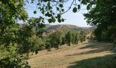
Trail Walking Laval-Roquecezière - Boucle de Combret depuis ND d'Orient - Photo

Boucle de Combret depuis ND d'Orient

 mbo8131
mbo8131

User

© OpenStreetMap contributors
Length
Length
14.7 km
Max alt
Max alt
593 m
Uphill gradient
Uphill gradient
520 m
Km-Effort
Km-Effort  
22 km
Min alt
Min alt
321 m
Downhill gradient
Downhill gradient
523 m
Boucle
Boucle
Yes
Creation date :
2020-08-15 06:29:04.688
Updated on :
2020-08-15 13:49:26.481

(0 Reviews)

Walking
Walking
4h26
Difficulty : Easy

Scan this QR Code to open this trail in the SityTrail application

FREE GPS app for hiking

Logo SityTrail SityTrail

IGN / Geographical institutes

Download SityTrail from the App Store Download SityTrail from Google Play

Logo SityTrail SityTrail World

The world is yours!

Download SityTrail from the App Store Download SityTrail from Google Play Download SityTrail on Huawei AppGallery

About

Trail Walking of 14.7 km to be discovered at Occitania, Aveyron, Laval-Roquecezière. This trail is proposed by mbo8131.

Description

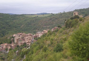
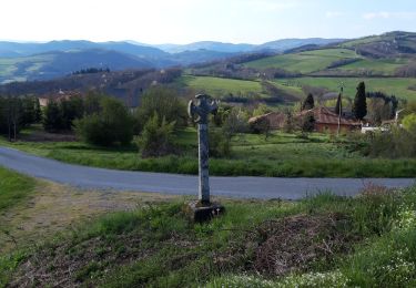
Randonnée facile avec de belles vues sur le village de Combret et les paysages vallonnés.
La première partie jusqu'à Combret est majoritairement à l'ombre, par contre la 2e , majoritairement au soleil.
Prévoir de bonnes chaussures car les sentiers sont pierreux/rocheux , avec des pierres roulantes. Des bâtons ne sont pas de trop.
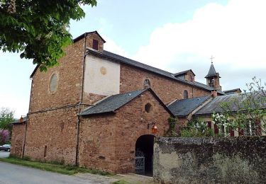
Prévoir 1/2h d'arrêt pour visiter un peu le village de Combret.
Avec cet arrêt, comptez 4h environ en marchant d'un bon pas.

Elevation profile

Photos

Positioning

Country:
France
Region :
Occitania
Department/Province :
Aveyron
Municipality :
Laval-Roquecezière
Location:
Unknown
Start:(UTM)
469939 ; 4855667 (31T) N.

Trails nearby

Trail Walking Combret - Combret  Sud Aveyron - Photo
Walking
tracegps

Walking

Difficult
Combret, Occitania, Aveyron, France
16.2 km | 24 km-effort
4h 45min
Yes
Trail On foot Laval-Roquecezière - Boucle de Combret - Photo
On foot
GUIDE+

On foot

Easy
Laval-Roquecezière, Occitania, Aveyron, France
3.9 km | 5.7 km-effort
1h 17min
No
Trail Walking Montfranc - montfranc - Photo
Walking
FrançoisB

Walking

Very difficult
Montfranc, Occitania, Aveyron, France
16.5 km | 22 km-effort
4h 12min
No
Trail Walking Saint-Sernin-sur-Rance - chemin du patrimoine - Photo
Walking
Prevel

Walking

Medium
Saint-Sernin-sur-Rance, Occitania, Aveyron, France
7.5 km | 11.7 km-effort
2h 39min
Yes
Trail Walking Pousthomy - Pousthomis  - Photo
Walking
FrançoisB

Walking

Very difficult
Pousthomy, Occitania, Aveyron, France
19.2 km | 29 km-effort
8h 49min
Yes
Trail Walking Montfranc - montfranc - Photo
Walking
jab31

Walking

Very easy
Montfranc, Occitania, Aveyron, France
15.8 km | 20 km-effort
Unknown
Yes
Trail Walking Saint-Sernin-sur-Rance - Alban st Sernin  - Photo
Walking
FrançoisB

Walking

Very difficult
Saint-Sernin-sur-Rance, Occitania, Aveyron, France
25 km | 39 km-effort
1h 39min
No
Trail Electric bike Laval-Roquecezière - Orient - St Sernin  - Photo
Electric bike
jpc34

Electric bike

Very easy
Laval-Roquecezière, Occitania, Aveyron, France
15.8 km | 21 km-effort
1h 9min
Yes
Trail Hybrid bike Laval-Roquecezière - orient miolle balaguier saint sernin  - Photo
Hybrid bike
pcabot

Hybrid bike

Difficult
Laval-Roquecezière, Occitania, Aveyron, France
36 km | 50 km-effort
2h 2min
Yes


Close
My subscriptions