


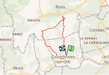


11.3 km | 20 km-effort

User


FREE GPS app for hiking
 SityTrail
IGN / Geographical institutes
SityTrail World
The world is yours!
Trail Walking of 14 km to be discovered at Occitania, Hérault, Colombières-sur-Orb. This trail is proposed by labarone.
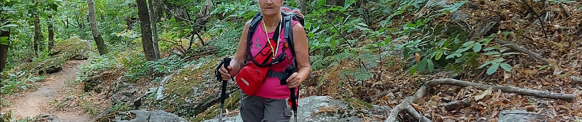
magnifique montee en escalier sur 5 kms tres transpirante
tres beaux points de vue
a faire par randonneurs averts


33 photos in total. Please click on a photo to see them all in the gallery.

Walking

Walking

Walking

Walking

Walking

Walking

Walking

Walking

Walking