


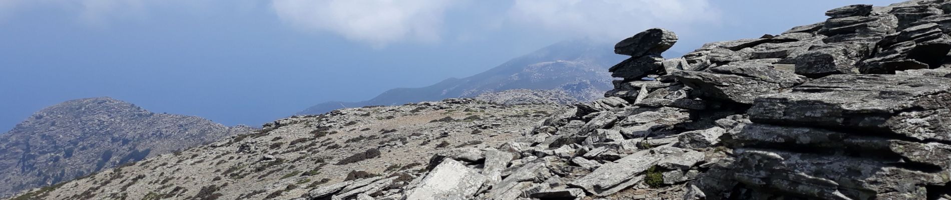
Pic Efanos

Daniel.BRUN-PICARD
User
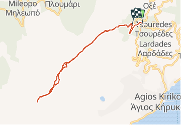

Length
10.3 km

Max alt
1034 m

Uphill gradient
573 m
Km-Effort
18.2 km

Min alt
379 m

Downhill gradient
651 m
Boucle
No
Creation date :
2020-08-10 05:42:45.568
Updated on :
2020-08-10 13:02:36.906
3h46
Difficulty : Difficult

FREE GPS app for hiking
 SityTrail
IGN / Geographical institutes
SityTrail World
The world is yours!
About
Trail Walking of 10.3 km to be discovered at Aegean, Ikaria Regional Unit. This trail is proposed by Daniel.BRUN-PICARD.
Description
Sommet le plus élevé de l'île d'Ikaria.
Photos


Positioning
Country:
Greece
Region :
Aegean
Department/Province :
Ikaria Regional Unit
Municipality :
Μαυράτο
Location:
Unknown
Start:(Dec)
Start:(UTM)
436823 ; 4165376 (35S) N.
Comments
Trails nearby