![](/images/other/stat-length.png)
![Trail Walking Gedinne - Rienne boucle presque complète 23,5 Km - Photo](https://media.geolcdn.com/t/1900/400/5f3aeb8a-0c0a-4387-bd61-31283d8dcd64.jpg&format=pjpeg&maxdim=2)
Rienne boucle presque complète 23,5 Km
rvapeldo
User GUIDE
![Length](/images/other/stat-length.png)
![Max alt](https://static1.geolcdn.com/siteimages/upload/files/1508320355ic_sort_altitude_max_24dp.png)
![Uphill gradient](https://static1.geolcdn.com/siteimages/upload/files/1508320355ic_sort_den_pos_24dp.png)
![Km-Effort](/images/other/stat-length.png)
![Min alt](https://static1.geolcdn.com/siteimages/upload/files/1508320355ic_sort_altitude_min_24dp.png)
![Downhill gradient](https://static1.geolcdn.com/siteimages/upload/files/1508320355ic_sort_den_neg_24dp.png)
![Boucle](https://static1.geolcdn.com/siteimages/upload/files/16400158638029165_repeat_loop_refresh_sync_direction_icon.png)
![Walking](https://static1.geolcdn.com/sitytour/trail-icons/101.png)
6h44
Difficulty : Easy
![Scan this QR Code to open this trail in the SityTrail application](https://capi.geolives.com/qq0zvz2zws4bq2lad0pu/sitytour/trails/2508285/qr.png?size=200)
FREE GPS app for hiking
About
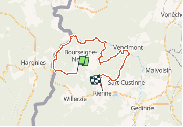
Trail Walking of 26 km to be discovered at Wallonia, Namur, Gedinne. This trail is proposed by rvapeldo.
Description
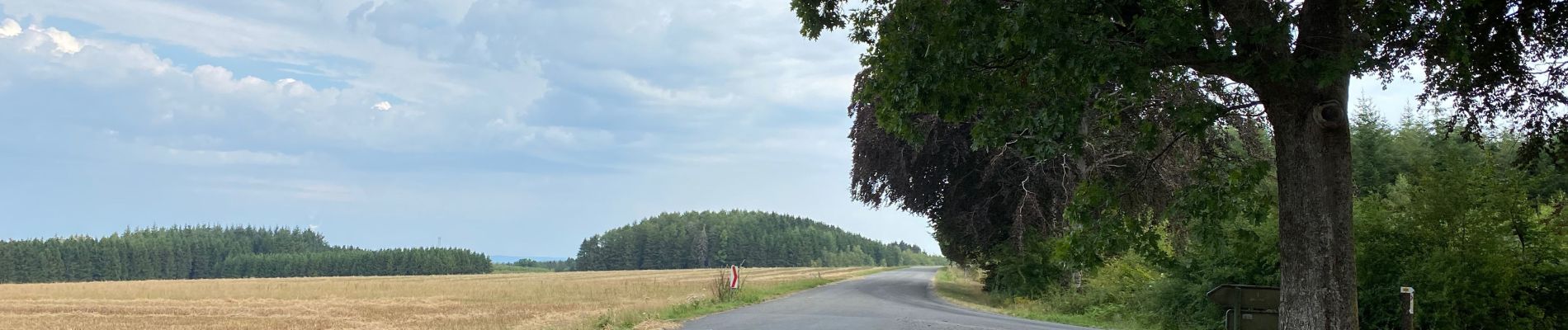
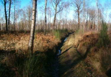
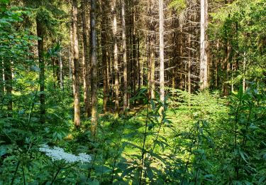
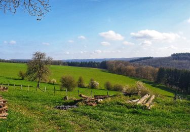
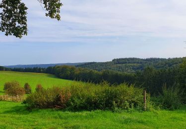
Randonnée douce et très forestière réalisée durant les jours très chauds d’août 2020. Il part des hauteurs de Rienne pour longer la frontière française et la Hulle, puis la Houille, passer près de Vencimont avant de revenir sur Rienne.
Heureusement sous un ciel voilé, et un peu de vent, c’était supportable. La balade ne fait pas une boucle complète, nous avons utilisé plusieurs véhicules pour faire le parcours, mais il y a moyen de le réaménager. Soit en la prolongeant, ce qui se rapproche des 30 km, soit en coupant le saillant près de Vencimont, ce qui permettrait de conserver les 26 km (à peu près). La pente du parcours est plutôt douce, le terrain n’est pas trop difficile, surtout pour de bons marcheurs/ses. Rien que du bonheur.
Positioning
Comments
Trails nearby
![Trail Walking Gedinne - RB-Na-08 Dans la vallée de la Houille - Photo](https://media.geolcdn.com/t/375/260/ext.jpg?maxdim=2&url=https%3A%2F%2Fservices.sitytrail.com%2FGeolivesWS%2FDownloadMedia.ashx%3FTrailID%3D179634%26Media%3D50c146e4-51ae-4441-b546-c84e45c04bf9.jpg)
![Walking Walking](https://static1.geolcdn.com/sitytour/trail-icons/101.png)
Walking
![](/images/other/stat-length.png)
![](https://static1.geolcdn.com/siteimages/upload/files/16400158638029165_repeat_loop_refresh_sync_direction_icon.png)
![Trail Walking Hargnies - De Hargnies au Point de vue de la Roche à Fépin par la vallée du Risdoux - Photo](https://media.geolcdn.com/t/375/260/ext.jpg?maxdim=2&url=https%3A%2F%2Fservices.sitytrail.com%2FGeolivesWS%2FDownloadMedia.ashx%3FTrailID%3D108901%26Media%3D2491_6.jpg)
![Walking Walking](https://static1.geolcdn.com/sitytour/trail-icons/101.png)
Walking
![](/images/other/stat-length.png)
![](https://static1.geolcdn.com/siteimages/upload/files/16400158638029165_repeat_loop_refresh_sync_direction_icon.png)
![Trail Walking Gedinne - La vallée de la Houille - Rienne - Photo](https://media.geolcdn.com/t/375/260/ext.jpg?maxdim=2&url=https%3A%2F%2Fstatic1.geolcdn.com%2Fsiteimages%2Fupload%2Ffiles%2F1553511878bg_sport_marche.png)
![Walking Walking](https://static1.geolcdn.com/sitytour/trail-icons/101.png)
Walking
![](/images/other/stat-length.png)
![](https://static1.geolcdn.com/siteimages/upload/files/16400158638029165_repeat_loop_refresh_sync_direction_icon.png)
![Trail Walking Hargnies - De Hargnies au Point de vue de la Roche à Fépin par la vallée du Risdoux - Photo](https://media.geolcdn.com/t/375/260/ext.jpg?maxdim=2&url=https%3A%2F%2Fstatic1.geolcdn.com%2Fsiteimages%2Fupload%2Ffiles%2F1553511878bg_sport_marche.png)
![Walking Walking](https://static1.geolcdn.com/sitytour/trail-icons/101.png)
Walking
![](/images/other/stat-length.png)
![](https://static1.geolcdn.com/siteimages/upload/files/16400158638029165_repeat_loop_refresh_sync_direction_icon.png)
![Trail Walking Gedinne - Balade à Willerzie - Gedinne - Photo](https://media.geolcdn.com/t/375/260/5ec22972-002a-40e1-b0ee-bd3232993f27.jpeg&format=jpg&maxdim=2)
![Walking Walking](https://static1.geolcdn.com/sitytour/trail-icons/101.png)
Walking
![](/images/other/stat-length.png)
![](https://static1.geolcdn.com/siteimages/upload/files/16400158638029165_repeat_loop_refresh_sync_direction_icon.png)
![Trail Walking Gedinne - Balade à Bourseigne-Neuve - Gedinne - Photo](https://media.geolcdn.com/t/375/260/f19f68c3-6956-44c1-8199-6f68e99309b9.jpeg&format=jpg&maxdim=2)
![Walking Walking](https://static1.geolcdn.com/sitytour/trail-icons/101.png)
Walking
![](/images/other/stat-length.png)
![](https://static1.geolcdn.com/siteimages/upload/files/16400158638029165_repeat_loop_refresh_sync_direction_icon.png)
![Trail Walking Gedinne - Balade de Bourseigne-Vieille à Vencimont - Photo](https://media.geolcdn.com/t/375/260/25a96cf8-0350-40e1-8c90-b4807b7178ca.jpeg&format=jpg&maxdim=2)
![Walking Walking](https://static1.geolcdn.com/sitytour/trail-icons/101.png)
Walking
![](/images/other/stat-length.png)
![](https://static1.geolcdn.com/siteimages/upload/files/16400158638029165_repeat_loop_refresh_sync_direction_icon.png)
![Trail On foot Gedinne - L'Ange Gardien 47 - Photo](https://media.geolcdn.com/t/375/260/ext.jpg?maxdim=2&url=https%3A%2F%2Fpivotmedia.tourismewallonie.be%2FOTH-A0-0062-3FPM%2FOTH-A0-0062-3FPM.jpg)
![On foot On foot](https://static1.geolcdn.com/sitytour/trail-icons/100.png)
On foot
![](/images/other/stat-length.png)
![](https://static1.geolcdn.com/siteimages/upload/files/16400158638029165_repeat_loop_refresh_sync_direction_icon.png)
![Trail Walking Gedinne - Balade à Bourseigne-Vieille - Gedinne - Photo](https://media.geolcdn.com/t/375/260/14770d4d-7897-48a7-8d83-c79eecefead3.jpeg&format=jpg&maxdim=2)
![Walking Walking](https://static1.geolcdn.com/sitytour/trail-icons/101.png)
Walking
![](/images/other/stat-length.png)
![](https://static1.geolcdn.com/siteimages/upload/files/16400158638029165_repeat_loop_refresh_sync_direction_icon.png)