Sommet Aenos 1600 m d’altitude. SityTrail > Trails > Outdoor > Greece > Peloponnese, Western Greece and the Ionian > Kefallonia Regional Unit > Λουρδάτα SityTrail > Trails > Outdoor > Greece > Peloponnese, Western Greece and the Ionian > Kefallonia Regional Unit > Λουρδάτα Sommet Aenos 1600 m d’altitude. GOHIER User 3D © OpenStreetMap contributors Length 108 km Max alt 1627 m Uphill gradient 2788 m Km-Effort 145 km Min alt -2 m Downhill gradient 2896 m Boucle No Creation date : 2020-08-07 13:28:32.0 Updated on : 2020-08-07 17:49:16.993 (0 Reviews) Car 4h19 Difficulty : Unknown FREE GPS app for hiking SityTrail IGN / Geographical institutes SityTrail World The world is yours! About 
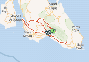
Trail Car of 108 km to be discovered at Peloponnese, Western Greece and the Ionian, Kefallonia Regional Unit. This trail is proposed by GOHIER. Legends | More details (PDF) Elevation profile Legends > 15% 15% - 10% 10% - 5% flat 5% - 10% 10% - 15% 15% - 30% > 30% Positioning Country: Greece Region : Peloponnese, Western Greece and the Ionian Department/Province : Kefallonia Regional Unit Municipality : Λουρδάτα Location: Unknown Start:(Dec) 38.117677 / 20.627356 Start:(UTM) 467335 ; 4218937 (34S) N. Comments Please log in to post a review or rate the element Trails nearby GOHIER Grèce Car , Peloponnese, Western Greece and the Ionian, Kefallonia Regional Unit, Greece 256 km | 368 km-effort 17h 59min No GOHIER Grèce Car , Peloponnese, Western Greece and the Ionian, Kefallonia Regional Unit, Greece 256 km | 368 km-effort 17h 59min No