![](/images/other/stat-length.png)
![Trail Electric bike Montalieu-Vercieu - Le Tour de la Vallée Bleue en VAE - Photo](https://media.geolcdn.com/t/1900/400/9253f46c-1312-4f3d-b4d2-f49e4324aa30.jpg&format=pjpeg&maxdim=2)
Le Tour de la Vallée Bleue en VAE
Baroux
User
![Length](/images/other/stat-length.png)
![Max alt](https://static1.geolcdn.com/siteimages/upload/files/1508320355ic_sort_altitude_max_24dp.png)
![Uphill gradient](https://static1.geolcdn.com/siteimages/upload/files/1508320355ic_sort_den_pos_24dp.png)
![Km-Effort](/images/other/stat-length.png)
![Min alt](https://static1.geolcdn.com/siteimages/upload/files/1508320355ic_sort_altitude_min_24dp.png)
![Downhill gradient](https://static1.geolcdn.com/siteimages/upload/files/1508320355ic_sort_den_neg_24dp.png)
![Boucle](https://static1.geolcdn.com/siteimages/upload/files/16400158638029165_repeat_loop_refresh_sync_direction_icon.png)
![Electric bike](https://static1.geolcdn.com/sitytour/trail-icons/205.png)
--
Difficulty : Medium
![Scan this QR Code to open this trail in the SityTrail application](https://capi.geolives.com/qq0zvz2zws4bq2lad0pu/sitytour/trails/2501179/qr.png?size=200)
FREE GPS app for hiking
About
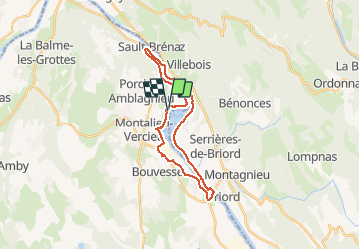
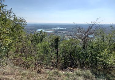
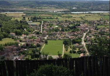
Trail Electric bike of 24 km to be discovered at Auvergne-Rhône-Alpes, Isère, Montalieu-Vercieu. This trail is proposed by Baroux.
Description
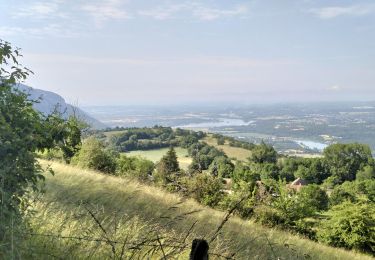
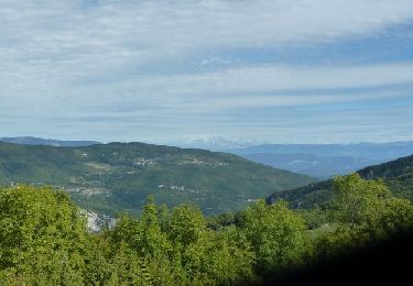
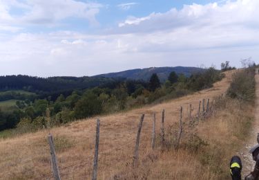
Balade variée alternant portion de la viarhôna revêtue et piste d'entretien en chemin caillouteux de la CNR le long du Rhône (passage de portillons).
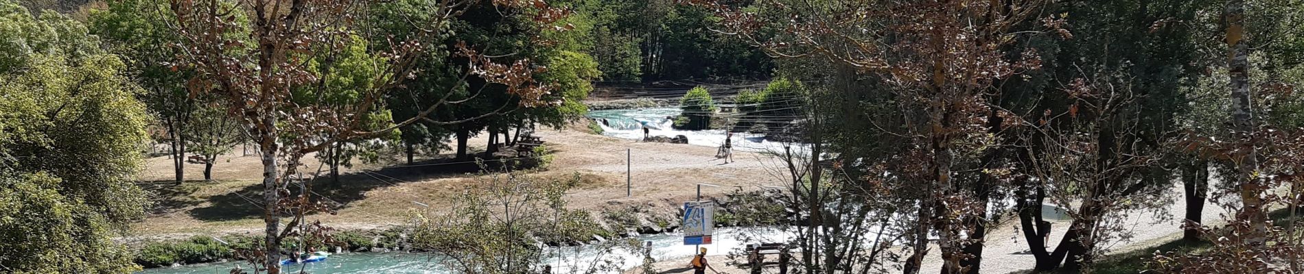
Passage par la base de loisir.
Attention un passage est en sentier pentu et assez difficile (juste avant le pont de Briord).
Positioning
Comments
Trails nearby
![Trail Walking Souclin - 01-soudon-cleyzieu-20km825m - Photo](https://media.geolcdn.com/t/375/260/0346293c-b114-4c04-91d5-976f9c67f4c8.jpg&format=jpg&maxdim=2)
![Walking Walking](https://static1.geolcdn.com/sitytour/trail-icons/101.png)
Walking
![](/images/other/stat-length.png)
![](https://static1.geolcdn.com/siteimages/upload/files/16400158638029165_repeat_loop_refresh_sync_direction_icon.png)
![Trail Walking Sault-Brénaz - 18 novembre 2022 Sault Brenat - Photo](https://media.geolcdn.com/t/375/260/aa92b50a-0f25-45d5-b589-dc4b5b0164e0.jpg&format=jpg&maxdim=2)
![Walking Walking](https://static1.geolcdn.com/sitytour/trail-icons/101.png)
Walking
![](/images/other/stat-length.png)
![](https://static1.geolcdn.com/siteimages/upload/files/16400158638029165_repeat_loop_refresh_sync_direction_icon.png)
![Trail Walking Villebois - les balcons de souclin hameau de buis - Photo](https://media.geolcdn.com/t/375/260/3b5f007f-b409-4554-ba2e-def6bfe006e4.jpg&format=jpg&maxdim=2)
![Walking Walking](https://static1.geolcdn.com/sitytour/trail-icons/101.png)
Walking
![](/images/other/stat-length.png)
![](https://static1.geolcdn.com/siteimages/upload/files/16400158638029165_repeat_loop_refresh_sync_direction_icon.png)
![Trail Walking Sault-Brénaz - 01-Sault-Brenaz-18.5km-740m-sept22 - Photo](https://media.geolcdn.com/t/375/260/b5bf9773-a9dc-4a2f-9fba-5d304d03ce5e.jpg&format=jpg&maxdim=2)
![Walking Walking](https://static1.geolcdn.com/sitytour/trail-icons/101.png)
Walking
![](/images/other/stat-length.png)
![](https://static1.geolcdn.com/siteimages/upload/files/16400158638029165_repeat_loop_refresh_sync_direction_icon.png)
![Trail Walking Bénonces - Cascade de Luiset /Rocher de Cuny - Photo](https://media.geolcdn.com/t/375/260/512cabb3-ac23-4daf-9f38-7ed7dd095ac7.jpg&format=jpg&maxdim=2)
![Walking Walking](https://static1.geolcdn.com/sitytour/trail-icons/101.png)
Walking
![](/images/other/stat-length.png)
![](https://static1.geolcdn.com/siteimages/upload/files/16400158638029165_repeat_loop_refresh_sync_direction_icon.png)
![Trail Walking Bouvesse-Quirieu - Cascade de la Roche - étangs de l’Isle Crémieu - Photo](https://media.geolcdn.com/t/375/260/9d3af39d-43b9-4826-b827-6573a4a58939.jpg&format=jpg&maxdim=2)
![Walking Walking](https://static1.geolcdn.com/sitytour/trail-icons/101.png)
Walking
![](/images/other/stat-length.png)
![](https://static1.geolcdn.com/siteimages/upload/files/16400158638029165_repeat_loop_refresh_sync_direction_icon.png)
![Trail Walking Serrières-de-Briord - voir la vierge - Photo](https://media.geolcdn.com/t/375/260/ext.jpg?maxdim=2&url=https%3A%2F%2Fservices.sitytrail.com%2FGeolivesWS%2FDownloadMedia.ashx%3FTrailID%3D200063%26Media%3D20130623154145.jpg)
![Walking Walking](https://static1.geolcdn.com/sitytour/trail-icons/101.png)
Walking
![](/images/other/stat-length.png)
![](https://static1.geolcdn.com/siteimages/upload/files/16400158638029165_repeat_loop_refresh_sync_direction_icon.png)
![Trail Mountain bike Serrières-de-Briord - Serrieres de Briord - Calvaire de Portes - Photo](https://media.geolcdn.com/t/375/260/ext.jpg?maxdim=2&url=https%3A%2F%2Fservices.sitytrail.com%2FGeolivesWS%2FDownloadMedia.ashx%3FTrailID%3D107044%26Media%3D11853_6.jpg)
![Mountain bike Mountain bike](https://static1.geolcdn.com/sitytour/trail-icons/202.png)
Mountain bike
![](/images/other/stat-length.png)
![](https://static1.geolcdn.com/siteimages/upload/files/16400158638029165_repeat_loop_refresh_sync_direction_icon.png)
![Trail Horseback riding Bénonces - col de portes - Photo](https://media.geolcdn.com/t/375/260/54810e80-f5d5-4cbb-9935-a749da2f45af.jpg&format=jpg&maxdim=2)
![Horseback riding Horseback riding](https://static1.geolcdn.com/sitytour/trail-icons/301.png)
Horseback riding
![](/images/other/stat-length.png)
![](https://static1.geolcdn.com/siteimages/upload/files/16400158638029165_repeat_loop_refresh_sync_direction_icon.png)