Trail On foot Waimes - #200801 - Mont Rigi(recalculated) - Photo

#200801 - Mont Rigi(recalculated)

© OpenStreetMap contributors
Length
Length
7 km
Max alt
Max alt
679 m
Uphill gradient
Uphill gradient
96 m
Km-Effort
Km-Effort  
8.3 km
Min alt
Min alt
610 m
Downhill gradient
Downhill gradient
95 m
Boucle
Boucle
Yes
Creation date :
2020-07-30 10:25:51.194
Updated on :
2020-11-11 17:00:15.762

(0 Reviews)

On foot
On foot
2h00
Difficulty : Very easy

Scan this QR Code to open this trail in the SityTrail application

FREE GPS app for hiking

Logo SityTrail SityTrail

IGN / Geographical institutes

Download SityTrail from the App Store Download SityTrail from Google Play

Logo SityTrail SityTrail World

The world is yours!

Download SityTrail from the App Store Download SityTrail from Google Play Download SityTrail on Huawei AppGallery

About

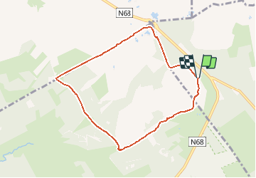
Trail On foot of 7 km to be discovered at Wallonia, Liège, Waimes. This trail is proposed by Randos Ouvertes.

Description

projet en cours

Elevation profile

Points of interest

Point of interest Malmedy - Heuvel - Photo
Randos Ouvertes
MALMEDY 
Point of interest Malmedy - Hoge Venen - Photo
Randos Ouvertes
MALMEDY 
Point of interest Malmedy - Fagne Polleur - Photo
Randos Ouvertes
MALMEDY 
Point of interest Malmedy - Fagne de la Poleûr - Photo
Randos Ouvertes
Point of interest Malmedy - Knuppelpaadjes - Photo
Randos Ouvertes
Point of interest Malmedy - Polleurvenn - Photo
Randos Ouvertes
MALMEDY 
Point of interest Malmedy - Fagne de Polleur - Photo
Randos Ouvertes
Point of interest Malmedy - Wegwijzer - Photo
Randos Ouvertes
MALMEDY 
Point of interest Waimes - Station météo - Photo
Randos Ouvertes
Point of interest Waimes - Station scientifique des Hautes-Fagnes - Photo
Randos Ouvertes
Point of interest Waimes - Mont Rigi - Photo
Randos Ouvertes
WAIMES 
Point of interest Waimes - Lehrpfad Poleur-venn (4 Km) - Photo
Randos Ouvertes
Point of interest Waimes - Ski Mont Rigi - Photo
Randos Ouvertes
Point of interest Waimes - Opération Stösser - Photo
Randos Ouvertes
Point of interest Waimes - Tourist Info Le Haut Pays Des Fagnes - Signal De Botrange - Photo
Randos Ouvertes

Positioning

Country:
Belgium
Region :
Wallonia
Department/Province :
Liège
Municipality :
Waimes
Location:
Robertville
Start:(Dec)
Start:(UTM)
292584 ; 5599478 (32U) N.

Trails nearby

Trail Walking Waimes - RB-Lg-32_Botrange_via-racc-2 - Photo
Walking
PRO

Walking

(6)
Waimes, Wallonia, Liège, Belgium
16.7 km | 22 km-effort
5h 4min
Yes
Trail Walking Waimes - RB-Lg-32_Botrange_via-racc-1 - Photo
Walking
PRO

Walking

(7)
Waimes, Wallonia, Liège, Belgium
12.3 km | 15.7 km-effort
3h 34min
Yes
Trail Walking Waimes - RB-Lg-32_Botrange - Photo
Walking
PRO

Walking

(7)
Waimes, Wallonia, Liège, Belgium
19.6 km | 26 km-effort
5h 51min
Yes
Trail Walking Malmedy - RB-Lg-31_Malmedy - Photo
Walking
PRO

Walking

(6)
Malmedy, Wallonia, Liège, Belgium
16.9 km | 23 km-effort
5h 9min
Yes
Trail Walking Waimes - Sourbrodt - Circuit Natura 2000, des sites qui valent le détour - Lg11 - Photo
Walking
GUIDE+

Walking

Easy
(8)
Waimes, Wallonia, Liège, Belgium
7.3 km | 8.3 km-effort
1h 50min
Yes
Trail Walking Waimes - Balade Peak Myrtille avec extension - restaurée - Photo
Walking
PRO

Walking

Medium
(34)
Waimes, Wallonia, Liège, Belgium
4.9 km | 6 km-effort
1h 22min
Yes
Trail Walking Waimes - Balade Peak Myrtille - restaurée - Photo
Walking
PRO

Walking

Easy
(16)
Waimes, Wallonia, Liège, Belgium
2.7 km | 3.3 km-effort
45min
Yes
Trail Walking Waimes - Balade Peak Beer IPA (new) - Photo
Walking
PRO

Walking

Medium
(27)
Waimes, Wallonia, Liège, Belgium
9.7 km | 12 km-effort
2h 43min
Yes
Trail Walking Waimes - baraque Michel . botrange  . baraque michel - Photo
Walking
GUIDE
stef789

Walking

Very easy
(2)
Waimes, Wallonia, Liège, Belgium
8.9 km | 10.5 km-effort
3h 2min
Yes


Close
My subscriptions