


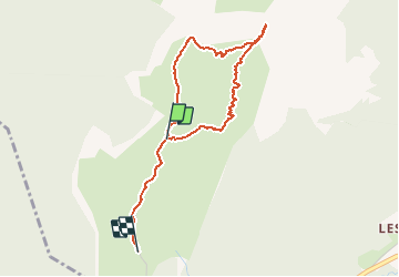

8.9 km | 17.3 km-effort

User


FREE GPS app for hiking
 SityTrail
IGN / Geographical institutes
SityTrail World
The world is yours!
Trail Walking of 3.6 km to be discovered at Auvergne-Rhône-Alpes, Isère, Saint-Pierre-de-Chartreuse. This trail is proposed by zazie.
Aller retour
Possibilité de manger une fondue savoyarde
Terrasse
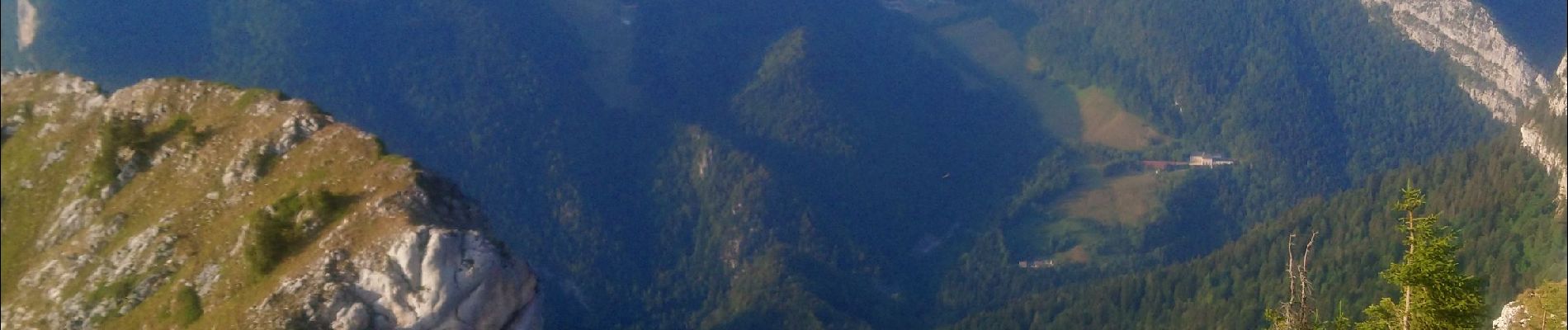
Vue sur le couché de soleil
Surplomb de la vallée de la Chartreuse


Walking

Walking

Walking

Walking

Touring skiing

Walking
Walking

Touring skiing

Walking