Trail Walking Fréjus - Fréjus plage-St Raph-retour littoral - Photo

Fréjus plage-St Raph-retour littoral

© OpenStreetMap contributors
Length
Length
17.8 km
Max alt
Max alt
82 m
Uphill gradient
Uphill gradient
200 m
Km-Effort
Km-Effort  
21 km
Min alt
Min alt
0 m
Downhill gradient
Downhill gradient
200 m
Boucle
Boucle
Yes
Creation date :
2020-07-27 05:05:29.654
Updated on :
2020-07-27 11:50:01.46

(0 Reviews)

Walking
Walking
4h19
Difficulty : Difficult

Scan this QR Code to open this trail in the SityTrail application

FREE GPS app for hiking

Logo SityTrail SityTrail

IGN / Geographical institutes

Download SityTrail from the App Store Download SityTrail from Google Play

Logo SityTrail SityTrail World

The world is yours!

Download SityTrail from the App Store Download SityTrail from Google Play Download SityTrail on Huawei AppGallery

About

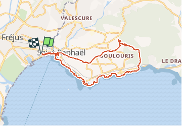
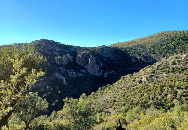
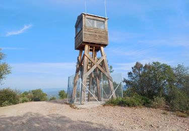
Trail Walking of 17.8 km to be discovered at Provence-Alpes-Côte d'Azur, Var, Fréjus. This trail is proposed by janussity.

Description

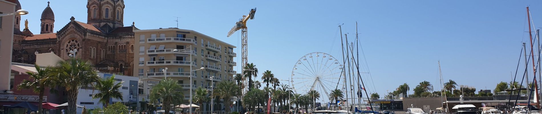
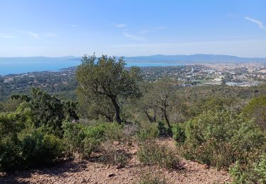
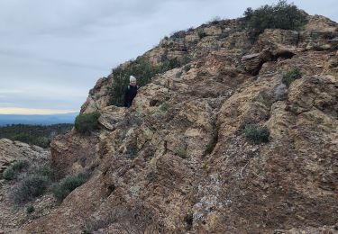
Beau temps .Depart rue Garnier et par littoral jusqu'à St Raph. Rando urbaine sur GR 51 ... plateau de Boulouris et descente vallon vers la mer. Littoral amenage vers Santa Lucia-Port St Raph et Fréjus Plage.
Difficile

Elevation profile

Photos

39 photos in total. Please click on a photo to see them all in the gallery.

Positioning

Country:
France
Region :
Provence-Alpes-Côte d'Azur
Department/Province :
Var
Municipality :
Fréjus
Location:
Unknown
Start:(UTM)
318368 ; 4810454 (32T) N.

Trails nearby

Trail Walking Fréjus - Etang de Villepey - Photo
Walking
marmotte83

Walking

Very easy
(2)
Fréjus, Provence-Alpes-Côte d'Azur, Var, France
6.5 km | 7 km-effort
3h 4min
Yes
Trail Mountain bike Fréjus - grand tour esterel par belles pistes larges - Photo
Mountain bike
Margaide

Mountain bike

Easy
(2)
Fréjus, Provence-Alpes-Côte d'Azur, Var, France
31 km | 40 km-effort
3h 17min
Yes
Trail Walking Fréjus - Mont Vinaigre par Colle Douce - Photo
Walking

Walking

Very difficult
(1)
Fréjus, Provence-Alpes-Côte d'Azur, Var, France
22 km | 33 km-effort
6h 1min
Yes
Trail Walking Fréjus - Sortie du lundi 8 janvier aprés-midi - Photo
Walking
OB83700

Walking

Medium
(1)
Fréjus, Provence-Alpes-Côte d'Azur, Var, France
7.4 km | 10.7 km-effort
2h 50min
Yes
Trail Walking Saint-Raphaël - Peïre Sarade à Ancienne Carrière de Dramont - Photo
Walking
LtZIP

Walking

Very easy
(1)
Saint-Raphaël, Provence-Alpes-Côte d'Azur, Var, France
13.6 km | 19.5 km-effort
4h 4min
Yes
Trail Mountain bike Fréjus - Roc Odyssée 2015 - Photo
Mountain bike
Dominick

Mountain bike

Medium
(1)
Fréjus, Provence-Alpes-Côte d'Azur, Var, France
37 km | 47 km-effort
3h 55min
No
Trail Walking Fréjus - VVA 2109 Etangs de Villepey - Photo
Walking
jmheydorff

Walking

Easy
(1)
Fréjus, Provence-Alpes-Côte d'Azur, Var, France
17 km | 19.6 km-effort
4h 13min
Yes
Trail Mountain bike Fréjus - Tour des Petites Maures - Photo
Mountain bike
barberou

Mountain bike

Very easy
(2)
Fréjus, Provence-Alpes-Côte d'Azur, Var, France
40 km | 52 km-effort
Unknown
Yes
Trail Walking Saint-Raphaël - Rando Light (A) depuis le Parcours Sportif St Raphaël - Photo
Walking
donda

Walking

Very easy
Saint-Raphaël, Provence-Alpes-Côte d'Azur, Var, France
10.4 km | 13.5 km-effort
3h 3min
Yes


Close
My subscriptions