![](/images/other/stat-length.png)
![Trail Mountain bike Le Monastère - Rodez Agglomeration - Circuit 2 - Les deux églises - Photo](https://media.geolcdn.com/t/1900/400/796e1274-6ffc-4ddb-aa65-0bd15f3091ac.jpg&format=pjpeg&maxdim=2)
Rodez Agglomeration - Circuit 2 - Les deux églises
randoruthene
User
![Length](/images/other/stat-length.png)
![Max alt](https://static1.geolcdn.com/siteimages/upload/files/1508320355ic_sort_altitude_max_24dp.png)
![Uphill gradient](https://static1.geolcdn.com/siteimages/upload/files/1508320355ic_sort_den_pos_24dp.png)
![Km-Effort](/images/other/stat-length.png)
![Min alt](https://static1.geolcdn.com/siteimages/upload/files/1508320355ic_sort_altitude_min_24dp.png)
![Downhill gradient](https://static1.geolcdn.com/siteimages/upload/files/1508320355ic_sort_den_neg_24dp.png)
![Boucle](https://static1.geolcdn.com/siteimages/upload/files/16400158638029165_repeat_loop_refresh_sync_direction_icon.png)
![Mountain bike](https://static1.geolcdn.com/sitytour/trail-icons/202.png)
1h59
Difficulty : Medium
![Scan this QR Code to open this trail in the SityTrail application](https://capi.geolives.com/qq0zvz2zws4bq2lad0pu/sitytour/trails/2492059/qr.png?size=200)
FREE GPS app for hiking
About
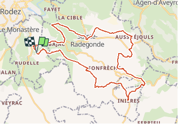
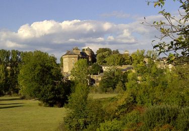
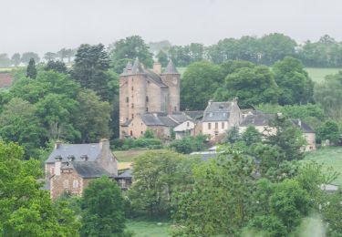
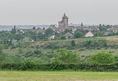
Trail Mountain bike of 24 km to be discovered at Occitania, Aveyron, Le Monastère. This trail is proposed by randoruthene.
Description
Espace VTT Rodez Agglo - 400 km de chemins balisés - 18 circuits labéllisés FFC
Vous pourrez découvrir durant ce parcours :
• Le Domaine de Combelles et son parc équestre, situés sur la Commune du Monastère.
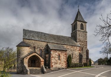
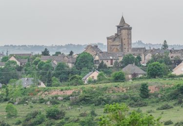
• Deux églises fortifiées des XIVe et XVe siècles à Sainte-Radegonde et Inières :
- l’église de Sainte-Radegonde défendue par trois tours et des échauguettes
- l’église Saint-Jacques dans le village d’Inières, massive et couronnée de mâchicoulis
• Un magnifique point de vue sur Rodez et sa cathédrale.
Positioning
Comments
Trails nearby
![Trail On foot Rodez - Randonnée de Rodez Agglomération Circuit n°2 - Layoule - Photo](https://media.geolcdn.com/t/375/260/f3313b5c-ce65-4318-890f-b27e77cbc381.jpeg&format=jpg&maxdim=2)
![On foot On foot](https://static1.geolcdn.com/sitytour/trail-icons/100.png)
On foot
![](/images/other/stat-length.png)
![](https://static1.geolcdn.com/siteimages/upload/files/16400158638029165_repeat_loop_refresh_sync_direction_icon.png)
![Trail On foot Onet-le-Château - Circuit 16 Moulin de cantarane - Photo](https://media.geolcdn.com/t/375/260/235c9653-a6cd-4d3e-a1cf-bad11a8eacbc.jpeg&format=jpg&maxdim=2)
![On foot On foot](https://static1.geolcdn.com/sitytour/trail-icons/100.png)
On foot
![](/images/other/stat-length.png)
![](https://static1.geolcdn.com/siteimages/upload/files/16400158638029165_repeat_loop_refresh_sync_direction_icon.png)
![Trail On foot Sainte-Radegonde - Circuit 14 Sainte-Radegonde - Photo](https://media.geolcdn.com/t/375/260/bfa8cc26-1f2d-4982-8155-a549091f1797.jpeg&format=jpg&maxdim=2)
![On foot On foot](https://static1.geolcdn.com/sitytour/trail-icons/100.png)
On foot
![](/images/other/stat-length.png)
![](https://static1.geolcdn.com/siteimages/upload/files/16400158638029165_repeat_loop_refresh_sync_direction_icon.png)
![Trail On foot Le Monastère - Circuit 11 Le Monsastère - Photo](https://media.geolcdn.com/t/375/260/7f6d0b8f-df20-456a-b847-03e2bacf2452.jpeg&format=jpg&maxdim=2)
![On foot On foot](https://static1.geolcdn.com/sitytour/trail-icons/100.png)
On foot
![](/images/other/stat-length.png)
![](https://static1.geolcdn.com/siteimages/upload/files/16400158638029165_repeat_loop_refresh_sync_direction_icon.png)
![Trail On foot Luc-la-Primaube - Circuit 10 La Capelle Saint-Martin - Photo](https://media.geolcdn.com/t/375/260/5a6f95bc-d295-4447-ad49-16f1eeefb33a.jpeg&format=jpg&maxdim=2)
![On foot On foot](https://static1.geolcdn.com/sitytour/trail-icons/100.png)
On foot
![](/images/other/stat-length.png)
![](https://static1.geolcdn.com/siteimages/upload/files/16400158638029165_repeat_loop_refresh_sync_direction_icon.png)
![Trail On foot Luc-la-Primaube - Circuit 9 Planèzes - Photo](https://media.geolcdn.com/t/375/260/5a6f95bc-d295-4447-ad49-16f1eeefb33a.jpeg&format=jpg&maxdim=2)
![On foot On foot](https://static1.geolcdn.com/sitytour/trail-icons/100.png)
On foot
![](/images/other/stat-length.png)
![](https://static1.geolcdn.com/siteimages/upload/files/16400158638029165_repeat_loop_refresh_sync_direction_icon.png)
![Trail On foot Olemps - Circuit 8 Le Viel Olemps - Photo](https://media.geolcdn.com/t/375/260/eb25fc91-7c0e-4dc4-8e2b-7796a039a790.jpeg&format=jpg&maxdim=2)
![On foot On foot](https://static1.geolcdn.com/sitytour/trail-icons/100.png)
On foot
![](/images/other/stat-length.png)
![](https://static1.geolcdn.com/siteimages/upload/files/16400158638029165_repeat_loop_refresh_sync_direction_icon.png)
![Trail On foot Rodez - Via Piodensis - Rodez - Photo](https://media.geolcdn.com/t/375/260/9dd22525-ee44-4bef-976c-a9f96d351214.jpeg&format=jpg&maxdim=2)
![On foot On foot](https://static1.geolcdn.com/sitytour/trail-icons/100.png)
On foot
![](/images/other/stat-length.png)
![](https://static1.geolcdn.com/siteimages/upload/files/16400158638029165_repeat_loop_refresh_sync_direction_icon.png)
![Trail On foot Sainte-Radegonde - Sainte-Radegonde - Photo](https://media.geolcdn.com/t/375/260/8f1cb6a9-35c6-49f1-bd01-3c3a300c688b.jpeg&format=jpg&maxdim=2)
![On foot On foot](https://static1.geolcdn.com/sitytour/trail-icons/100.png)
On foot
![](/images/other/stat-length.png)
![](https://static1.geolcdn.com/siteimages/upload/files/16400158638029165_repeat_loop_refresh_sync_direction_icon.png)