


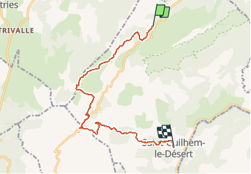


18.4 km | 28 km-effort


User GUIDE


FREE GPS app for hiking
 SityTrail
IGN / Geographical institutes
SityTrail World
The world is yours!
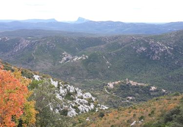
Trail Walking of 13.2 km to be discovered at Occitania, Hérault, Saint-Guilhem-le-Désert. This trail is proposed by Kargil.
Enfin, il est temps de retourner à Aumont-Aubrac.
La meilleure façon est d’utiliser les services de la Malle Postale (transports bagages et passagers) : www.lamallepostale.com.
Et pour rejoindre Montpellier TGV, ligne 668 de Hérault transports : www.herault-transport.fr
Walking

Walking

Walking
Walking
Walking
Walking

Walking

Walking

Walking