![](/images/other/stat-length.png)
![Trail Walking Allevard - Col de claran par le refuge de la Pierre du Carré - Photo](https://media.geolcdn.com/t/1900/400/f60605e6-c8e6-4aa0-93f8-096b0074d8aa.jpg&format=pjpeg&maxdim=2)
Col de claran par le refuge de la Pierre du Carré
GuyVachet
User
![Length](/images/other/stat-length.png)
![Max alt](https://static1.geolcdn.com/siteimages/upload/files/1508320355ic_sort_altitude_max_24dp.png)
![Uphill gradient](https://static1.geolcdn.com/siteimages/upload/files/1508320355ic_sort_den_pos_24dp.png)
![Km-Effort](/images/other/stat-length.png)
![Min alt](https://static1.geolcdn.com/siteimages/upload/files/1508320355ic_sort_altitude_min_24dp.png)
![Downhill gradient](https://static1.geolcdn.com/siteimages/upload/files/1508320355ic_sort_den_neg_24dp.png)
![Boucle](https://static1.geolcdn.com/siteimages/upload/files/16400158638029165_repeat_loop_refresh_sync_direction_icon.png)
![Walking](https://static1.geolcdn.com/sitytour/trail-icons/101.png)
6h43
Difficulty : Difficult
![Scan this QR Code to open this trail in the SityTrail application](https://capi.geolives.com/qq0zvz2zws4bq2lad0pu/sitytour/trails/2489013/qr.png?size=200)
FREE GPS app for hiking
About
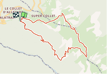
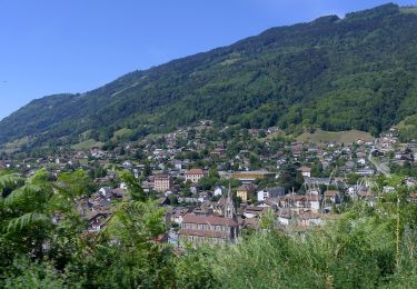
Trail Walking of 11.6 km to be discovered at Auvergne-Rhône-Alpes, Isère, Allevard. This trail is proposed by GuyVachet.
Description
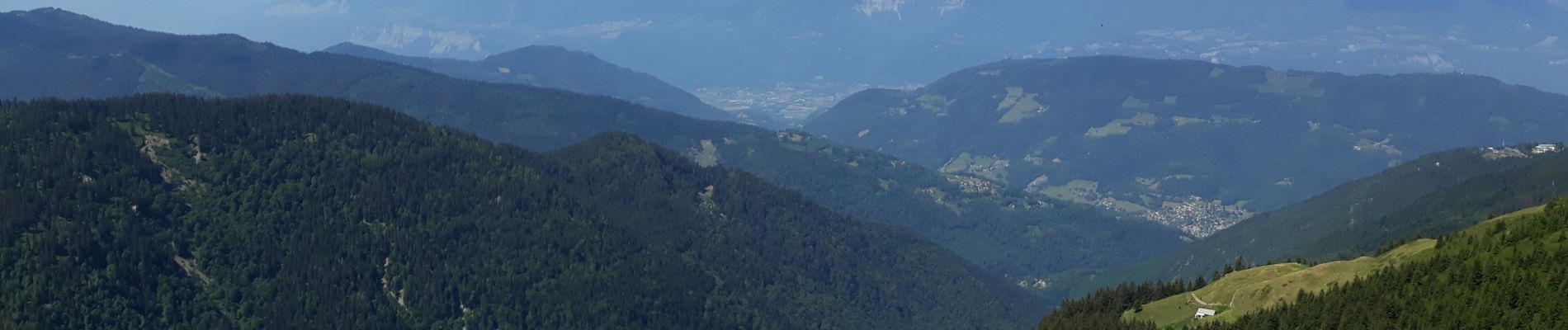
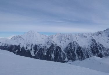
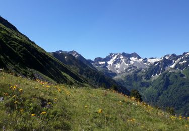
Boucle au dessus du Collet d'Allevard par le col de Claran au pied des Petit et Grand Charnier et retour par Les Plagnes sur le haut de la station. La montée entre le Pas du Boeuf, le refuge de la Pierre du Carré (étape du GR 738 : Haute traversée de Belledonne) est plus que rude mais l'accueil au refuge le vaut bien. A partir de là, l'itinéraire devient très agréable avec une vue dégagée sur la Chartreuse, les Bauges et sur les Grands Moulins. Il serait possible d'aller aux sommets des Charniers mais plutôt à partir de Super Collet pour réduire le dénivelé.
Positioning
Comments
Trails nearby
![Trail Walking La Chapelle-du-Bard - Le Grand Charnier 2561m, par l'arête de l'Évêque - Photo](https://media.geolcdn.com/t/375/260/ext.jpg?maxdim=2&url=https%3A%2F%2Fservices.sitytrail.com%2FGeolivesWS%2FDownloadMedia.ashx%3FTrailID%3D102683%26Media%3D3706_1.jpg)
![Walking Walking](https://static1.geolcdn.com/sitytour/trail-icons/101.png)
Walking
![](/images/other/stat-length.png)
![](https://static1.geolcdn.com/siteimages/upload/files/16400158638029165_repeat_loop_refresh_sync_direction_icon.png)
![Trail Walking Arvillard - Les Grands Moulins 2495m - Photo](https://media.geolcdn.com/t/375/260/ext.jpg?maxdim=2&url=https%3A%2F%2Fservices.sitytrail.com%2FGeolivesWS%2FDownloadMedia.ashx%3FTrailID%3D102590%26Media%3D3501_1.jpg)
![Walking Walking](https://static1.geolcdn.com/sitytour/trail-icons/101.png)
Walking
![](/images/other/stat-length.png)
![](https://static1.geolcdn.com/siteimages/upload/files/16400158638029165_repeat_loop_refresh_sync_direction_icon.png)
![Trail Touring skiing La Chapelle-du-Bard - Crête de la Plagne descente Nord - Photo](https://media.geolcdn.com/t/375/260/a18dcbf8-7d05-4d6a-95a3-6473edcc6b7f.jpg&format=jpg&maxdim=2)
![Touring skiing Touring skiing](https://static1.geolcdn.com/sitytour/trail-icons/503.png)
Touring skiing
![](/images/other/stat-length.png)
![](https://static1.geolcdn.com/siteimages/upload/files/16400158638029165_repeat_loop_refresh_sync_direction_icon.png)
![Trail Walking La Chapelle-du-Bard - Col de l'Occiput en raquettes - Photo](https://media.geolcdn.com/t/375/260/097b251d-d4e3-4eff-83ad-ca4286267be3.jpg&format=jpg&maxdim=2)
![Walking Walking](https://static1.geolcdn.com/sitytour/trail-icons/101.png)
Walking
![](/images/other/stat-length.png)
![](https://static1.geolcdn.com/siteimages/upload/files/16400158638029165_repeat_loop_refresh_sync_direction_icon.png)
![Trail On foot Le Haut-Bréda - Tour Pays Allevard - Photo](https://media.geolcdn.com/t/375/260/0a5c4a99-9cde-4ae9-a3b1-f2c7b44e7d78.jpeg&format=jpg&maxdim=2)
![On foot On foot](https://static1.geolcdn.com/sitytour/trail-icons/100.png)
On foot
![](/images/other/stat-length.png)
![](https://static1.geolcdn.com/siteimages/upload/files/16400158638029165_repeat_loop_refresh_sync_direction_icon.png)
![Trail On foot Allevard - sentier du fer - Photo](https://media.geolcdn.com/t/375/260/0b37781f-1d1d-46b3-ad09-4357a539d2ee.jpeg&format=jpg&maxdim=2)
![On foot On foot](https://static1.geolcdn.com/sitytour/trail-icons/100.png)
On foot
![](/images/other/stat-length.png)
![](https://static1.geolcdn.com/siteimages/upload/files/16400158638029165_repeat_loop_refresh_sync_direction_icon.png)
![Trail Touring skiing Allevard - Les Plagnes - Photo](https://media.geolcdn.com/t/375/260/383df5fa-dc7c-46dc-ad36-1d6d4340459d.jpg&format=jpg&maxdim=2)
![Touring skiing Touring skiing](https://static1.geolcdn.com/sitytour/trail-icons/503.png)
Touring skiing
![](/images/other/stat-length.png)
![](https://static1.geolcdn.com/siteimages/upload/files/16400158638029165_repeat_loop_refresh_sync_direction_icon.png)
![Trail Snowshoes Allevard - Collet d Allevard - arête de l évêque - Prarion - Photo](https://media.geolcdn.com/t/375/260/2d809917-d6c7-4f5f-87e7-6acb96740662.jpg&format=jpg&maxdim=2)
![Snowshoes Snowshoes](https://static1.geolcdn.com/sitytour/trail-icons/504.png)
Snowshoes
![](/images/other/stat-length.png)
![](https://static1.geolcdn.com/siteimages/upload/files/16400158638029165_repeat_loop_refresh_sync_direction_icon.png)
![Trail Walking Arvillard - Crete du Gargoton - Photo](https://media.geolcdn.com/t/375/260/c9c62c49-770b-457d-b723-13784f4fc8a6.jpg&format=jpg&maxdim=2)
![Walking Walking](https://static1.geolcdn.com/sitytour/trail-icons/101.png)
Walking
![](/images/other/stat-length.png)
![](https://static1.geolcdn.com/siteimages/upload/files/16400158638029165_repeat_loop_refresh_sync_direction_icon.png)