Trail Walking Grandfontaine - Positions fortifiées du Donon sentier des casemates - sud - Photo

Positions fortifiées du Donon sentier des casemates - sud

© OpenStreetMap contributors
Length
Length
12.6 km
Max alt
Max alt
892 m
Uphill gradient
Uphill gradient
313 m
Km-Effort
Km-Effort  
16.8 km
Min alt
Min alt
729 m
Downhill gradient
Downhill gradient
313 m
Boucle
Boucle
Yes
Creation date :
2020-07-19 09:19:26.554
Updated on :
2020-07-28 15:03:33.682

(1 Reviews)

Walking
Walking
3h12
Difficulty : Medium

Scan this QR Code to open this trail in the SityTrail application

FREE GPS app for hiking

Logo SityTrail SityTrail

IGN / Geographical institutes

Download SityTrail from the App Store Download SityTrail from Google Play

Logo SityTrail SityTrail World

The world is yours!

Download SityTrail from the App Store Download SityTrail from Google Play Download SityTrail on Huawei AppGallery

About

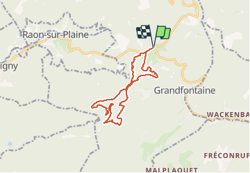
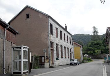
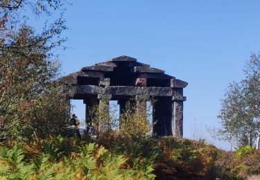
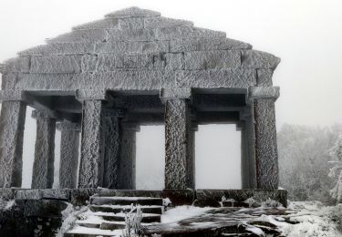
Trail Walking of 12.6 km to be discovered at Grand Est, Bas-Rhin, Grandfontaine. This trail is proposed by VacheKiri67.

Description

Faite le 19/07/2020 avec notre fils Théo de 15 ans. D'après "Passion Vosges - Sentiers de mémoire de la Grande Guerre " N°4 :  Positions fortifiées du Donon sentier des casemates - sud. Durée indiquée pour le circuit : 5h00 avec la visite des vestiges. Départ : parking du cimetière du Donon. Balisage : anneau rouge. Lampe torche indispensable notamment pour la traversée du tunnel de 60 mètres non éclairé sur le site de La Corbeille.

Elevation profile

Photos

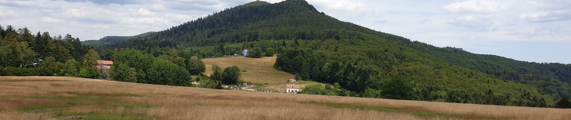
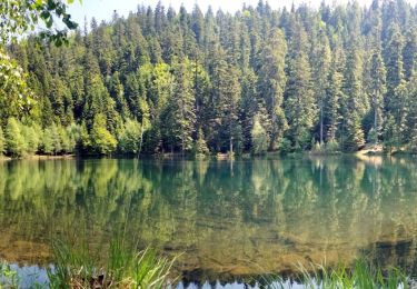
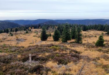
48 photos in total. Please click on a photo to see them all in the gallery.

Positioning

Country:
France
Region :
Grand Est
Department/Province :
Bas-Rhin
Municipality :
Grandfontaine
Location:
Unknown
Start:(UTM)
363067 ; 5374339 (32U) N.

Comments

Please log in to post a review or rate the element


Trails nearby

Trail Walking Grandfontaine - Donon sentier des casemates - sud - Photo
Walking
VacheKiri67

Walking

Medium
(1)
Grandfontaine, Grand Est, Bas-Rhin, France
12.6 km | 16.9 km-effort
4h 13min
Yes
Trail Walking Grandfontaine - Le site des 2 Donons - Photo
Walking
VacheKiri67

Walking

Medium
(4)
Grandfontaine, Grand Est, Bas-Rhin, France
12.6 km | 19.4 km-effort
4h 52min
Yes
Trail Walking Moussey - Col de Prayé - Photo
Walking
VacheKiri67

Walking

Difficult
(1)
Moussey, Grand Est, Vosges, France
16.8 km | 23 km-effort
6h 55min
Yes
Trail Walking La Broque - suuntoapp-Hiking-2024-03-17T08-46-21Z - Photo
Walking
GUIDE
holtzv

Walking

Easy
La Broque, Grand Est, Bas-Rhin, France
23 km | 35 km-effort
7h 55min
Yes
Trail Walking Grandfontaine - 2023-05-29 Marche Les Minières Lac de la Maix - Photo
Walking
GUIDE
holtzv

Walking

Medium
Grandfontaine, Grand Est, Bas-Rhin, France
22 km | 34 km-effort
7h 43min
Yes
Trail Walking Grandfontaine - 2022-11-12 Marche Grandfontaine Tête Mathis Col de Praye La Corbeille - Photo
Walking
GUIDE
holtzv

Walking

Medium
Grandfontaine, Grand Est, Bas-Rhin, France
15.3 km | 23 km-effort
4h 34min
Yes
Trail On foot Grandfontaine - Circuit du Chemin d'Allemagne - Photo
On foot
GUIDE+

On foot

Easy
Grandfontaine, Grand Est, Bas-Rhin, France
8.7 km | 13.9 km-effort
3h 10min
No
Trail Walking Grandfontaine - 2020-09-20 Marche Donon Petit Donon Casemates - Photo
Walking
GUIDE
holtzv

Walking

Very easy
(1)
Grandfontaine, Grand Est, Bas-Rhin, France
13.4 km | 20 km-effort
4h 17min
Yes
Trail Walking Grandfontaine - 2019-01-05 Marche Temple du Donon - Photo
Walking
GUIDE
holtzv

Walking

Medium
Grandfontaine, Grand Est, Bas-Rhin, France
5.6 km | 9.3 km-effort
1h 54min
Yes


Close
My subscriptions