![](/images/other/stat-length.png)
![Trail Hybrid bike Charleville-Mézières - Ardennes - VTT - Charleville-Mezieres Chateau-Regnault A-R 37km 140m - Photo](https://media.geolcdn.com/t/1900/400/ext.pjpeg?maxdim=2&url=https%3A%2F%2Fstatic1.geolcdn.com%2Fsiteimages%2Fupload%2Ffiles%2F1524743154velo.jpg)
Ardennes - VTT - Charleville-Mezieres Chateau-Regnault A-R 37km 140m
RandoVal
User
![Length](/images/other/stat-length.png)
Length
37 km
![Max alt](https://static1.geolcdn.com/siteimages/upload/files/1508320355ic_sort_altitude_max_24dp.png)
Max alt
171 m
![Uphill gradient](https://static1.geolcdn.com/siteimages/upload/files/1508320355ic_sort_den_pos_24dp.png)
Uphill gradient
378 m
![Km-Effort](/images/other/stat-length.png)
Km-Effort
42 km
![Min alt](https://static1.geolcdn.com/siteimages/upload/files/1508320355ic_sort_altitude_min_24dp.png)
Min alt
131 m
![Downhill gradient](https://static1.geolcdn.com/siteimages/upload/files/1508320355ic_sort_den_neg_24dp.png)
Downhill gradient
378 m
![Boucle](https://static1.geolcdn.com/siteimages/upload/files/16400158638029165_repeat_loop_refresh_sync_direction_icon.png)
Boucle
Yes
Creation date :
2020-07-14 07:38:04.081
Updated on :
2020-07-14 07:39:38.58
![Hybrid bike](https://static1.geolcdn.com/sitytour/trail-icons/203.png)
--
Difficulty : Unknown
![Scan this QR Code to open this trail in the SityTrail application](https://capi.geolives.com/qq0zvz2zws4bq2lad0pu/sitytour/trails/2474677/qr.png?size=200)
FREE GPS app for hiking
About
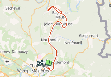
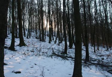
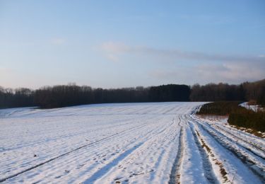
Trail Hybrid bike of 37 km to be discovered at Grand Est, Ardennes, Charleville-Mézières. This trail is proposed by RandoVal.
Description
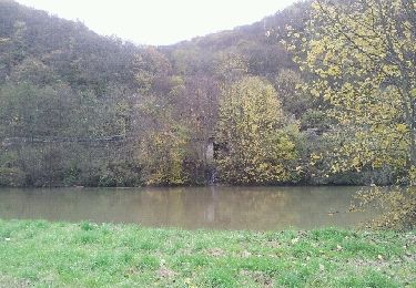
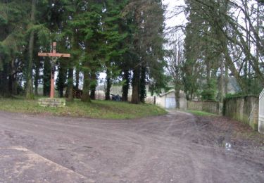
Petit aller/retour sur la voie verte Trans-Ardennes, départ et stationnement sur le parking en face de l'ancien lycée Chanzy. Petit resto à Chateau-Regnault et visite du musée de la métallurgie de Lévrézy
Positioning
Country:
France
Region :
Grand Est
Department/Province :
Ardennes
Municipality :
Charleville-Mézières
Location:
Unknown
Start:(Dec)
Start:(UTM)
624605 ; 5514645 (31U) N.
Comments
Trails nearby
![Trail Walking Charleville-Mézières - De Charleville Mézières à Olly (Commune d'Illy) - Photo](https://media.geolcdn.com/t/375/260/7d73bd6e-f0b7-4726-8c94-18c6cbf615f3.jpg&format=jpg&maxdim=2)
![Walking Walking](https://static1.geolcdn.com/sitytour/trail-icons/101.png)
De Charleville Mézières à Olly (Commune d'Illy)
Walking
Medium
Charleville-Mézières,
Grand Est,
Ardennes,
France
![](/images/other/stat-length.png)
28 km | 33 km-effort
8h 20min
![](https://static1.geolcdn.com/siteimages/upload/files/16400158638029165_repeat_loop_refresh_sync_direction_icon.png)
No
![Trail Walking Neufmanil - 2022-01-10_15h31m44_SityTrail - 2331539 - neufmanil-2020x02x11 - Photo](https://media.geolcdn.com/t/375/260/ext.jpg?maxdim=2&url=https%3A%2F%2Fstatic1.geolcdn.com%2Fsiteimages%2Fupload%2Ffiles%2F1553511878bg_sport_marche.png)
![Walking Walking](https://static1.geolcdn.com/sitytour/trail-icons/101.png)
2022-01-10_15h31m44_SityTrail - 2331539 - neufmanil-2020x02x11
Walking
Very difficult
(1)
Neufmanil,
Grand Est,
Ardennes,
France
![](/images/other/stat-length.png)
14.1 km | 19.1 km-effort
4h 20min
![](https://static1.geolcdn.com/siteimages/upload/files/16400158638029165_repeat_loop_refresh_sync_direction_icon.png)
Yes
![Trail Walking Charleville-Mézières - la havetiere CHM - Photo](https://media.geolcdn.com/t/375/260/c5f7d70f-e79d-4044-a8a3-c9b0a21efbd5.jpg&format=jpg&maxdim=2)
![Walking Walking](https://static1.geolcdn.com/sitytour/trail-icons/101.png)
la havetiere CHM
Walking
Easy
Charleville-Mézières,
Grand Est,
Ardennes,
France
![](/images/other/stat-length.png)
10.5 km | 14 km-effort
2h 41min
![](https://static1.geolcdn.com/siteimages/upload/files/16400158638029165_repeat_loop_refresh_sync_direction_icon.png)
Yes
![Trail Walking Charleville-Mézières - Berthaucourt - Photo](https://media.geolcdn.com/t/375/260/ext.jpg?maxdim=2&url=https%3A%2F%2Fservices.sitytrail.com%2FGeolivesWS%2FDownloadMedia.ashx%3FTrailID%3D1129015%26Media%3Dfix__20190331110619.jpg)
![Walking Walking](https://static1.geolcdn.com/sitytour/trail-icons/101.png)
Berthaucourt
Walking
Very easy
Charleville-Mézières,
Grand Est,
Ardennes,
France
![](/images/other/stat-length.png)
5.7 km | 7.1 km-effort
1h 34min
![](https://static1.geolcdn.com/siteimages/upload/files/16400158638029165_repeat_loop_refresh_sync_direction_icon.png)
Yes
![Trail Mountain bike Damouzy - De Sorel à Bogny - Damouzy - Photo](https://media.geolcdn.com/t/375/260/ext.jpg?maxdim=2&url=https%3A%2F%2Fservices.sitytrail.com%2FGeolivesWS%2FDownloadMedia.ashx%3FTrailID%3D317153%26Media%3D16302_6.jpg)
![Mountain bike Mountain bike](https://static1.geolcdn.com/sitytour/trail-icons/202.png)
De Sorel à Bogny - Damouzy
Mountain bike
Difficult
Damouzy,
Grand Est,
Ardennes,
France
![](/images/other/stat-length.png)
20 km | 28 km-effort
2h 45min
![](https://static1.geolcdn.com/siteimages/upload/files/16400158638029165_repeat_loop_refresh_sync_direction_icon.png)
Yes
![Trail Mountain bike Montcy-Notre-Dame - De Montcy Notre Dame vers Nouzonville - Photo](https://media.geolcdn.com/t/375/260/ext.jpg?maxdim=2&url=https%3A%2F%2Fservices.sitytrail.com%2FGeolivesWS%2FDownloadMedia.ashx%3FTrailID%3D191388%26Media%3D14958_3.jpg)
![Mountain bike Mountain bike](https://static1.geolcdn.com/sitytour/trail-icons/202.png)
De Montcy Notre Dame vers Nouzonville
Mountain bike
Difficult
Montcy-Notre-Dame,
Grand Est,
Ardennes,
France
![](/images/other/stat-length.png)
18.5 km | 24 km-effort
2h 15min
![](https://static1.geolcdn.com/siteimages/upload/files/16400158638029165_repeat_loop_refresh_sync_direction_icon.png)
Yes
![Trail Walking Nouzonville - De Nouzonville à Aiglemont - Photo](https://media.geolcdn.com/t/375/260/ext.jpg?maxdim=2&url=https%3A%2F%2Fservices.sitytrail.com%2FGeolivesWS%2FDownloadMedia.ashx%3FTrailID%3D191374%26Media%3D14943_3.jpg)
![Walking Walking](https://static1.geolcdn.com/sitytour/trail-icons/101.png)
De Nouzonville à Aiglemont
Walking
Difficult
(1)
Nouzonville,
Grand Est,
Ardennes,
France
![](/images/other/stat-length.png)
13.8 km | 19.4 km-effort
3h 0min
![](https://static1.geolcdn.com/siteimages/upload/files/16400158638029165_repeat_loop_refresh_sync_direction_icon.png)
Yes
![Trail Walking Nouzonville - joigny - Photo](https://media.geolcdn.com/t/375/260/ext.jpg?maxdim=2&url=https%3A%2F%2Fservices.sitytrail.com%2FGeolivesWS%2FDownloadMedia.ashx%3FTrailID%3D161916%26Media%3D20121108145658.jpeg)
![Walking Walking](https://static1.geolcdn.com/sitytour/trail-icons/101.png)
joigny
Walking
Very easy
Nouzonville,
Grand Est,
Ardennes,
France
![](/images/other/stat-length.png)
6.1 km | 7.7 km-effort
1h 12min
![](https://static1.geolcdn.com/siteimages/upload/files/16400158638029165_repeat_loop_refresh_sync_direction_icon.png)
No
![Trail Mountain bike Lumes - Lumes - Gespon - Photo](https://media.geolcdn.com/t/375/260/ext.jpg?maxdim=2&url=https%3A%2F%2Fservices.sitytrail.com%2FGeolivesWS%2FDownloadMedia.ashx%3FTrailID%3D104229%26Media%3D7397_5.jpg)
![Mountain bike Mountain bike](https://static1.geolcdn.com/sitytour/trail-icons/202.png)
Lumes - Gespon
Mountain bike
Difficult
Lumes,
Grand Est,
Ardennes,
France
![](/images/other/stat-length.png)
36 km | 46 km-effort
3h 45min
![](https://static1.geolcdn.com/siteimages/upload/files/16400158638029165_repeat_loop_refresh_sync_direction_icon.png)
Yes