


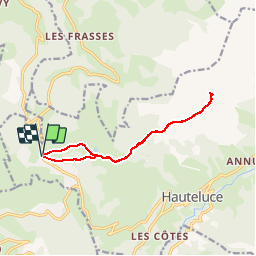

18.1 km | 28 km-effort


User


FREE GPS app for hiking
 SityTrail
IGN / Geographical institutes
SityTrail World
The world is yours!
Trail Snowshoes of 11.8 km to be discovered at Auvergne-Rhône-Alpes, Savoy, Hauteluce. This trail is proposed by GGsavoie.
Départ des Saisies en direction du col de la Légette puis montée en direction du Mont Clocher. Tour interrompu par le brouillard, retour au point e départ

Walking

Cycle

Walking

Mountain bike

Walking
Walking

Walking

Walking
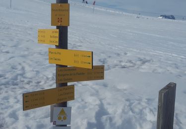
Snowshoes