![](/images/other/stat-length.png)
![Trail Walking Vesseaux - Vesseaux - tour de Louyre - Photo](https://media.geolcdn.com/t/1900/400/ext.pjpeg?maxdim=2&url=https%3A%2F%2Fservices.sitytrail.com%2FGeolivesWS%2FDownloadMedia.ashx%3FTrailID%3D246913%26Media%3Dfix__20140203145313.jpg)
Vesseaux - tour de Louyre
pb07
User
![Length](/images/other/stat-length.png)
![Max alt](https://static1.geolcdn.com/siteimages/upload/files/1508320355ic_sort_altitude_max_24dp.png)
![Uphill gradient](https://static1.geolcdn.com/siteimages/upload/files/1508320355ic_sort_den_pos_24dp.png)
![Km-Effort](/images/other/stat-length.png)
![Min alt](https://static1.geolcdn.com/siteimages/upload/files/1508320355ic_sort_altitude_min_24dp.png)
![Downhill gradient](https://static1.geolcdn.com/siteimages/upload/files/1508320355ic_sort_den_neg_24dp.png)
![Boucle](https://static1.geolcdn.com/siteimages/upload/files/16400158638029165_repeat_loop_refresh_sync_direction_icon.png)
![Walking](https://static1.geolcdn.com/sitytour/trail-icons/101.png)
5h15
Difficulty : Medium
![Scan this QR Code to open this trail in the SityTrail application](https://capi.geolives.com/qq0zvz2zws4bq2lad0pu/sitytour/trails/246913/qr.png?size=200)
FREE GPS app for hiking
About
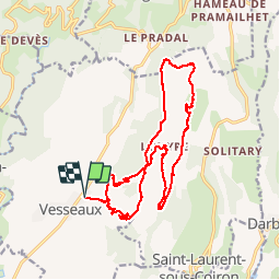
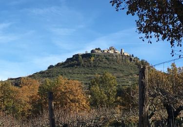
Trail Walking of 19.2 km to be discovered at Auvergne-Rhône-Alpes, Ardèche, Vesseaux. This trail is proposed by pb07.
Description
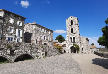
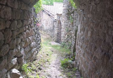
Louyre, village abandonné il y a 50 ans, maintenant restauré et occupé.
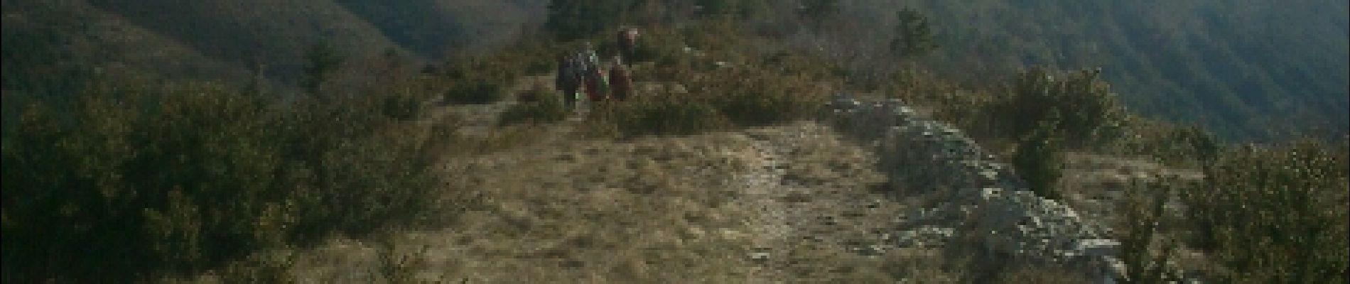
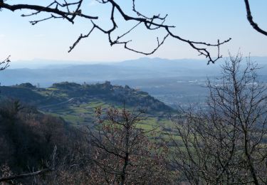
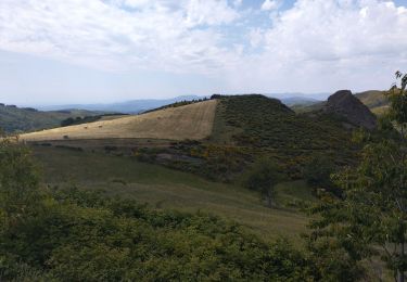
Circuit par les crêtes avec belles vues, surtout à la descente.
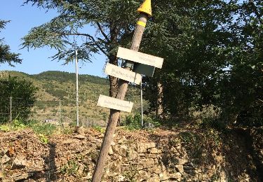
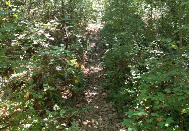
Le chemin sur la crête de Chante Epine n'est pas marqué sur la carte mais il est bon presque tout le long sauf deux passages :
- près de la Combe Rajeau il n'y a pas de chemin, suivre la clôture sur environ 100 m.
- vers le Sauvage il faut monter dans le bois par des pistes mal tracées pour rejoindre le pré sous Champ Blanc.
Deux passages hors chemin
Positioning
Comments
Trails nearby
![Trail Walking Saint-Laurent-sous-Coiron - SityTrail - 2460537 - st-laurent - Photo](https://media.geolcdn.com/t/375/260/248a6b55-9b40-4f3e-9231-07b72c1a2693.jpg&format=jpg&maxdim=2)
![Walking Walking](https://static1.geolcdn.com/sitytour/trail-icons/101.png)
Walking
![](/images/other/stat-length.png)
![](https://static1.geolcdn.com/siteimages/upload/files/16400158638029165_repeat_loop_refresh_sync_direction_icon.png)
![Trail Walking Vesseaux - Vesseaux - Photo](https://media.geolcdn.com/t/375/260/ext.jpg?maxdim=2&url=https%3A%2F%2Fservices.sitytrail.com%2FGeolivesWS%2FDownloadMedia.ashx%3FTrailID%3D442802%26Media%3D20150708175142.jpg)
![Walking Walking](https://static1.geolcdn.com/sitytour/trail-icons/101.png)
Walking
![](/images/other/stat-length.png)
![](https://static1.geolcdn.com/siteimages/upload/files/16400158638029165_repeat_loop_refresh_sync_direction_icon.png)
![Walking Walking](https://static1.geolcdn.com/sitytour/trail-icons/101.png)
Walking
![](/images/other/stat-length.png)
![](https://static1.geolcdn.com/siteimages/upload/files/16400158638029165_repeat_loop_refresh_sync_direction_icon.png)
![Walking Walking](https://static1.geolcdn.com/sitytour/trail-icons/101.png)
Walking
![](/images/other/stat-length.png)
![](https://static1.geolcdn.com/siteimages/upload/files/16400158638029165_repeat_loop_refresh_sync_direction_icon.png)
![Trail Walking Mirabel - 2025-01-25_15h34m21_SityTrail - 3633141 - mirabel-11km-den367m- - Photo](https://media.geolcdn.com/t/375/260/e7aad9c3-6c53-4829-ad7f-8298786bbba5.jpg&format=jpg&maxdim=2)
![Walking Walking](https://static1.geolcdn.com/sitytour/trail-icons/101.png)
Walking
![](/images/other/stat-length.png)
![](https://static1.geolcdn.com/siteimages/upload/files/16400158638029165_repeat_loop_refresh_sync_direction_icon.png)
![Trail Walking Saint-Laurent-sous-Coiron - St-Laurent sous-Coiron](https://media.geolcdn.com/t/375/260/af45344e-33a5-4544-8743-643b0c5ac849.jpg&format=jpg&maxdim=2)
![Walking Walking](https://static1.geolcdn.com/sitytour/trail-icons/101.png)
Walking
![](/images/other/stat-length.png)
![](https://static1.geolcdn.com/siteimages/upload/files/16400158638029165_repeat_loop_refresh_sync_direction_icon.png)
![Trail Walking Lussas - 07 loutre gorges 09.07.2033 - Photo](https://media.geolcdn.com/t/375/260/b383ddff-373b-408a-8d2a-0f2891f1c4a5.jpg&format=jpg&maxdim=2)
![Walking Walking](https://static1.geolcdn.com/sitytour/trail-icons/101.png)
Walking
![](/images/other/stat-length.png)
![](https://static1.geolcdn.com/siteimages/upload/files/16400158638029165_repeat_loop_refresh_sync_direction_icon.png)
![Trail Running Saint-Michel-de-Boulogne - saint Michel de Boulogne - Photo](https://media.geolcdn.com/t/375/260/62a1acde-2372-46d5-896a-ffdc73b65bdd.jpg&format=jpg&maxdim=2)
![Running Running](https://static1.geolcdn.com/sitytour/trail-icons/103.png)
Running
![](/images/other/stat-length.png)
![](https://static1.geolcdn.com/siteimages/upload/files/16400158638029165_repeat_loop_refresh_sync_direction_icon.png)
![Trail Road bike Saint-Michel-de-Boulogne - Saint Joseph des bancs - Photo](https://media.geolcdn.com/t/375/260/350d6854-c630-4550-9cef-3634e2177ee4.jpg&format=jpg&maxdim=2)
![Road bike Road bike](https://static1.geolcdn.com/sitytour/trail-icons/201.png)
Road bike
![](/images/other/stat-length.png)
![](https://static1.geolcdn.com/siteimages/upload/files/16400158638029165_repeat_loop_refresh_sync_direction_icon.png)