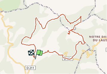
![](/images/other/stat-length.png)
![Trail On foot Jarjayes - Autour de Puy Maurel - Photo](https://media.geolcdn.com/t/1900/400/ext.pjpeg?maxdim=2&url=https%3A%2F%2Fstatic1.geolcdn.com%2Fsiteimages%2Fupload%2Ffiles%2F1545311037marcheuse_200dpi.jpg)
Autour de Puy Maurel
rigol05
User
![Length](/images/other/stat-length.png)
![Max alt](https://static1.geolcdn.com/siteimages/upload/files/1508320355ic_sort_altitude_max_24dp.png)
![Uphill gradient](https://static1.geolcdn.com/siteimages/upload/files/1508320355ic_sort_den_pos_24dp.png)
![Km-Effort](/images/other/stat-length.png)
![Min alt](https://static1.geolcdn.com/siteimages/upload/files/1508320355ic_sort_altitude_min_24dp.png)
![Downhill gradient](https://static1.geolcdn.com/siteimages/upload/files/1508320355ic_sort_den_neg_24dp.png)
![Boucle](https://static1.geolcdn.com/siteimages/upload/files/16400158638029165_repeat_loop_refresh_sync_direction_icon.png)
![On foot](https://static1.geolcdn.com/sitytour/trail-icons/100.png)
--
Difficulty : Medium
![Scan this QR Code to open this trail in the SityTrail application](https://capi.geolives.com/qq0zvz2zws4bq2lad0pu/sitytour/trails/2468049/qr.png?size=200)
FREE GPS app for hiking
About
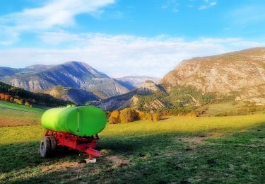
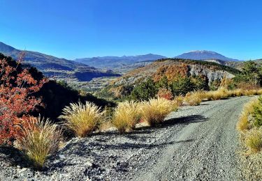
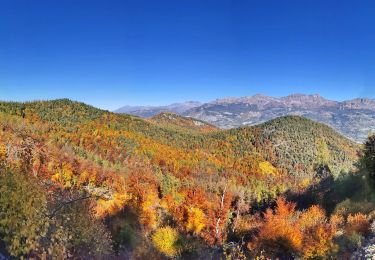
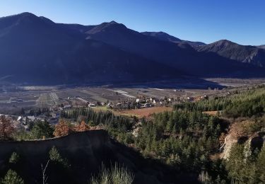
Trail On foot of 12.5 km to be discovered at Provence-Alpes-Côte d'Azur, Hautes-Alpes, Jarjayes. This trail is proposed by rigol05.
Description
Randonnée du 05/08/2020 - Départ Jarjayes parking (petit) cimetière de St.Pierre
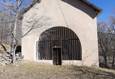
Suivre le balisage jaune du départ du sentier ,puis la route et la piste jusqu'à la Sarrière. Quitter le balisage et emprunter N NE le sentier montant à la crête de Blache Coutière. Le suivre jusqu'à la côte 1112m. Descendre SE, rejoindre une exploitation agricole puis la route goudronnée. Attention ce tronçon traverse une propriété privée. Monter au Puy Maurel, suivre le balisage jaune, Col du Tourrond et route goudronnée jusqu'au stationnement
Positioning
Comments
Trails nearby
![Trail Walking Jarjayes - VALSAIRES CHAPELLE NOTRE DAME DU LAIS - Photo](https://media.geolcdn.com/t/375/260/860e51d5-4111-42e4-9649-8920f6056baf.jpg&format=jpg&maxdim=2)
![Walking Walking](https://static1.geolcdn.com/sitytour/trail-icons/101.png)
Walking
![](/images/other/stat-length.png)
![](https://static1.geolcdn.com/siteimages/upload/files/16400158638029165_repeat_loop_refresh_sync_direction_icon.png)
![Trail Walking Remollon - Remollon-un-tresor-cache-de-la-vallee-de-la-durance - Photo](https://media.geolcdn.com/t/375/260/073a624b-9a54-4ca5-a179-7003c0d6383d.jpg&format=jpg&maxdim=2)
![Walking Walking](https://static1.geolcdn.com/sitytour/trail-icons/101.png)
Walking
![](/images/other/stat-length.png)
![](https://static1.geolcdn.com/siteimages/upload/files/16400158638029165_repeat_loop_refresh_sync_direction_icon.png)
![Trail Walking Remollon - Des Demoiselles Coiffées aux balcons de Remollon - Photo](https://media.geolcdn.com/t/375/260/2094a0e8-535c-4f81-bf59-f1f898a15092.jpg&format=jpg&maxdim=2)
![Walking Walking](https://static1.geolcdn.com/sitytour/trail-icons/101.png)
Walking
![](/images/other/stat-length.png)
![](https://static1.geolcdn.com/siteimages/upload/files/16400158638029165_repeat_loop_refresh_sync_direction_icon.png)
![Trail Electric bike Remollon - Le Puy et la Chapelle Saint-Sixte Via Remollon (Vélo) - Photo](https://media.geolcdn.com/t/375/260/9848f8cc-dc59-4eb7-862a-9f5bf908e081.jpg&format=jpg&maxdim=2)
![Electric bike Electric bike](https://static1.geolcdn.com/sitytour/trail-icons/205.png)
Electric bike
![](/images/other/stat-length.png)
![](https://static1.geolcdn.com/siteimages/upload/files/16400158638029165_repeat_loop_refresh_sync_direction_icon.png)
![Trail Electric bike Remollon - VTT-ae - Mont Colombis via Valserres - Croix des prés - Photo](https://media.geolcdn.com/t/375/260/cae6d5f9-a8e8-4077-ab5a-04e6867e007f.jpg&format=jpg&maxdim=2)
![Electric bike Electric bike](https://static1.geolcdn.com/sitytour/trail-icons/205.png)
Electric bike
![](/images/other/stat-length.png)
![](https://static1.geolcdn.com/siteimages/upload/files/16400158638029165_repeat_loop_refresh_sync_direction_icon.png)
![Trail Mountain bike Remollon - VTT-ae - La Croix des Prés avec V&H - Photo](https://media.geolcdn.com/t/375/260/9b08ae67-d798-4978-a9ac-e62d1c938cfe.jpg&format=jpg&maxdim=2)
![Mountain bike Mountain bike](https://static1.geolcdn.com/sitytour/trail-icons/202.png)
Mountain bike
![](/images/other/stat-length.png)
![](https://static1.geolcdn.com/siteimages/upload/files/16400158638029165_repeat_loop_refresh_sync_direction_icon.png)
![Trail Walking Remollon - REMOLON Les demoiselles coiffées, Chapelle S Philippine .Tueuse o n l - Photo](https://media.geolcdn.com/t/375/260/0cbb9a09-f191-4c7c-af26-e28f897b633e.jpg&format=jpg&maxdim=2)
![Walking Walking](https://static1.geolcdn.com/sitytour/trail-icons/101.png)
Walking
![](/images/other/stat-length.png)
![](https://static1.geolcdn.com/siteimages/upload/files/16400158638029165_repeat_loop_refresh_sync_direction_icon.png)
![Trail Walking Remollon - Le Balcon de Remollon - Photo](https://media.geolcdn.com/t/375/260/96fc6b22-1a87-42f0-8bd0-326bf7c90e88.jpg&format=jpg&maxdim=2)
![Walking Walking](https://static1.geolcdn.com/sitytour/trail-icons/101.png)
Walking
![](/images/other/stat-length.png)
![](https://static1.geolcdn.com/siteimages/upload/files/16400158638029165_repeat_loop_refresh_sync_direction_icon.png)
![Trail Walking Saint-Étienne-le-Laus - N.D. du Laus - Col de l'Ange - Photo](https://media.geolcdn.com/t/375/260/3c060a35-f9ba-4b2a-aa26-bf027944e5fb.jpg&format=jpg&maxdim=2)
![Walking Walking](https://static1.geolcdn.com/sitytour/trail-icons/101.png)
Walking
![](/images/other/stat-length.png)
![](https://static1.geolcdn.com/siteimages/upload/files/16400158638029165_repeat_loop_refresh_sync_direction_icon.png)