Trail Walking La Motte-Saint-Martin - Le Conest depuis le Majeuil - Photo
© OpenStreetMap contributors
Length
Length
12.5 km
Max alt
Max alt
1707 m
Uphill gradient
Uphill gradient
849 m
Km-Effort
Km-Effort  
24 km
Min alt
Min alt
970 m
Downhill gradient
Downhill gradient
853 m
Boucle
Boucle
Yes
Creation date :
2020-06-26 06:17:56.456
Updated on :
2020-07-28 12:44:01.449

(0 Reviews)

Walking
Walking
5h15
Difficulty : Difficult

Scan this QR Code to open this trail in the SityTrail application

FREE GPS app for hiking

Logo SityTrail SityTrail

IGN / Geographical institutes

Download SityTrail from the App Store Download SityTrail from Google Play

Logo SityTrail SityTrail World

The world is yours!

Download SityTrail from the App Store Download SityTrail from Google Play Download SityTrail on Huawei AppGallery

About

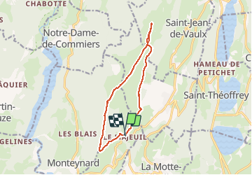
Trail Walking of 12.5 km to be discovered at Auvergne-Rhône-Alpes, Isère, La Motte-Saint-Martin. This trail is proposed by GuyVachet.

Description

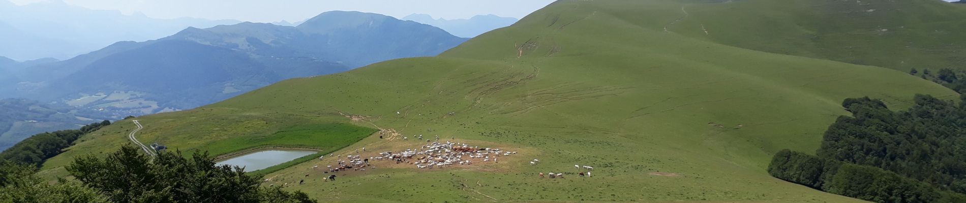
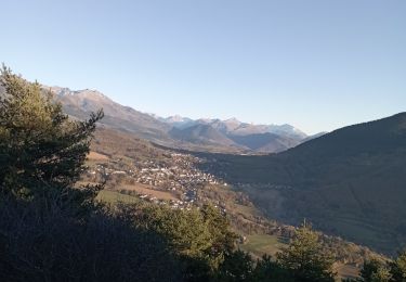
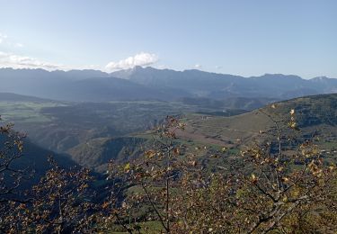
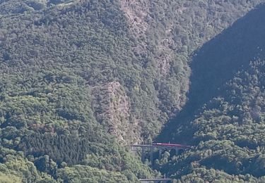
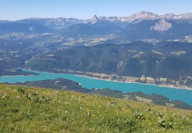
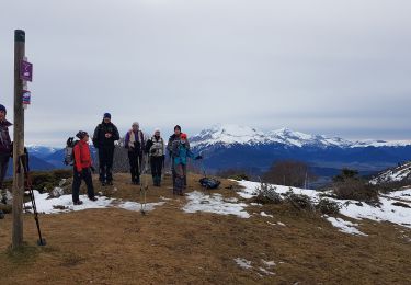
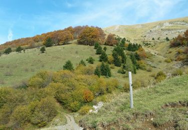
Boucle sur la montagne du Conest depuis Le Majeuil (hameau de Notre Dame de Vaulx) en passant par La Peyrouse (photo 2 depuis Beauregard) et Beauregard. La montée commence rapidement en forêt sur la croupe et il ne reste que 200m à gravir à découvert pour arriver à La Peyrouse qui offre une vue à 360° notamment sur le Vercors et le Mont-Aiguille (photo 1).  Redescente au Petit Lac pour remonter à Beauregard (environ 100 m). Le retour se fait par le chalet de l'As par un sentier ombragé très agréable. A la cote 1159, ne pas s'engager sur le retour direct sur Le Majeuil car le sentier disparait rapidement. Il est préférable de revenir sur Notre Dame de Vaulx quitte à revenir au Majeuil (sentier de 2 km).

Elevation profile

Photos

Positioning

Country:
France
Region :
Auvergne-Rhône-Alpes
Department/Province :
Isère
Municipality :
La Motte-Saint-Martin
Location:
Unknown
Start:(UTM)
715016 ; 4983819 (31T) N.

Trails nearby

Trail Mountain bike Pierre-Châtel - Tour des lacs Pierre-Chatel - Photo
Mountain bike
Vicenzozo

Mountain bike

Very easy
(1)
Pierre-Châtel, Auvergne-Rhône-Alpes, Isère, France
32 km | 46 km-effort
4h 28min
Yes
Trail Walking La Motte-Saint-Martin - connex - Photo
Walking
paulin bruno

Walking

Medium
La Motte-Saint-Martin, Auvergne-Rhône-Alpes, Isère, France
15.6 km | 28 km-effort
6h 26min
Yes
Trail Walking La Motte-Saint-Martin - Sinepi  - Photo
Walking
marc vitoria

Walking

(1)
La Motte-Saint-Martin, Auvergne-Rhône-Alpes, Isère, France
24 km | 40 km-effort
6h 0min
No
Trail Mountain bike La Motte-d'Aveillans - Le Sénépy depuis Les Signaraux - Photo
Mountain bike
patjobou

Mountain bike

Medium
La Motte-d'Aveillans, Auvergne-Rhône-Alpes, Isère, France
20 km | 32 km-effort
3h 39min
Yes
Trail Walking La Motte-d'Aveillans - Col du Sénépy et Pierre Plantée depuis les Signaraux - Photo
Walking
GuyVachet

Walking

Medium
La Motte-d'Aveillans, Auvergne-Rhône-Alpes, Isère, France
10.2 km | 15.8 km-effort
5h 39min
Yes
Trail Walking La Motte-d'Aveillans - Les Signaraux - La Pierre Plantée  - Le Serre de L'Horizon - Le Col du Sénépy - Photo
Walking
patjobou

Walking

Easy
La Motte-d'Aveillans, Auvergne-Rhône-Alpes, Isère, France
8.7 km | 14.3 km-effort
2h 48min
Yes
Trail Walking Saint-Théoffrey - chollonge villard saint Christophe  - Photo
Walking
bailleulherve

Walking

Very easy
Saint-Théoffrey, Auvergne-Rhône-Alpes, Isère, France
13 km | 18.4 km-effort
4h 10min
Yes
Trail Walking Pierre-Châtel - PF-Pierre-Châtel - La Pierre Percée - Photo
Walking
MicDul

Walking

Difficult
Pierre-Châtel, Auvergne-Rhône-Alpes, Isère, France
8.4 km | 12.9 km-effort
3h 46min
Yes
Trail Walking Saint-Jean-de-Vaulx - PIERRE PERCÉE - Photo
Walking
floup6138

Walking

Medium
Saint-Jean-de-Vaulx, Auvergne-Rhône-Alpes, Isère, France
9.5 km | 14.5 km-effort
3h 8min
No


Close
My subscriptions