![](/images/other/stat-length.png)
![Trail Walking Ivrey - Ivrey - Mr Poupet 7 juillet 20250 CAF - Photo](https://media.geolcdn.com/t/1900/400/5f9423aa-ea9d-41da-ade4-234e9fd3c0f0.jpg&format=pjpeg&maxdim=2)
Ivrey - Mr Poupet 7 juillet 20250 CAF
TRIMAILLE
User
![Length](/images/other/stat-length.png)
Length
17.8 km
![Max alt](https://static1.geolcdn.com/siteimages/upload/files/1508320355ic_sort_altitude_max_24dp.png)
Max alt
847 m
![Uphill gradient](https://static1.geolcdn.com/siteimages/upload/files/1508320355ic_sort_den_pos_24dp.png)
Uphill gradient
829 m
![Km-Effort](/images/other/stat-length.png)
Km-Effort
29 km
![Min alt](https://static1.geolcdn.com/siteimages/upload/files/1508320355ic_sort_altitude_min_24dp.png)
Min alt
420 m
![Downhill gradient](https://static1.geolcdn.com/siteimages/upload/files/1508320355ic_sort_den_neg_24dp.png)
Downhill gradient
826 m
![Boucle](https://static1.geolcdn.com/siteimages/upload/files/16400158638029165_repeat_loop_refresh_sync_direction_icon.png)
Boucle
Yes
Creation date :
2020-07-07 17:00:09.352
Updated on :
2020-07-08 08:26:44.644
![Walking](https://static1.geolcdn.com/sitytour/trail-icons/101.png)
5h55
Difficulty : Difficult
![Scan this QR Code to open this trail in the SityTrail application](https://capi.geolives.com/qq0zvz2zws4bq2lad0pu/sitytour/trails/2466070/qr.png?size=200)
FREE GPS app for hiking
About
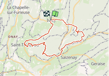
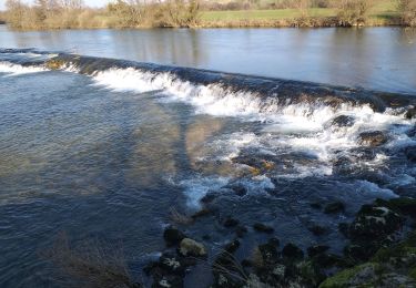
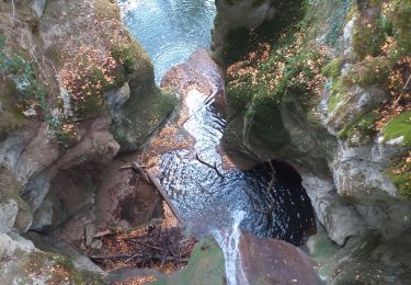
Trail Walking of 17.8 km to be discovered at Bourgogne-Franche-Comté, Jura, Ivrey. This trail is proposed by TRIMAILLE.
Description
Départ du parking du cimetière Ivrey.
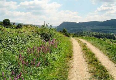
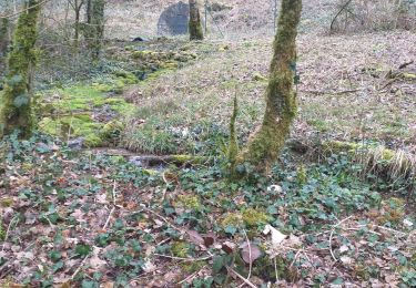
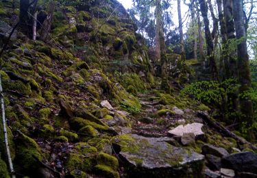
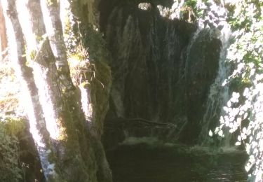
Passage au gourde Conche.
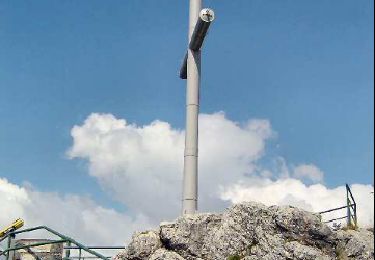
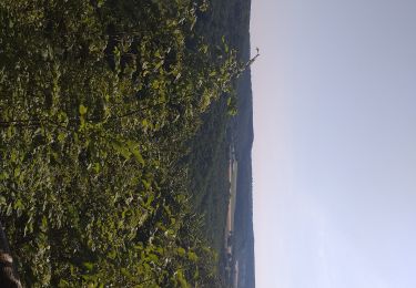
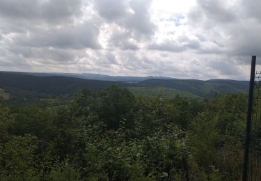
Mont Poupet, la croix, le Signal, les Hêtres tors et l'aire de Delta.
Passage à St Thiébaud, avant de rejoindre Ivrey.
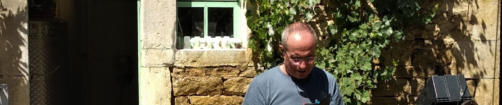
Visite et dégustation à la brasserie artisanale d'Ivrey.
Positioning
Country:
France
Region :
Bourgogne-Franche-Comté
Department/Province :
Jura
Municipality :
Ivrey
Location:
Unknown
Start:(Dec)
Start:(UTM)
720106 ; 5208158 (31T) N.
Comments
Trails nearby
![Trail Walking Salins-les-Bains - Le Mont Poupet (850 m) - Photo](https://media.geolcdn.com/t/375/260/ext.jpg?maxdim=2&url=https%3A%2F%2Fservices.sitytrail.com%2FGeolivesWS%2FDownloadMedia.ashx%3FTrailID%3D108774%26Media%3D1916_2.jpg)
![Walking Walking](https://static1.geolcdn.com/sitytour/trail-icons/101.png)
Le Mont Poupet (850 m)
Walking
Difficult
(3)
Salins-les-Bains,
Bourgogne-Franche-Comté,
Jura,
France
![](/images/other/stat-length.png)
16.8 km | 25 km-effort
5h 0min
![](https://static1.geolcdn.com/siteimages/upload/files/16400158638029165_repeat_loop_refresh_sync_direction_icon.png)
Yes
![Trail Walking Saizenay - Saizenay_Mt Poupet - Photo](https://media.geolcdn.com/t/375/260/ext.jpg?maxdim=2&url=https%3A%2F%2Fservices.sitytrail.com%2FGeolivesWS%2FDownloadMedia.ashx%3FTrailID%3D243535%26Media%3D19f600c2-652e-47aa-bdd5-be6e172b09ab.jpg)
![Walking Walking](https://static1.geolcdn.com/sitytour/trail-icons/101.png)
Saizenay_Mt Poupet
Walking
Medium
(1)
Saizenay,
Bourgogne-Franche-Comté,
Jura,
France
![](/images/other/stat-length.png)
13.9 km | 21 km-effort
4h 27min
![](https://static1.geolcdn.com/siteimages/upload/files/16400158638029165_repeat_loop_refresh_sync_direction_icon.png)
Yes
![Trail Walking Myon - myon les lunettes à Stéphane - Photo](https://media.geolcdn.com/t/375/260/25acafcd-fd37-4522-a9e0-f3895665c873.jpg&format=jpg&maxdim=2)
![Walking Walking](https://static1.geolcdn.com/sitytour/trail-icons/101.png)
myon les lunettes à Stéphane
Walking
Medium
Myon,
Bourgogne-Franche-Comté,
Doubs,
France
![](/images/other/stat-length.png)
17.4 km | 23 km-effort
5h 2min
![](https://static1.geolcdn.com/siteimages/upload/files/16400158638029165_repeat_loop_refresh_sync_direction_icon.png)
Yes
![Trail Walking Rennes-sur-Loue - Rennes sur Loue - Photo](https://media.geolcdn.com/t/375/260/eb24f96c-dd7d-40a0-a849-4c5b681e042a.jpg&format=jpg&maxdim=2)
![Walking Walking](https://static1.geolcdn.com/sitytour/trail-icons/101.png)
Rennes sur Loue
Walking
Medium
Rennes-sur-Loue,
Bourgogne-Franche-Comté,
Doubs,
France
![](/images/other/stat-length.png)
21 km | 27 km-effort
4h 7min
![](https://static1.geolcdn.com/siteimages/upload/files/16400158638029165_repeat_loop_refresh_sync_direction_icon.png)
Yes
![Trail Walking Myon - Myon le gour de conche - Photo](https://media.geolcdn.com/t/375/260/828466b3-4a5a-411c-b191-55f6e34400fe.jpg&format=jpg&maxdim=2)
![Walking Walking](https://static1.geolcdn.com/sitytour/trail-icons/101.png)
Myon le gour de conche
Walking
Easy
Myon,
Bourgogne-Franche-Comté,
Doubs,
France
![](/images/other/stat-length.png)
14.4 km | 20 km-effort
4h 57min
![](https://static1.geolcdn.com/siteimages/upload/files/16400158638029165_repeat_loop_refresh_sync_direction_icon.png)
Yes
![Trail Walking Myon - Myon 3 collines - Photo](https://media.geolcdn.com/t/375/260/d4f8bb66-121f-460c-987f-bea11d25d8d0.jpg&format=jpg&maxdim=2)
![Walking Walking](https://static1.geolcdn.com/sitytour/trail-icons/101.png)
Myon 3 collines
Walking
Easy
Myon,
Bourgogne-Franche-Comté,
Doubs,
France
![](/images/other/stat-length.png)
16.5 km | 23 km-effort
5h 42min
![](https://static1.geolcdn.com/siteimages/upload/files/16400158638029165_repeat_loop_refresh_sync_direction_icon.png)
Yes
![Trail Walking Myon - Myon - Photo](https://media.geolcdn.com/t/375/260/e011c131-f78b-4966-a193-682c39bb3a11.jpg&format=jpg&maxdim=2)
![Walking Walking](https://static1.geolcdn.com/sitytour/trail-icons/101.png)
Myon
Walking
Easy
Myon,
Bourgogne-Franche-Comté,
Doubs,
France
![](/images/other/stat-length.png)
14.7 km | 19.5 km-effort
8h 32min
![](https://static1.geolcdn.com/siteimages/upload/files/16400158638029165_repeat_loop_refresh_sync_direction_icon.png)
Yes
![Trail Walking Ivrey - Nans sous ste Anne - Photo](https://media.geolcdn.com/t/375/260/2c1907f9-25f3-456f-93de-39df357245b8.jpg&format=jpg&maxdim=2)
![Walking Walking](https://static1.geolcdn.com/sitytour/trail-icons/101.png)
Nans sous ste Anne
Walking
Difficult
Ivrey,
Bourgogne-Franche-Comté,
Jura,
France
![](/images/other/stat-length.png)
27 km | 39 km-effort
5h 1min
![](https://static1.geolcdn.com/siteimages/upload/files/16400158638029165_repeat_loop_refresh_sync_direction_icon.png)
Yes
![Trail Walking Marnoz - Marnoz Fort St André Fort Belin Salin 8 sept 2020 CAF - Photo](https://media.geolcdn.com/t/375/260/cdb91fff-1d43-4f4c-9a00-4f9a0c26d660.jpg&format=jpg&maxdim=2)
![Walking Walking](https://static1.geolcdn.com/sitytour/trail-icons/101.png)
Marnoz Fort St André Fort Belin Salin 8 sept 2020 CAF
Walking
Difficult
Marnoz,
Bourgogne-Franche-Comté,
Jura,
France
![](/images/other/stat-length.png)
21 km | 34 km-effort
5h 22min
![](https://static1.geolcdn.com/siteimages/upload/files/16400158638029165_repeat_loop_refresh_sync_direction_icon.png)
Yes