![](/images/other/stat-length.png)
![Trail Walking Aiguèze - 30 - AIGUEZE - 7.7 Km - 03h00 – D 200 m - Photo](https://media.geolcdn.com/t/1900/400/ext.pjpeg?maxdim=2&url=https%3A%2F%2Fstatic1.geolcdn.com%2Fsiteimages%2Fupload%2Ffiles%2F1553511878bg_sport_marche.png)
30 - AIGUEZE - 7.7 Km - 03h00 – D 200 m
dansmabulle
User
![Length](/images/other/stat-length.png)
![Max alt](https://static1.geolcdn.com/siteimages/upload/files/1508320355ic_sort_altitude_max_24dp.png)
![Uphill gradient](https://static1.geolcdn.com/siteimages/upload/files/1508320355ic_sort_den_pos_24dp.png)
![Km-Effort](/images/other/stat-length.png)
![Min alt](https://static1.geolcdn.com/siteimages/upload/files/1508320355ic_sort_altitude_min_24dp.png)
![Downhill gradient](https://static1.geolcdn.com/siteimages/upload/files/1508320355ic_sort_den_neg_24dp.png)
![Boucle](https://static1.geolcdn.com/siteimages/upload/files/16400158638029165_repeat_loop_refresh_sync_direction_icon.png)
![Walking](https://static1.geolcdn.com/sitytour/trail-icons/101.png)
2h23
Difficulty : Easy
![Scan this QR Code to open this trail in the SityTrail application](https://capi.geolives.com/qq0zvz2zws4bq2lad0pu/sitytour/trails/245507/qr.png?size=200)
FREE GPS app for hiking
About
Trail Walking of 7.7 km to be discovered at Occitania, Gard, Aiguèze. This trail is proposed by dansmabulle.
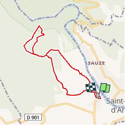
Description
30 - AIGUEZE
7.7 Km - 03h00 – D 280 m
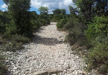
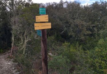
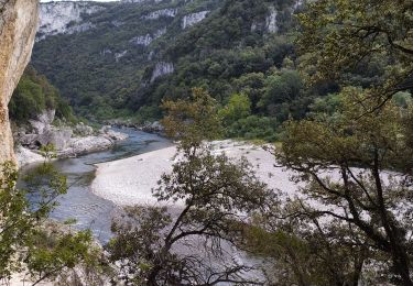
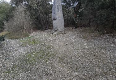
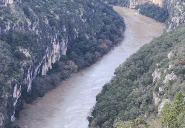
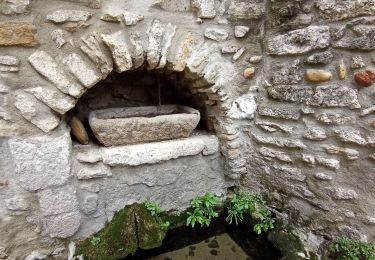
Départ randonnée : Parking à l'entrée du village de Aiguèze (gard) Promenade au village d'Aiguèze, ravissant village de pierre niché au dessus de l'Ardèche, cette balade nous amènera au dessus des gorges de l'Ardèche et à travers les vignes.Bonne randonnée.Vous trouverez tout le détail de cette randonnée sur le site
Positioning
Comments
Trails nearby
![Trail Walking Saint-Martin-d'Ardèche - GR4 Aigueze - Photo](https://media.geolcdn.com/t/375/260/ext.jpg?maxdim=2&url=https%3A%2F%2Fservices.sitytrail.com%2FGeolivesWS%2FDownloadMedia.ashx%3FTrailID%3D325544%26Media%3Dfix__20140709163308.jpg)
![Walking Walking](https://static1.geolcdn.com/sitytour/trail-icons/101.png)
Walking
![](/images/other/stat-length.png)
![](https://static1.geolcdn.com/siteimages/upload/files/16400158638029165_repeat_loop_refresh_sync_direction_icon.png)
![Trail Walking Saint-Martin-d'Ardèche - Aigueze rocher de Castelviel - Photo](https://media.geolcdn.com/t/375/260/ext.jpg?maxdim=2&url=https%3A%2F%2Fmedia.geolcdn.com%2Ff%2F416d7ebd-2359-4463-8249-a90d2272e98d.jpg)
![Walking Walking](https://static1.geolcdn.com/sitytour/trail-icons/101.png)
Walking
![](/images/other/stat-length.png)
![](https://static1.geolcdn.com/siteimages/upload/files/16400158638029165_repeat_loop_refresh_sync_direction_icon.png)
![Trail Walking Aiguèze - 30 aigueze ribeirol - Photo](https://media.geolcdn.com/t/375/260/ext.jpg?maxdim=2&url=https%3A%2F%2Fmedia.geolcdn.com%2Ff%2Fa5de248d-2217-49e5-9c57-d3e37cd5f6c4.jpg)
![Walking Walking](https://static1.geolcdn.com/sitytour/trail-icons/101.png)
Walking
![](/images/other/stat-length.png)
![](https://static1.geolcdn.com/siteimages/upload/files/16400158638029165_repeat_loop_refresh_sync_direction_icon.png)
![Trail Walking Aiguèze - Aigueze - Photo](https://media.geolcdn.com/t/375/260/ext.jpg?maxdim=2&url=https%3A%2F%2Fmedia.geolcdn.com%2Ff%2Fe7b8de9a-d915-48ca-baac-0319f593dc54.jpg)
![Walking Walking](https://static1.geolcdn.com/sitytour/trail-icons/101.png)
![Trail Walking Saint-Martin-d'Ardèche - Saint Martin d’Ardéche - Photo](https://media.geolcdn.com/t/375/260/ext.jpg?maxdim=2&url=https%3A%2F%2Fmedia.geolcdn.com%2Ff%2Fb543bd48-15f1-4b47-a933-7d4f79f7128e.jpg)
![Walking Walking](https://static1.geolcdn.com/sitytour/trail-icons/101.png)
Walking
![](/images/other/stat-length.png)
![](https://static1.geolcdn.com/siteimages/upload/files/16400158638029165_repeat_loop_refresh_sync_direction_icon.png)
![Trail Walking Saint-Marcel-d'Ardèche - rando octobre rose - Photo](https://media.geolcdn.com/t/375/260/ext.jpg?maxdim=2&url=https%3A%2F%2Fmedia.geolcdn.com%2Ff%2F501d2ffe-4bd2-45c8-898e-66f9a74c15e7.jpg)
![Walking Walking](https://static1.geolcdn.com/sitytour/trail-icons/101.png)
Walking
![](/images/other/stat-length.png)
![](https://static1.geolcdn.com/siteimages/upload/files/16400158638029165_repeat_loop_refresh_sync_direction_icon.png)
![Trail Walking Saint-Martin-d'Ardèche - Sauze bivouac de Gournier - Photo](https://media.geolcdn.com/t/375/260/ext.jpg?maxdim=2&url=https%3A%2F%2Fmedia.geolcdn.com%2Ff%2Fbaac8ebe-8937-4db4-b6c4-7e0bd115b9f1.jpg)
![Walking Walking](https://static1.geolcdn.com/sitytour/trail-icons/101.png)
Walking
![](/images/other/stat-length.png)
![](https://static1.geolcdn.com/siteimages/upload/files/16400158638029165_repeat_loop_refresh_sync_direction_icon.png)
![Trail On foot Aiguèze - FR-PR 24 - Photo](https://media.geolcdn.com/t/375/260/ext.jpg?maxdim=2&url=https%3A%2F%2Fmedia.geolcdn.com%2Ff%2Fadb231a8-9d03-4c90-9261-a3c9f3c8fd1c.jpeg)
![On foot On foot](https://static1.geolcdn.com/sitytour/trail-icons/100.png)
![Trail Walking Aiguèze - aigueze - Photo](https://media.geolcdn.com/t/375/260/ext.jpg?maxdim=2&url=https%3A%2F%2Fmedia.geolcdn.com%2Ff%2F9a8e66bd-28b9-4786-9840-dbf6e6fca8cf.jpg)
![Walking Walking](https://static1.geolcdn.com/sitytour/trail-icons/101.png)