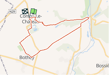
![](/images/other/stat-length.png)
#200626 - Corroy-le-Château, campagne des 7 fontaines et Bothey***(recalculated)
Randos Ouvertes
User
![Length](/images/other/stat-length.png)
![Max alt](https://static1.geolcdn.com/siteimages/upload/files/1508320355ic_sort_altitude_max_24dp.png)
![Uphill gradient](https://static1.geolcdn.com/siteimages/upload/files/1508320355ic_sort_den_pos_24dp.png)
![Km-Effort](/images/other/stat-length.png)
![Min alt](https://static1.geolcdn.com/siteimages/upload/files/1508320355ic_sort_altitude_min_24dp.png)
![Downhill gradient](https://static1.geolcdn.com/siteimages/upload/files/1508320355ic_sort_den_neg_24dp.png)
![Boucle](https://static1.geolcdn.com/siteimages/upload/files/16400158638029165_repeat_loop_refresh_sync_direction_icon.png)
![On foot](https://static1.geolcdn.com/sitytour/trail-icons/100.png)
2h00
Difficulty : Very easy
![Scan this QR Code to open this trail in the SityTrail application](https://capi.geolives.com/qq0zvz2zws4bq2lad0pu/sitytour/trails/2454684/qr.png?size=200)
FREE GPS app for hiking
About
Trail On foot of 7.8 km to be discovered at Wallonia, Namur, Gembloux. This trail is proposed by Randos Ouvertes.
Description
Cet itinéraire correspond à un détail près à celui proposé par l'utilisateur de RouteYou PASAR. La description est une version inspirée et enrichie de celle dudit circuit (en néerlandais).
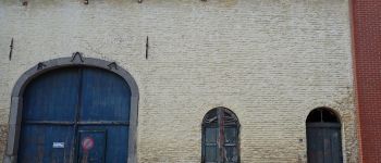
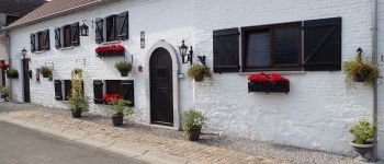
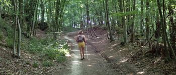
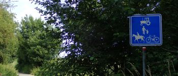
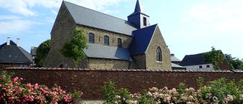
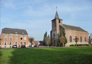
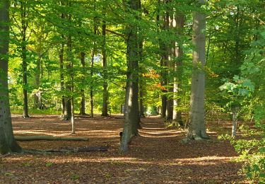
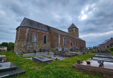
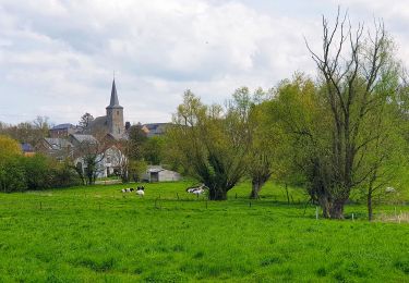
Départ de l'église Saint Lambert**. La promenade débute par quelques rues du village ponctuées par de belles maisons anciennes, dont certaines joliment restaurées (voir photos). On y découvre une jolie petite servitude passant entre les jardins. Plus loin, on aperçoit un des parcs éoliens faisant désormais partie intégrante des paysages de cette région. Passage à proximité des étangs d'une pêcherie. Beau chemin de terre montant dans le Bois de Chenémont. On passe ensuite en lisière du bois à droite et de vastes étendues agricoles à gauche. On aperçoit les bâtiments de l'imposante Ferme de Chenémont. Puis les installations de la station d'épuration de Corroy-le-Château. Passage du pont sur l'Orneau, un affluent de la Sambre connu pour le site des grottes de Spy, quelques kilomètres en aval, où ont été découverts les restes d'un homme de Néandertal.
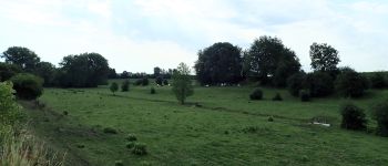
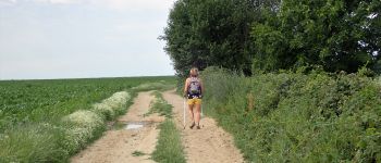
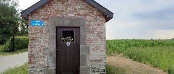
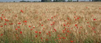
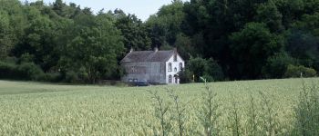
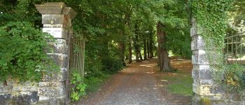
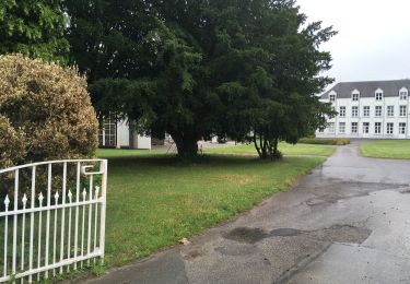
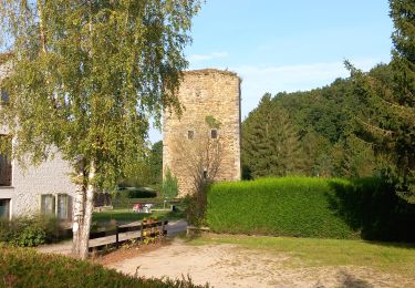
Une des plus belles parties du circuit, c'est le chemin (répertorié rue de la Tombale sur certaines cartes) traversant sur 2 km les champs de la Campagne des 7 Fontaines**. Ce chemin, qui culmine à plus de 170 m d'altitude, offre un magnifique panorama*** à 360 °. Il longe l'aérodrome du club de petite aviation "les Accros du Servo". Passage par la chapelle Sainte-Anne puis par le hameau de Bothey. On rejoint la grand route par un beau petit sentier à travers champs. Cette route longe le domaine du magnifique château médiéval de Corroy-le-Château****. Au km 7,2 se trouve la grille de l'entrée principale du château, qu'on aperçoit à peine. Si la grille est ouverte, engagez-vous dans l'allée d'accès. Le domaine est privé, mais l'accès est autorisé si la grille est ouverte. Dans le cas contraire, faites le tour du domaine par la grand route. Tournez à gauche avant le pont des douves pour sortir du domaine. En remontant sur le village à votre gauche, On peut voir l'imposante Ferme du Marais.
Points of interest
Positioning
Comments
Trails nearby
![Trail Walking Jemeppe-sur-Sambre - De Balâtre à Tongrinne par la vallée de la Ligne - Photo](https://media.geolcdn.com/t/375/260/ext.jpg?maxdim=2&url=https%3A%2F%2Fservices.sitytrail.com%2FGeolivesWS%2FDownloadMedia.ashx%3FTrailID%3D95534%26Media%3De2db5dc2-0ab1-4cda-b9fd-3c87611cc9a3.jpg)
![Walking Walking](https://static1.geolcdn.com/sitytour/trail-icons/101.png)
Walking
![](/images/other/stat-length.png)
![](https://static1.geolcdn.com/siteimages/upload/files/16400158638029165_repeat_loop_refresh_sync_direction_icon.png)
![Walking Walking](https://static1.geolcdn.com/sitytour/trail-icons/101.png)
Walking
![](/images/other/stat-length.png)
![](https://static1.geolcdn.com/siteimages/upload/files/16400158638029165_repeat_loop_refresh_sync_direction_icon.png)
![Trail Walking Chastre - Balade récréative de Cortil - Photo](https://media.geolcdn.com/t/375/260/ext.jpg?maxdim=2&url=https%3A%2F%2Fservices.sitytrail.com%2FGeolivesWS%2FDownloadMedia.ashx%3FTrailID%3D232278%26Media%3D010369e0-b48e-4ca2-9215-837380cbac27.jpg)
![Walking Walking](https://static1.geolcdn.com/sitytour/trail-icons/101.png)
Walking
![](/images/other/stat-length.png)
![](https://static1.geolcdn.com/siteimages/upload/files/16400158638029165_repeat_loop_refresh_sync_direction_icon.png)
![Trail Walking Chastre - Balade de la fontaine Saint Géry à Chastre - Photo](https://media.geolcdn.com/t/375/260/3874746a-e710-4e6b-abe9-6518786cab88.jpg&format=jpg&maxdim=2)
![Walking Walking](https://static1.geolcdn.com/sitytour/trail-icons/101.png)
Walking
![](/images/other/stat-length.png)
![](https://static1.geolcdn.com/siteimages/upload/files/16400158638029165_repeat_loop_refresh_sync_direction_icon.png)
![Trail Walking Gembloux - Balade à Bossière - Gembloux - Photo](https://media.geolcdn.com/t/375/260/60cbd9cf-8e4d-4bbf-889b-adeed6ff6542.jpeg&format=jpg&maxdim=2)
![Walking Walking](https://static1.geolcdn.com/sitytour/trail-icons/101.png)
Walking
![](/images/other/stat-length.png)
![](https://static1.geolcdn.com/siteimages/upload/files/16400158638029165_repeat_loop_refresh_sync_direction_icon.png)
![Trail Walking Gembloux - Balade de Gembloux à Corroy-le-Château - Photo](https://media.geolcdn.com/t/375/260/8bfe3e44-67e5-4d79-bff4-ef099b232ea5.jpg&format=jpg&maxdim=2)
![Walking Walking](https://static1.geolcdn.com/sitytour/trail-icons/101.png)
Walking
![](/images/other/stat-length.png)
![](https://static1.geolcdn.com/siteimages/upload/files/16400158638029165_repeat_loop_refresh_sync_direction_icon.png)
![Trail Walking Chastre - Saint Gery - Namur - par le GR126 - Photo](https://media.geolcdn.com/t/375/260/18f2aab5-a522-40c8-9ccf-e3f0f1d2197a.jpg&format=jpg&maxdim=2)
![Walking Walking](https://static1.geolcdn.com/sitytour/trail-icons/101.png)
Walking
![](/images/other/stat-length.png)
![](https://static1.geolcdn.com/siteimages/upload/files/16400158638029165_repeat_loop_refresh_sync_direction_icon.png)
![Trail Walking Gembloux - SityTrail - Chastre - Perwez GR127 - Photo](https://media.geolcdn.com/t/375/260/70607764-bcef-4ec9-9b5f-6048d2579c09.jpg&format=jpg&maxdim=2)
![Walking Walking](https://static1.geolcdn.com/sitytour/trail-icons/101.png)
Walking
![](/images/other/stat-length.png)
![](https://static1.geolcdn.com/siteimages/upload/files/16400158638029165_repeat_loop_refresh_sync_direction_icon.png)
![Trail Walking Sombreffe - Marche Adeps à Tongrinne - Sombreffe - Photo](https://media.geolcdn.com/t/375/260/58790356-bb4c-4aa2-b69b-43a492b28054.jpeg&format=jpg&maxdim=2)
![Walking Walking](https://static1.geolcdn.com/sitytour/trail-icons/101.png)
Walking
![](/images/other/stat-length.png)
![](https://static1.geolcdn.com/siteimages/upload/files/16400158638029165_repeat_loop_refresh_sync_direction_icon.png)