![](/images/other/stat-length.png)
![Trail Horseback riding Champoly - champoly-point du jour par chateau d'urfé - Photo](https://media.geolcdn.com/t/1900/400/ext.pjpeg?maxdim=2&url=https%3A%2F%2Fstatic1.geolcdn.com%2Fsiteimages%2Fupload%2Ffiles%2F1524743154cheval.jpg)
champoly-point du jour par chateau d'urfé
leoutre
User
![Length](/images/other/stat-length.png)
Length
23 km
![Max alt](https://static1.geolcdn.com/siteimages/upload/files/1508320355ic_sort_altitude_max_24dp.png)
Max alt
1001 m
![Uphill gradient](https://static1.geolcdn.com/siteimages/upload/files/1508320355ic_sort_den_pos_24dp.png)
Uphill gradient
894 m
![Km-Effort](/images/other/stat-length.png)
Km-Effort
34 km
![Min alt](https://static1.geolcdn.com/siteimages/upload/files/1508320355ic_sort_altitude_min_24dp.png)
Min alt
539 m
![Downhill gradient](https://static1.geolcdn.com/siteimages/upload/files/1508320355ic_sort_den_neg_24dp.png)
Downhill gradient
688 m
![Boucle](https://static1.geolcdn.com/siteimages/upload/files/16400158638029165_repeat_loop_refresh_sync_direction_icon.png)
Boucle
No
Creation date :
2020-06-25 13:11:14.034
Updated on :
2020-06-25 13:14:37.153
![Horseback riding](https://static1.geolcdn.com/sitytour/trail-icons/301.png)
4h14
Difficulty : Medium
![Scan this QR Code to open this trail in the SityTrail application](https://capi.geolives.com/qq0zvz2zws4bq2lad0pu/sitytour/trails/2450017/qr.png?size=200)
FREE GPS app for hiking
About
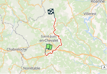
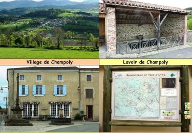
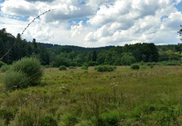
Trail Horseback riding of 23 km to be discovered at Auvergne-Rhône-Alpes, Loire, Champoly. This trail is proposed by leoutre.
Description
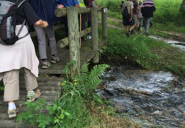
Magnifique site du chateau à ne pas rater; étape courte tendance montée.
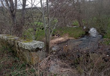
Quelques passages mauvais ( caillouteux) mais pas tres longs
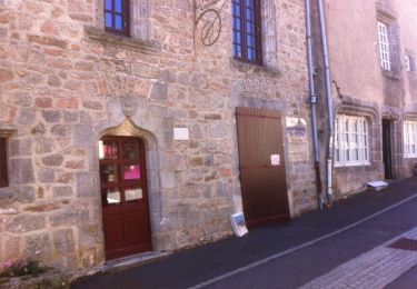
Epicerie à Juré
Positioning
Country:
France
Region :
Auvergne-Rhône-Alpes
Department/Province :
Loire
Municipality :
Champoly
Location:
Unknown
Start:(Dec)
Start:(UTM)
564404 ; 5079363 (31T) N.
Comments
Trails nearby
![Trail Walking Champoly - Le Bois des Côtes, les Gorges de Corbillon et le Château d'Urfé - Champoly - Photo](https://media.geolcdn.com/t/375/260/ext.jpg?maxdim=2&url=https%3A%2F%2Fservices.sitytrail.com%2FGeolivesWS%2FDownloadMedia.ashx%3FTrailID%3D317904%26Media%3D17320_6.jpg)
![Walking Walking](https://static1.geolcdn.com/sitytour/trail-icons/101.png)
Le Bois des Côtes, les Gorges de Corbillon et le Château d'Urfé - Champoly
Walking
Very difficult
(2)
Champoly,
Auvergne-Rhône-Alpes,
Loire,
France
![](/images/other/stat-length.png)
15 km | 23 km-effort
4h 0min
![](https://static1.geolcdn.com/siteimages/upload/files/16400158638029165_repeat_loop_refresh_sync_direction_icon.png)
Yes
![Trail Walking Chausseterre - Randonnée au dessus de Chausseterre en passant par le col de St Thomas - Photo](https://media.geolcdn.com/t/375/260/96044bca-bff5-4754-a681-7e2e2adbd021.jpg&format=jpg&maxdim=2)
![Walking Walking](https://static1.geolcdn.com/sitytour/trail-icons/101.png)
Randonnée au dessus de Chausseterre en passant par le col de St Thomas
Walking
Medium
Chausseterre,
Auvergne-Rhône-Alpes,
Loire,
France
![](/images/other/stat-length.png)
16.3 km | 23 km-effort
3h 38min
![](https://static1.geolcdn.com/siteimages/upload/files/16400158638029165_repeat_loop_refresh_sync_direction_icon.png)
Yes
![Trail Running Champoly - Le Bois des Côtes, les Gorges de Corbillon et le Château d'Urfé - Champoly - Photo](https://media.geolcdn.com/t/375/260/ext.jpg?maxdim=2&url=https%3A%2F%2Fservices.sitytrail.com%2FGeolivesWS%2FDownloadMedia.ashx%3FTrailID%3D317906%26Media%3D17320_6.jpg)
![Running Running](https://static1.geolcdn.com/sitytour/trail-icons/103.png)
Le Bois des Côtes, les Gorges de Corbillon et le Château d'Urfé - Champoly
Running
Very difficult
Champoly,
Auvergne-Rhône-Alpes,
Loire,
France
![](/images/other/stat-length.png)
15 km | 23 km-effort
2h 0min
![](https://static1.geolcdn.com/siteimages/upload/files/16400158638029165_repeat_loop_refresh_sync_direction_icon.png)
Yes
![Trail Mountain bike Champoly - Le Bois des Côtes, les Gorges de Corbillon et le Château d'Urfé - Champoly - Photo](https://media.geolcdn.com/t/375/260/ext.jpg?maxdim=2&url=https%3A%2F%2Fservices.sitytrail.com%2FGeolivesWS%2FDownloadMedia.ashx%3FTrailID%3D317905%26Media%3D17320_6.jpg)
![Mountain bike Mountain bike](https://static1.geolcdn.com/sitytour/trail-icons/202.png)
Le Bois des Côtes, les Gorges de Corbillon et le Château d'Urfé - Champoly
Mountain bike
Very difficult
Champoly,
Auvergne-Rhône-Alpes,
Loire,
France
![](/images/other/stat-length.png)
15 km | 23 km-effort
1h 40min
![](https://static1.geolcdn.com/siteimages/upload/files/16400158638029165_repeat_loop_refresh_sync_direction_icon.png)
Yes
![Trail Walking Cervières - Cervières col St Thomas - Photo](https://media.geolcdn.com/t/375/260/ext.jpg?maxdim=2&url=https%3A%2F%2Fservices.sitytrail.com%2FGeolivesWS%2FDownloadMedia.ashx%3FTrailID%3D143023%26Media%3D20120731121857.jpg)
![Walking Walking](https://static1.geolcdn.com/sitytour/trail-icons/101.png)
Cervières col St Thomas
Walking
Medium
(2)
Cervières,
Auvergne-Rhône-Alpes,
Loire,
France
![](/images/other/stat-length.png)
15.2 km | 21 km-effort
4h 0min
![](https://static1.geolcdn.com/siteimages/upload/files/16400158638029165_repeat_loop_refresh_sync_direction_icon.png)
Yes
![Trail Walking Les Salles - Domaine de la Plagnette - Photo](https://media.geolcdn.com/t/375/260/40ce0fdb-bc4b-4c71-a6cb-2c6f3d0eaab4.jpg&format=jpg&maxdim=2)
![Walking Walking](https://static1.geolcdn.com/sitytour/trail-icons/101.png)
Domaine de la Plagnette
Walking
Difficult
Les Salles,
Auvergne-Rhône-Alpes,
Loire,
France
![](/images/other/stat-length.png)
8.9 km | 12.4 km-effort
2h 48min
![](https://static1.geolcdn.com/siteimages/upload/files/16400158638029165_repeat_loop_refresh_sync_direction_icon.png)
Yes
![Trail Walking Saint-Romain-d'Urfé - boucle le Limousin - Photo](https://media.geolcdn.com/t/375/260/ext.jpg?maxdim=2&url=https%3A%2F%2Fservices.sitytrail.com%2FGeolivesWS%2FDownloadMedia.ashx%3FTrailID%3D632218%26Media%3Dfix__20160827152748.jpg)
![Walking Walking](https://static1.geolcdn.com/sitytour/trail-icons/101.png)
boucle le Limousin
Walking
Very easy
Saint-Romain-d'Urfé,
Auvergne-Rhône-Alpes,
Loire,
France
![](/images/other/stat-length.png)
3.6 km | 5 km-effort
1h 4min
![](https://static1.geolcdn.com/siteimages/upload/files/16400158638029165_repeat_loop_refresh_sync_direction_icon.png)
Yes
![Trail Walking Chausseterre - petite Chaussetere 28 juin 2016 - Photo](https://media.geolcdn.com/t/375/260/ext.jpg?maxdim=2&url=https%3A%2F%2Fservices.sitytrail.com%2FGeolivesWS%2FDownloadMedia.ashx%3FTrailID%3D590233%26Media%3D20160628110837.jpg)
![Walking Walking](https://static1.geolcdn.com/sitytour/trail-icons/101.png)
petite Chaussetere 28 juin 2016
Walking
Easy
Chausseterre,
Auvergne-Rhône-Alpes,
Loire,
France
![](/images/other/stat-length.png)
9.2 km | 11.9 km-effort
2h 48min
![](https://static1.geolcdn.com/siteimages/upload/files/16400158638029165_repeat_loop_refresh_sync_direction_icon.png)
Yes
![Trail Walking Les Salles - gerbières petite - Photo](https://media.geolcdn.com/t/375/260/ext.jpg?maxdim=2&url=https%3A%2F%2Fservices.sitytrail.com%2FGeolivesWS%2FDownloadMedia.ashx%3FTrailID%3D439645%26Media%3D20150630115800.jpg)
![Walking Walking](https://static1.geolcdn.com/sitytour/trail-icons/101.png)
gerbières petite
Walking
Difficult
Les Salles,
Auvergne-Rhône-Alpes,
Loire,
France
![](/images/other/stat-length.png)
10.2 km | 14.4 km-effort
3h 21min
![](https://static1.geolcdn.com/siteimages/upload/files/16400158638029165_repeat_loop_refresh_sync_direction_icon.png)
Yes