


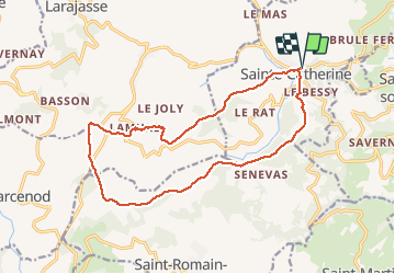

16.8 km | 24 km-effort


User


FREE GPS app for hiking
 SityTrail
IGN / Geographical institutes
SityTrail World
The world is yours!
Trail Walking of 16.4 km to be discovered at Auvergne-Rhône-Alpes, Rhône, Sainte-Catherine. This trail is proposed by GRISON-Alain.
Ste Catherine vers Chapelle St Appolinaire
Picnic Lamure et sur GR7
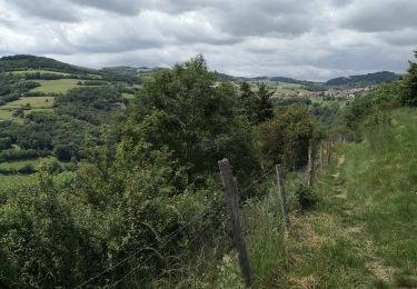
GR7 en partie à l'ombre l'apm.
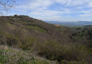
Randonnée très panoramique.

Walking

Walking

Walking

Walking

Walking

Walking

Walking
Walking
Walking